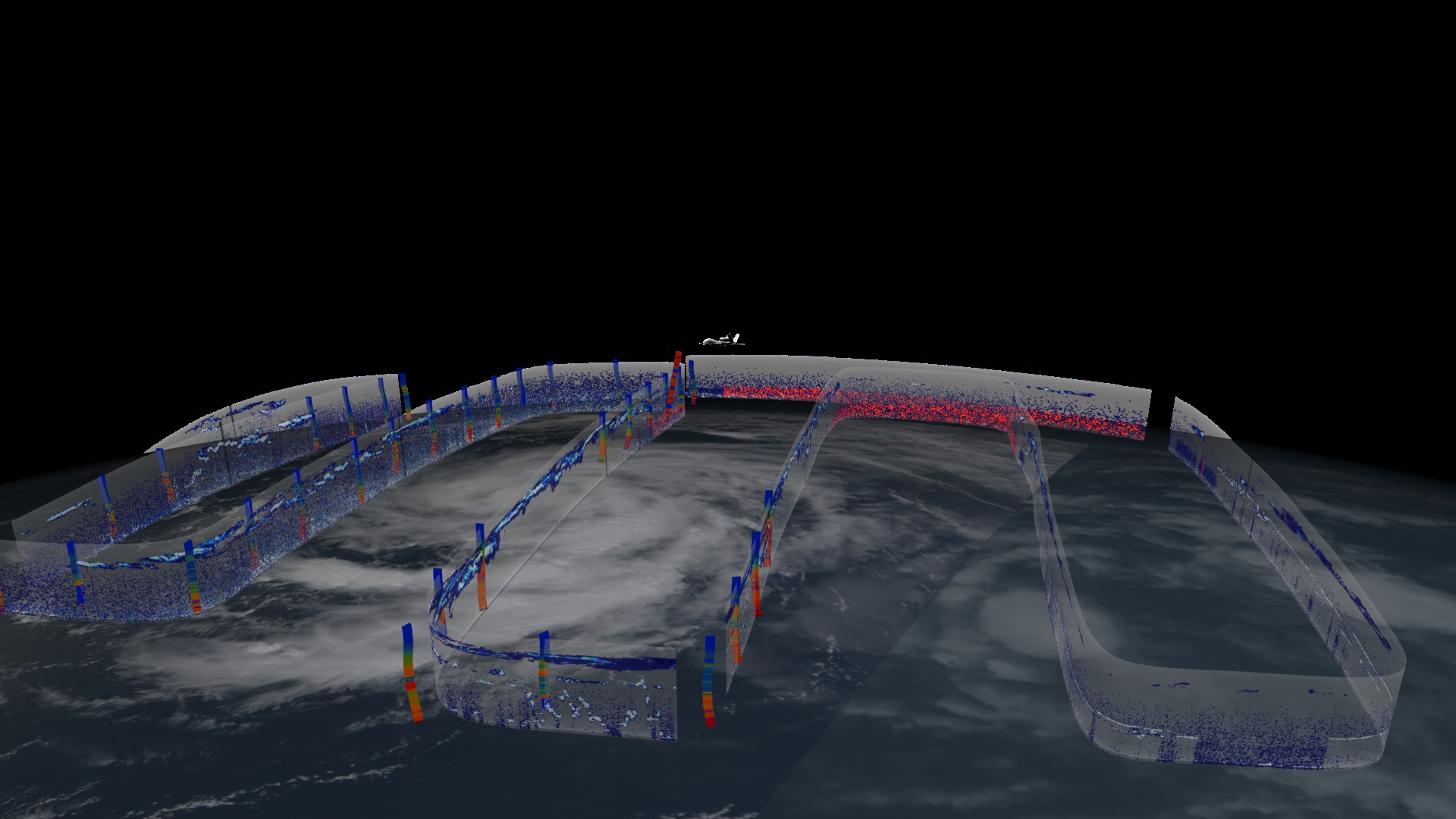
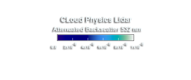
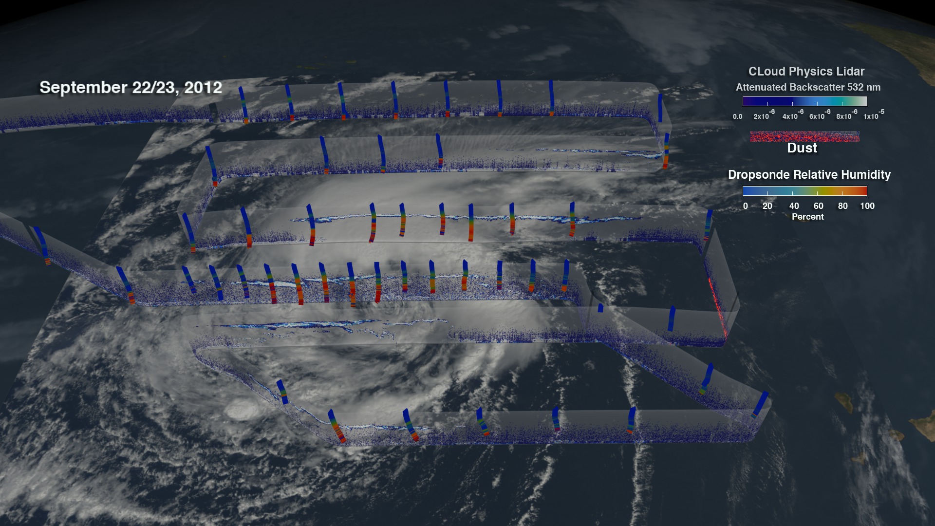
Global Hawk observes the Saharan Air Layer through the Cloud Physics Lidar (CPL) during Hurricane Nadine
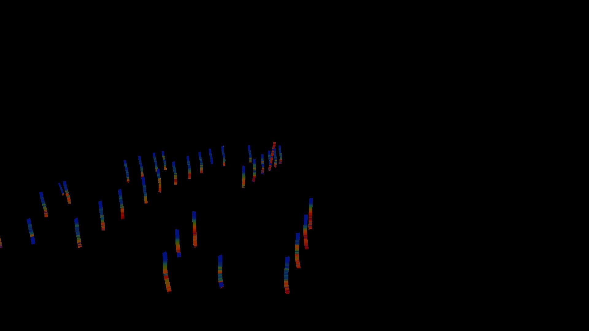
One instrument used to investigate the SAL is the cloud physics lidar(CPL). CPL uses a laser to measure vertical profiles of dust; a dropsonde system that releases small instrumented packages from the aircraft that fall to the surface while measuring profiles of temperature, humidity, and winds; and an infrared sounder that measures temperature and humidity in clear-sky regions.The CPL is an airborne lidar system designed specifically for studying clouds and aerosols. CPL will study cloud- and dust-layer boundaries and will provide optical depth or thickness of aerosols and clouds
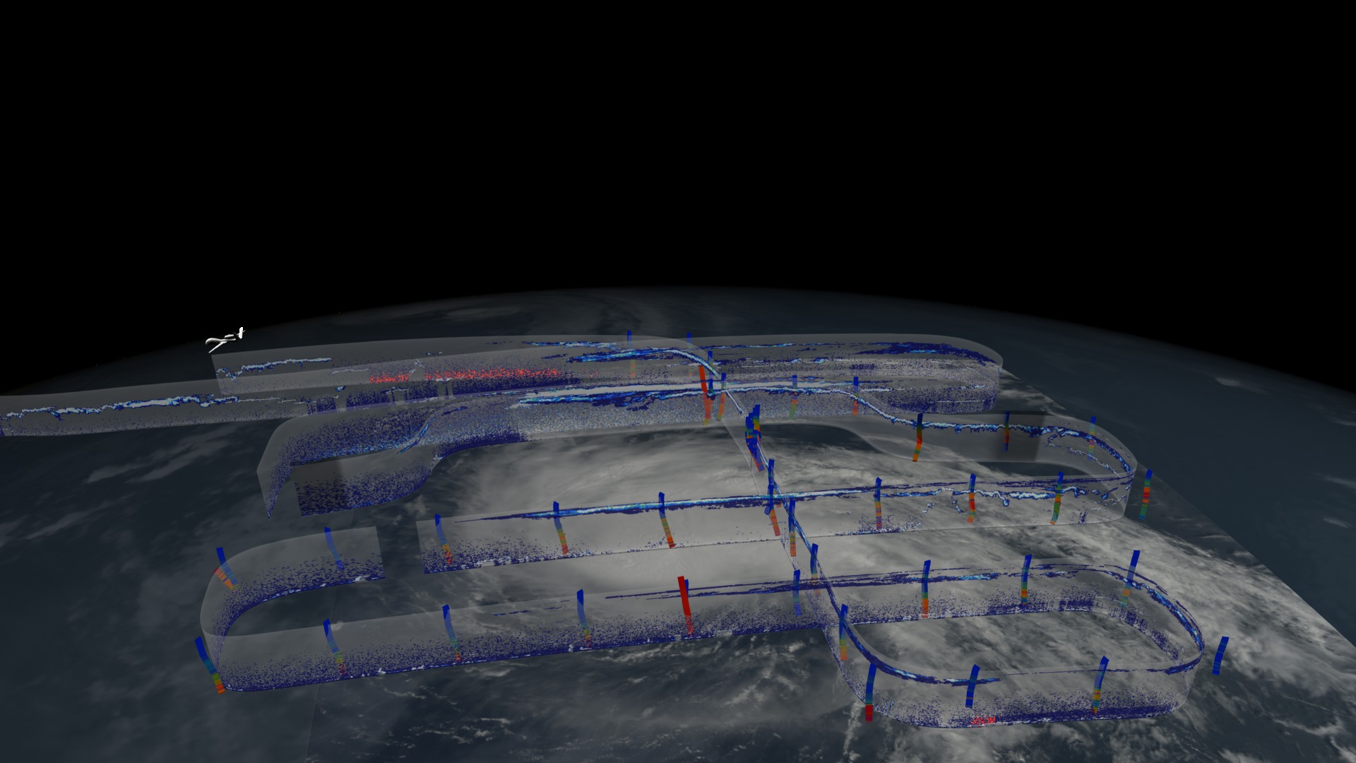
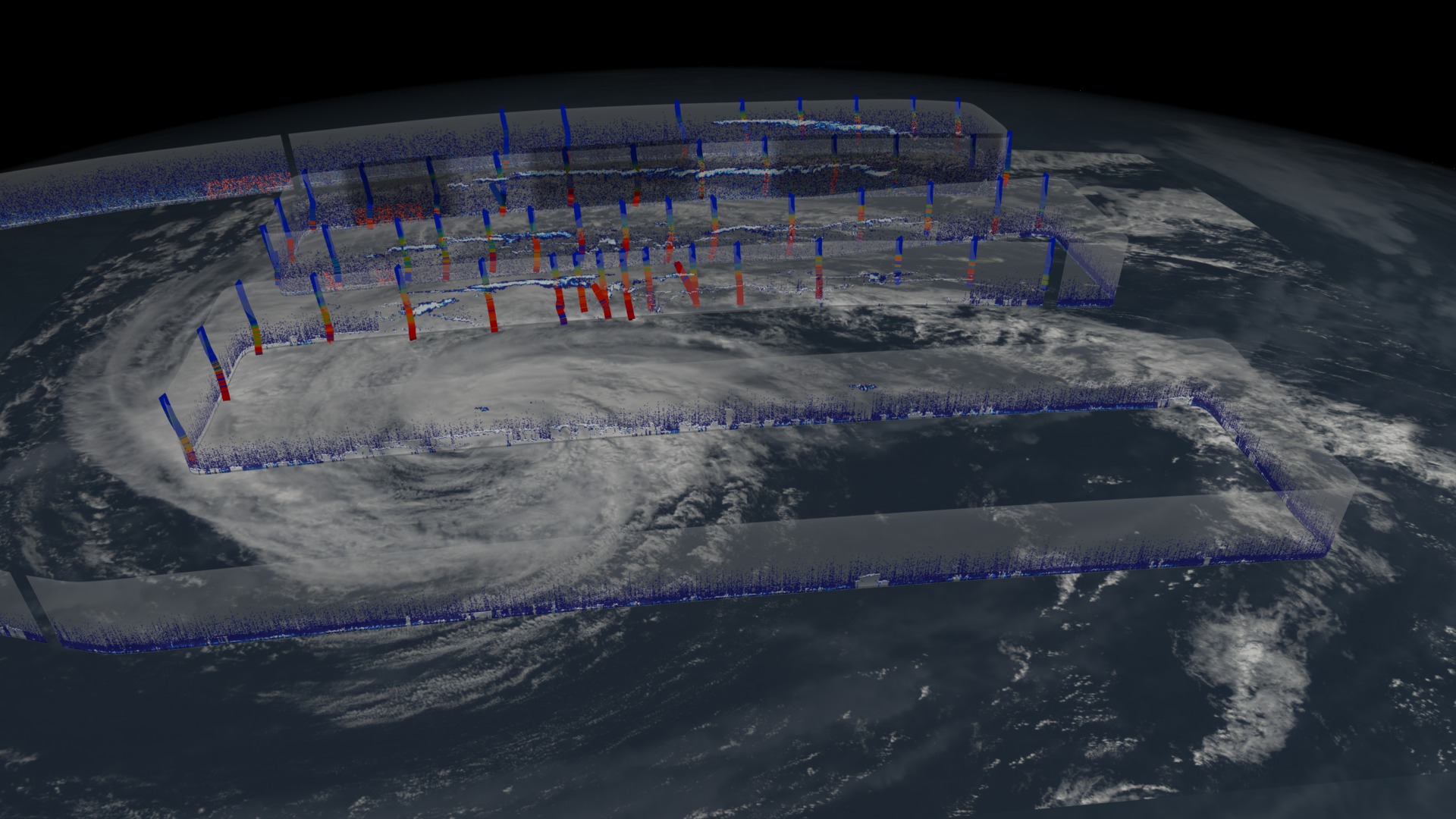
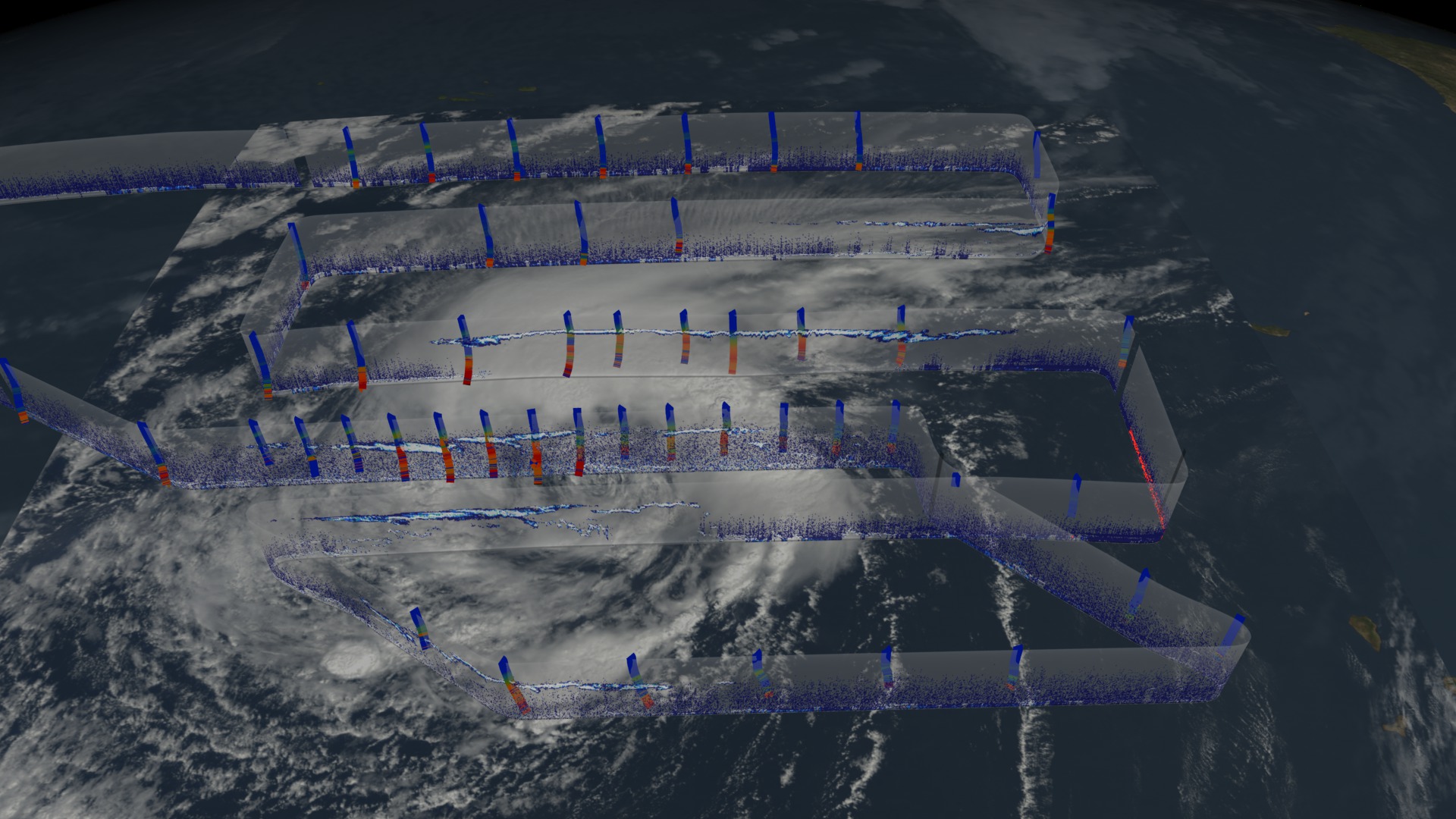
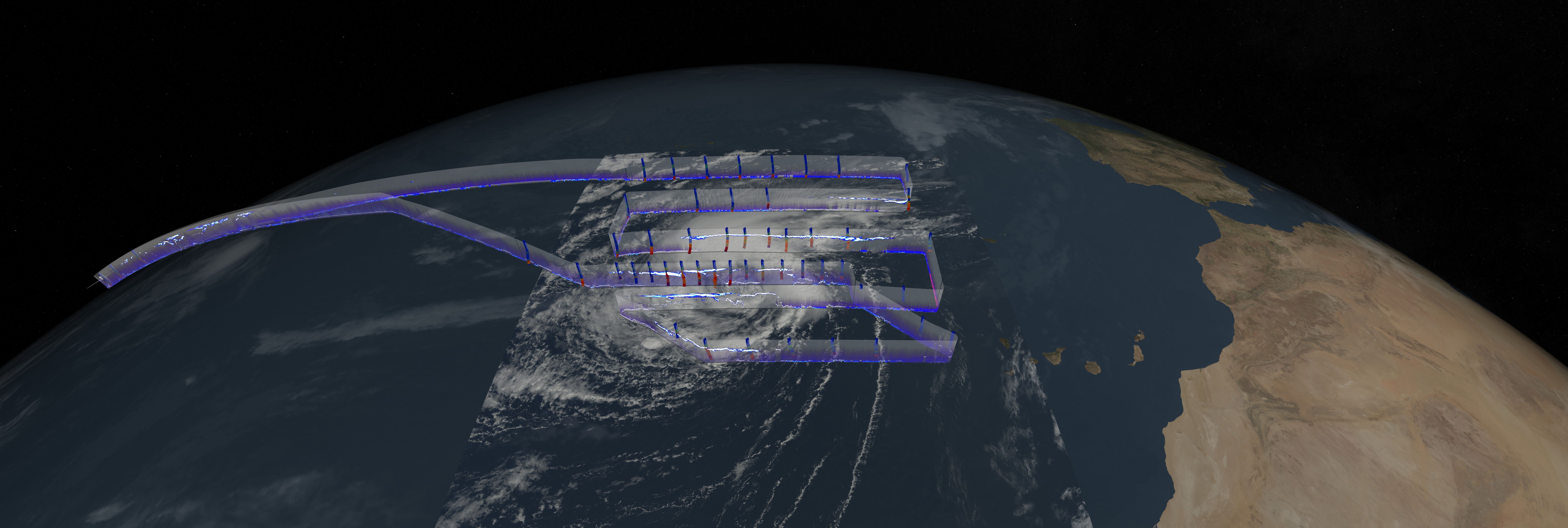
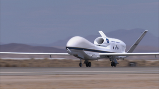
On Sept. 11 and 12, during the 2012 HS3 mission, the NASA Global Hawk aircraft covered more than one million square kilometers (386,100 square miles) going back and forth over the storm in a gridded fashion in what's called a "lawnmower pattern."
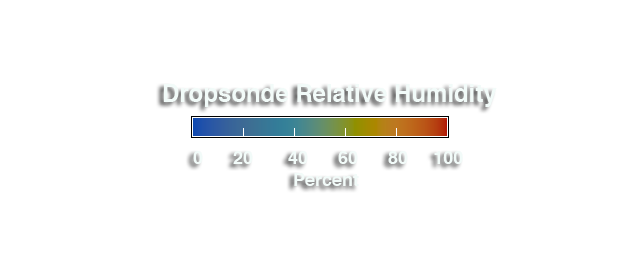
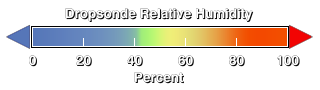
Dropsonde data from HS3's flights show temperature and humidity conditions in the storm. In this movie, the dropsondes are colored with the relative humidity data where blue represents dry air and red represents moist air.
For more information about NASA's HS3 mission, visit:


Related
Visualization Credits
Greg Shirah (NASA/GSFC): Animator
Rob Gutro (NASA/GSFC): Producer
Scott Braun (NASA/GSFC): Scientist
Dennis L. Hlavka (SSAI): Scientist
NASA/Goddard Space Flight Center
Scientific Visualization Studio
https://svs.gsfc.nasa.gov/4102
Data Used:
Global Hawk/Cloud Physics Lidar/Attenuated Backscatter also referred to as: CPL
NASAGlobal Hawk/Dropsondes/Relative Humidity
Observed Data - NASA HS3Global Hawk/Dropsondes/Temperature Anomalies
Observed Data - NASA HS3This item is part of this series:
GRIP Airborne Field Campaign
Keywords:
DLESE >> Atmospheric science
DLESE >> Natural hazards
GCMD >> Earth Science >> Atmosphere >> Atmospheric Phenomena >> Hurricanes
SVS >> Hyperwall
SVS >> Hurricane Intensity
NASA Science >> Earth
GCMD keywords can be found on the Internet with the following citation: Olsen, L.M., G. Major, K. Shein, J. Scialdone, S. Ritz, T. Stevens, M. Morahan, A. Aleman, R. Vogel, S. Leicester, H. Weir, M. Meaux, S. Grebas, C.Solomon, M. Holland, T. Northcutt, R. A. Restrepo, R. Bilodeau, 2013. NASA/Global Change Master Directory (GCMD) Earth Science Keywords. Version 8.0.0.0.0


