LRO at the June 15, 2011 Lunar Eclipse: View from the Moon
For Lunar Reconnaissance Orbiter (LRO), the lunar eclipse on June 15, 2011 is likely to be the longest and darkest of its life. This matters because LRO relies on sunlight to power its systems and instruments. Although it spends half of every orbit on the night side of the Moon, each night side pass lasts only an hour. For the June 15 eclipse, LRO will be in the dark for more than twice as long.
During a previous total eclipse, LRO hibernated, turning off all of its instruments to conserve its battery power until the Moon emerged from the Earth's shadow. For the June 15 event, LRO will leave on the Diviner Lunar Radiometry Experiment. Diviner will measure the cooling of the Moon's surface during the eclipse. This unique temperature record is expected to reveal information about the roughness and composition of the swath of lunar surface visible to Diviner's sensors during the eclipse.
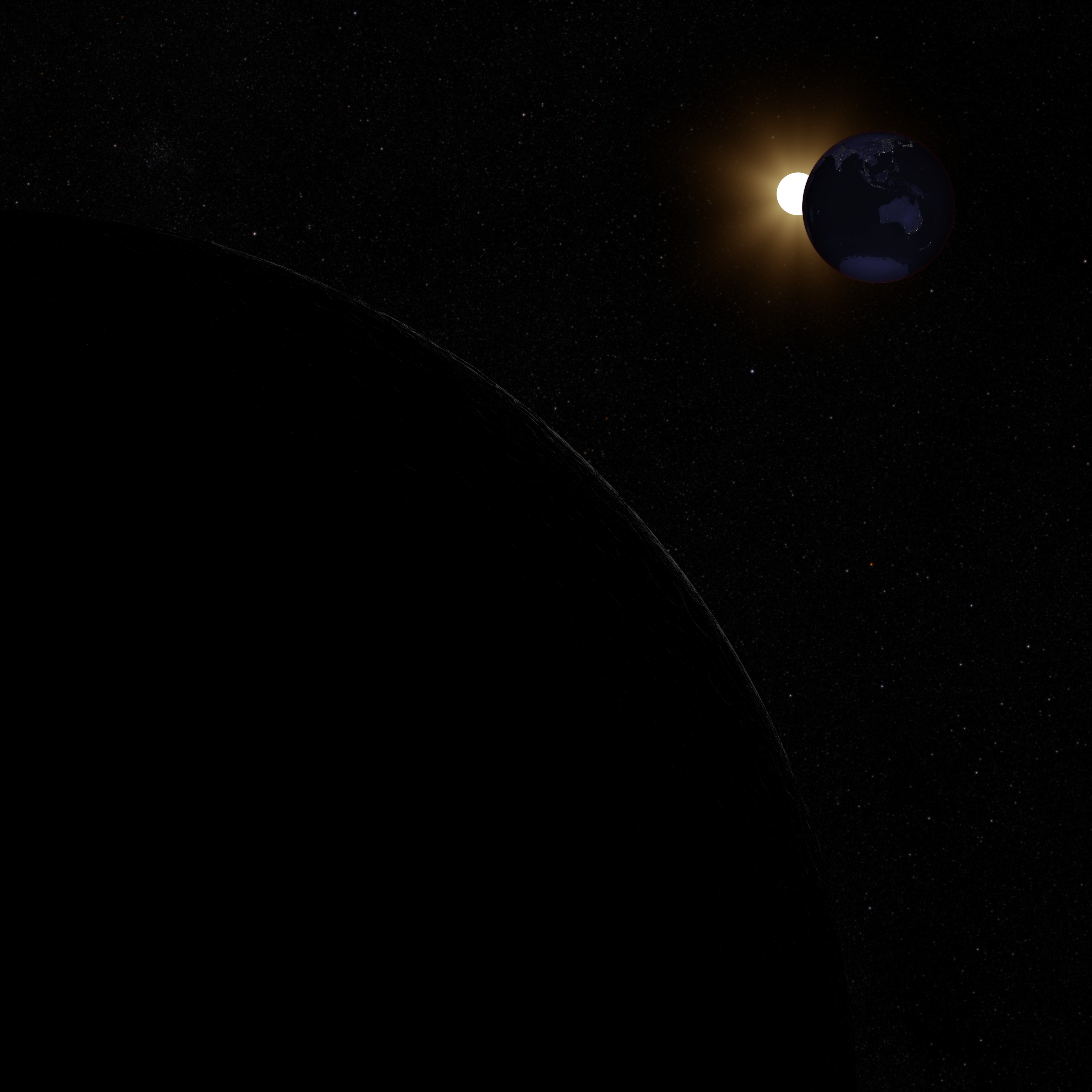
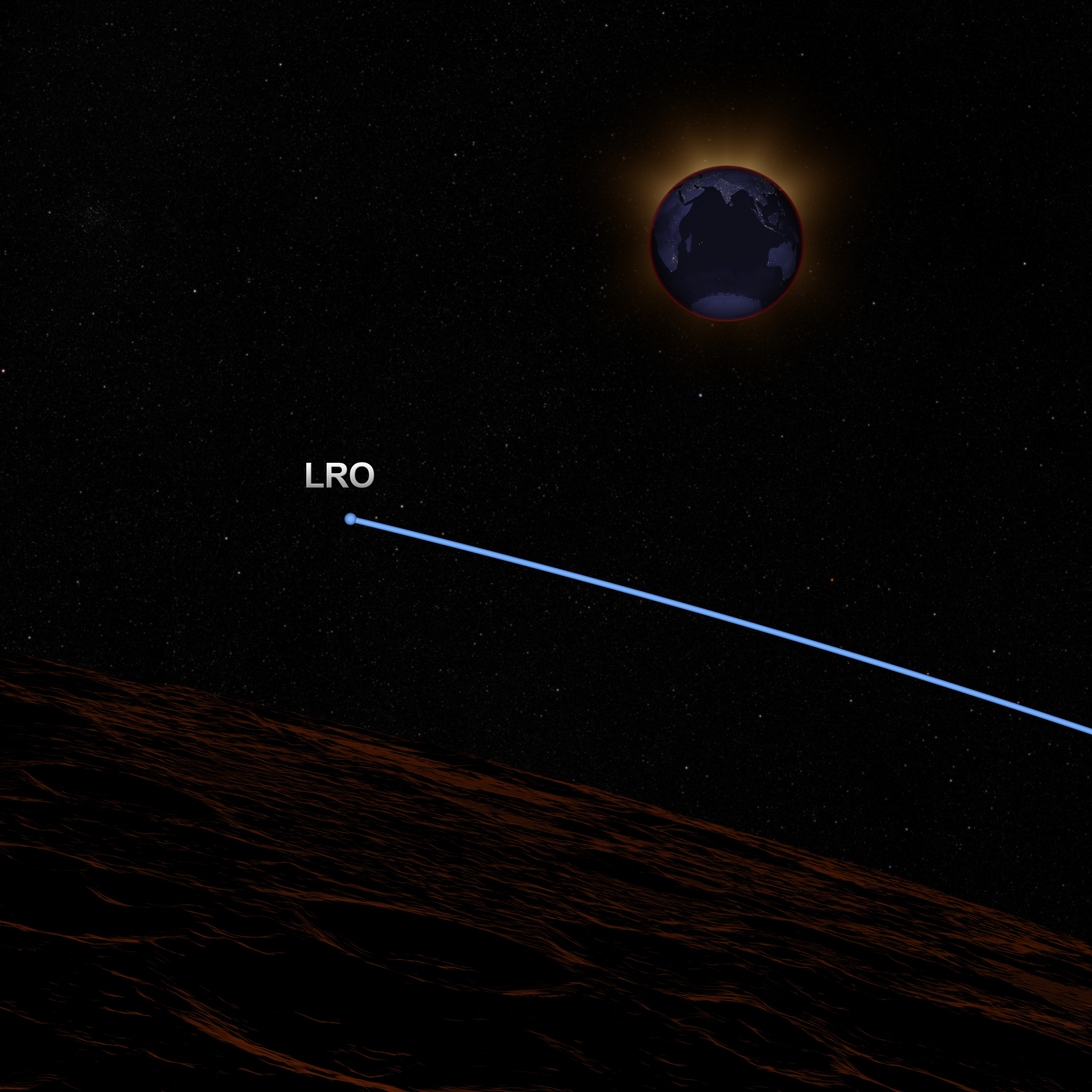
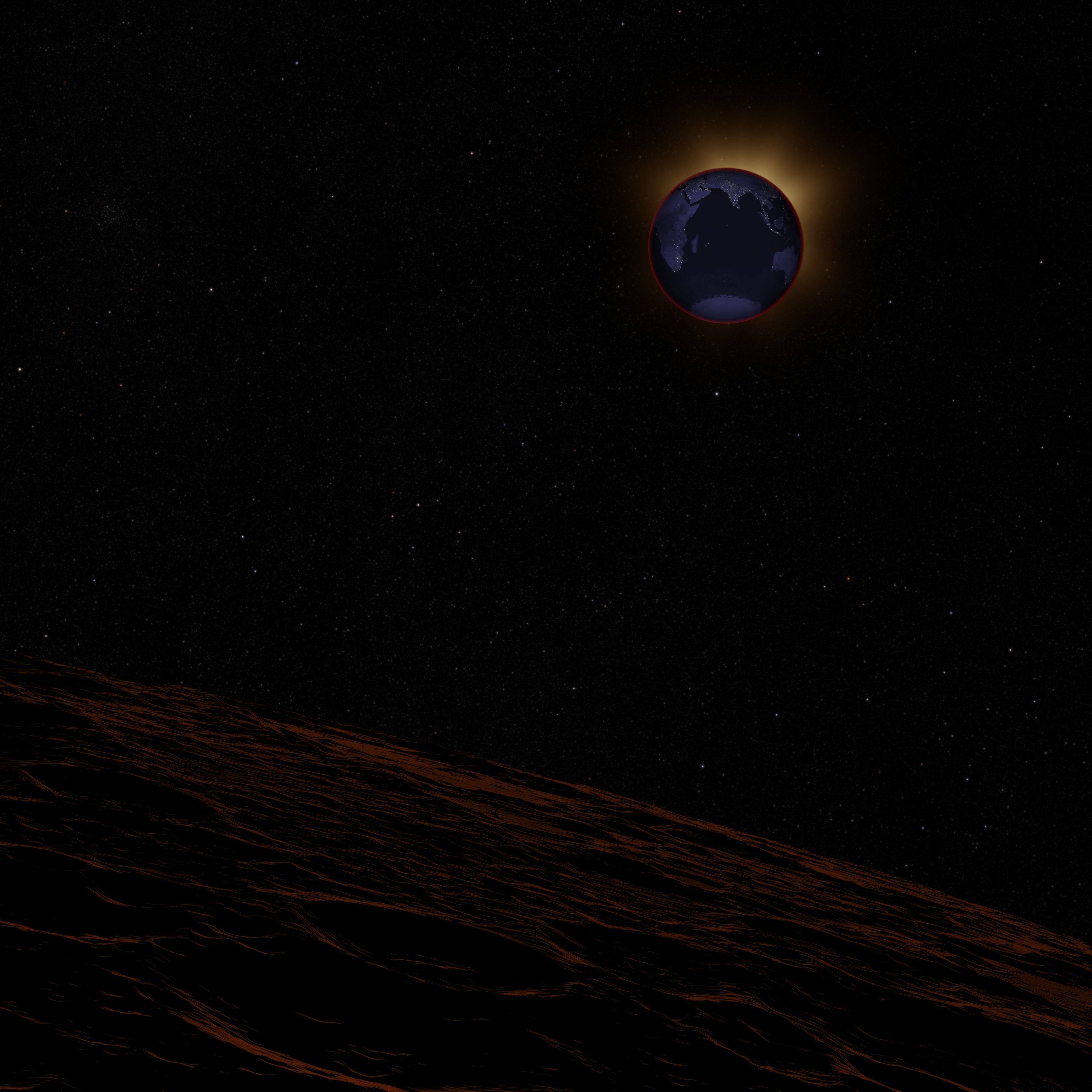
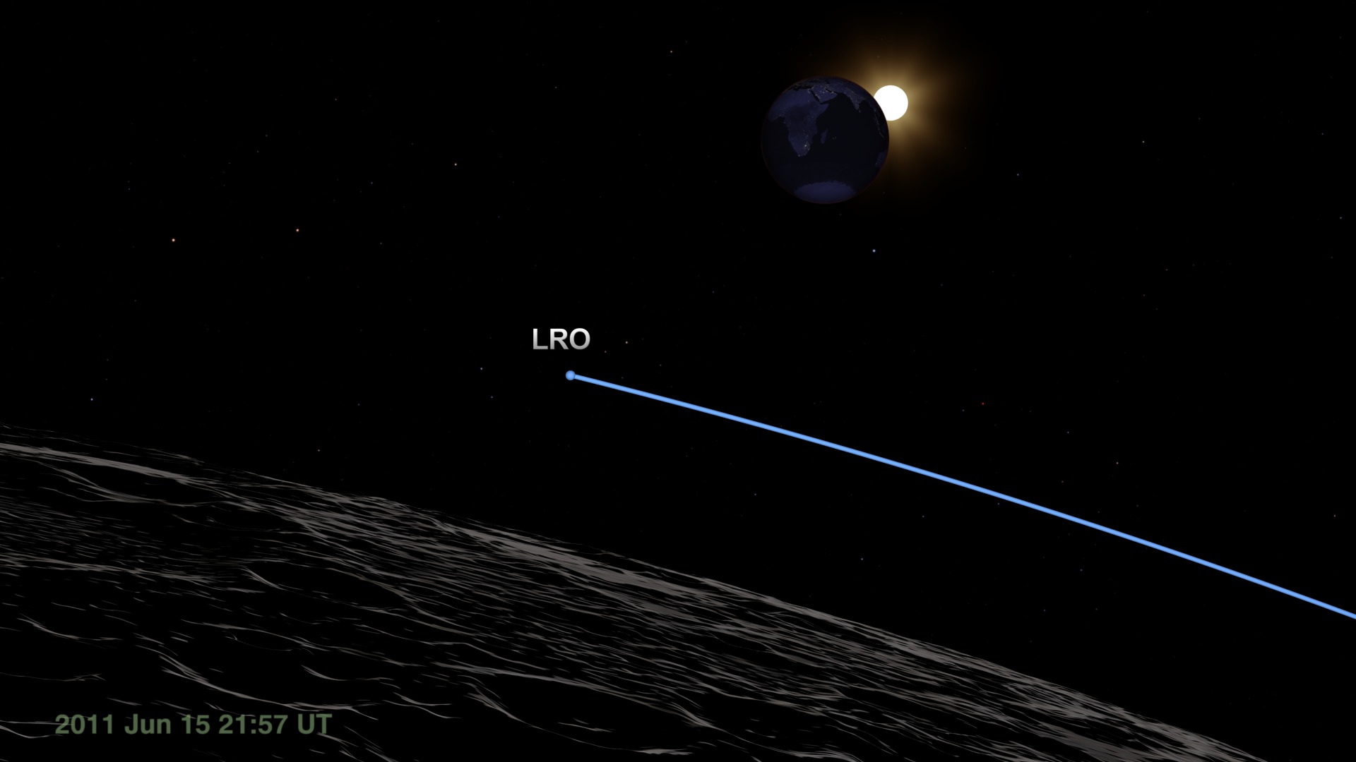
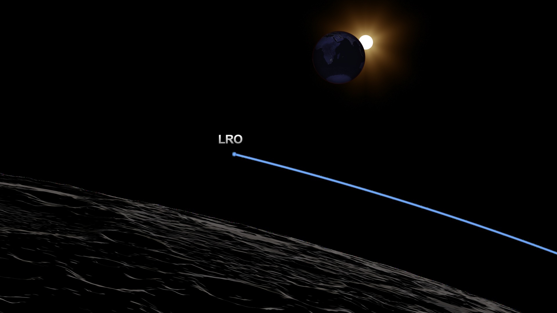
The visualization archived on this page shows the view of the eclipse from the Moon, looking back toward the Earth and the Sun. On the Moon, this event is a solar eclipse. As the Sun disappears behind the Earth, the umbral shadow sweeps across the lunar landscape, and as our eyes adjust to the darkness, the stars come out, and the lunar surface looks a dull red. The atmosphere of the Earth lights up as a red ring around the planet, the sunrises and sunsets all around the edge of the globe lending their faint light to the Moon while the Sun is otherwise blocked. At the start of the eclipse, Australia is facing us, but over time, the Moon sets in eastern Australia while southern Africa rotates into view. LRO streaks through the frame several times on its orbit 50 kilometers above the Moon's surface.
Other visualizations in this series depict the view of the eclipse
- along the shadow line, with the figures of the umbra, penumbra, and lunar and solar paths
- through a telescope on Earth
- flying above LRO as Diviner takes temperature measurements
A narrated piece that uses these visualizations is available in entry #10794. For an explanation of lunar eclipses, visit entry #10787.


Visualization Credits
Genna Duberstein (USRA): Producer
Chris Smith (HTSI): Producer
Richard Vondrak (NASA/GSFC): Scientist
NASA/Goddard Space Flight Center Scientific Visualization Studio
https://svs.gsfc.nasa.gov/3836
Mission:
LRO (Lunar Reconnaissance Orbiter)
Data Used:
DMSP/OLS/Earth at Night
October 2000LRO/LOLA/Digital Elevation Map also referred to as: DEM
August 2009 - December 2010This item is part of these series:
The Moon
LRO - Animations
Keywords:
SVS >> HDTV
SVS >> Lunar
SVS >> Moon
SVS >> LRO
SVS >> Lunar Reconnaissance Orbiter
SVS >> Eclipse
SVS >> LOLA
SVS >> Lunar Eclipse
SVS >> Lunar Surface
SVS >> Lunar Topography
SVS >> Lunar Elevation Map
SVS >> Satellites >> Lunar
SVS >> Solar System >> Moon >> Lunar Surface
NASA Science >> Planets and Moons


