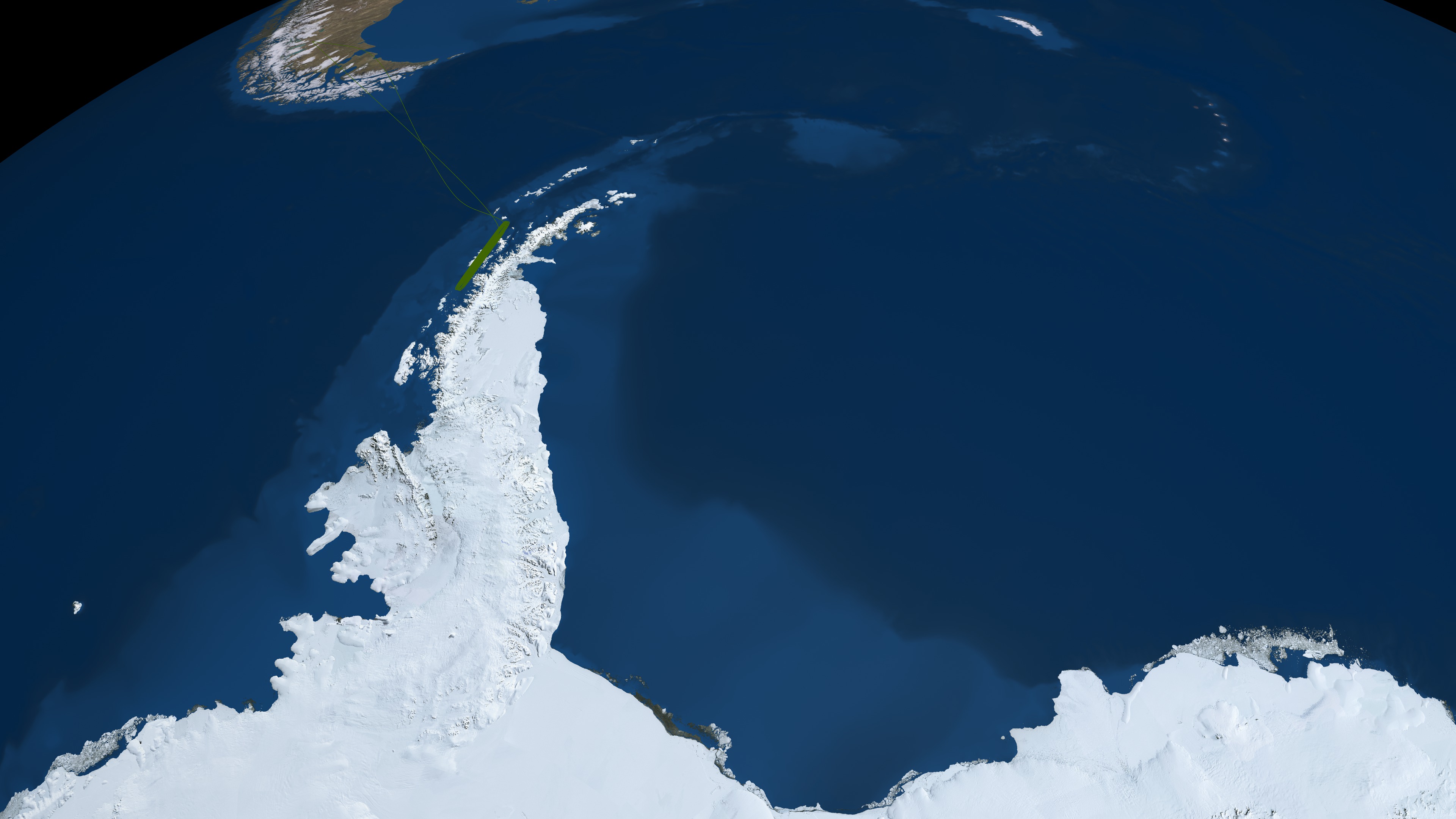
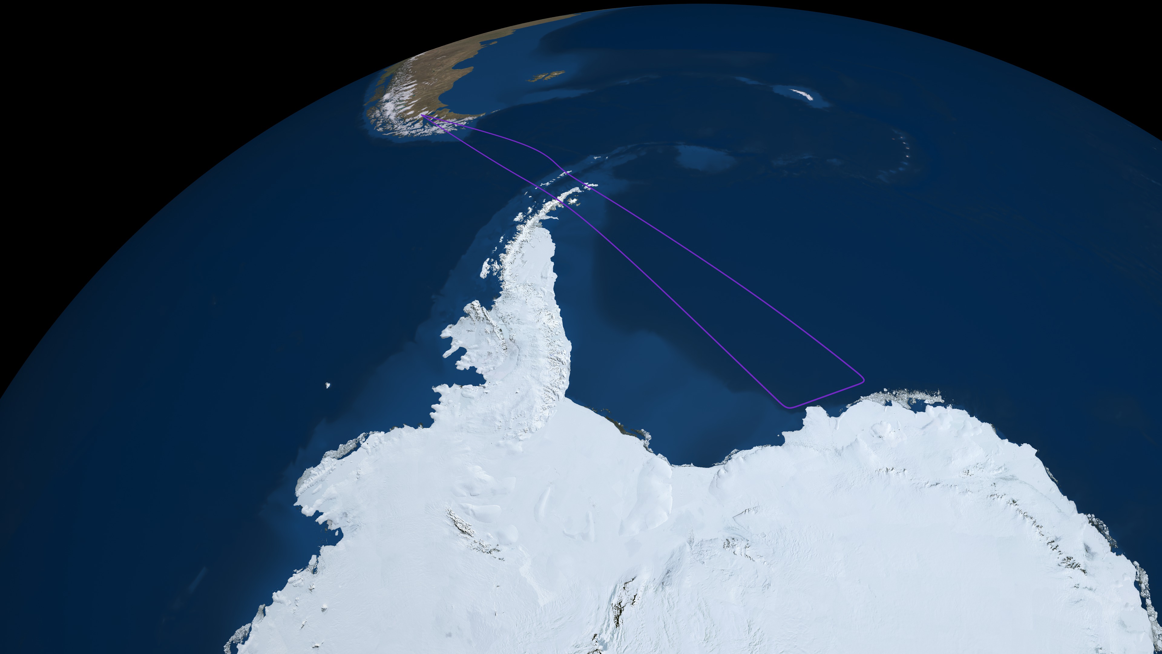
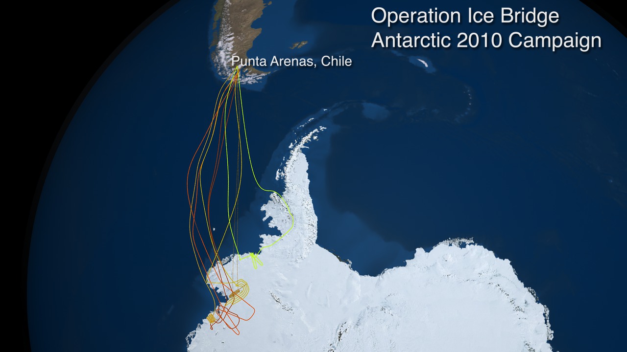
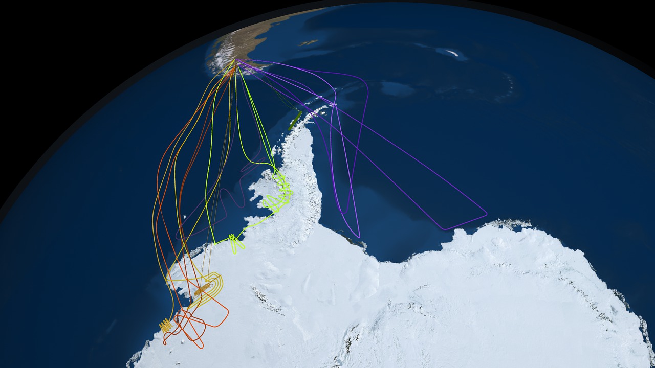
Operation IceBridge Flight Paths - Antarctica Fall 2010 Campaign
Data from campaigns flown prior to the inception of IceBridge will also be archived at NSIDC. These include data from the Airborne Topographic Mapper (ATM) instrument; mountain glacier data from the University of Alaska Fairbanks; and deep radar bedmap data from University of Kansas radar instruments. Combined with NSIDC's existing complete archive of data from the Geoscience Laser Altimeter System (GLAS) instrument aboard ICESat, researchers will be able to access a rich repository of complementary measurements.
IceBridge, a six-year NASA mission, is the largest airborne survey of Earth's polar ice ever flown. It will yield an unprecedented three-dimensional view of Arctic and Antarctic ice sheets, ice shelves and sea ice. These flights will provide a yearly, multi-instrument look at the behavior of the rapidly changing features of the Greenland and Antarctic ice.
Data collected during IceBridge will help scientists bridge the gap in polar observations between NASA's ICESat — in orbit since 2003 — and ICESat-2, planned for late 2015. ICESat stopped collecting science data in 2009, making IceBridge critical for ensuring a continuous series of observations.


Visualization Credits
Michelle Williams (UMBC): Producer
Tom Wagner (NASA): Scientist
John Sonntag (EGG): Scientist
NASA/Goddard Space Flight Center Scientific Visualization Studio.
https://svs.gsfc.nasa.gov/3782
Missions:
Landsat
Operation IceBridge
Terra
Data Used:
Operation Ice Bridge Flight Paths
Terra and Aqua/MODIS/MODIS Mosaic of Antarctica (MOA) Image Map also referred to as: MOA
Mosaic - National Snow and Ice Data Center (NSIDC) and the University of New HampshireLandsat-7/ETM+/Landsat Image Mosaic of Antarctica also referred to as: LIMA
Mosaic - NASA/GSFC, British Antarctic Survey, USGS EROS Data CenterLandsat-7/ETM+/Band Combination 3, 2, 1
This item is part of these series:
Landsat Image Mosaic of Antarctica
Operation IceBridge
Keywords:
SVS >> HDTV
GCMD >> Earth Science >> Cryosphere >> Glaciers/Ice Sheets
GCMD >> Earth Science >> Cryosphere >> Glaciers/Ice Sheets >> Glacier Elevation/Ice Sheet Elevation
GCMD >> Earth Science >> Cryosphere >> Glaciers/Ice Sheets >> Glacier Topography/Ice Sheet Topography
GCMD >> Location >> Antarctica
SVS >> Hyperwall
NASA Science >> Earth
GCMD keywords can be found on the Internet with the following citation: Olsen, L.M., G. Major, K. Shein, J. Scialdone, S. Ritz, T. Stevens, M. Morahan, A. Aleman, R. Vogel, S. Leicester, H. Weir, M. Meaux, S. Grebas, C.Solomon, M. Holland, T. Northcutt, R. A. Restrepo, R. Bilodeau, 2013. NASA/Global Change Master Directory (GCMD) Earth Science Keywords. Version 8.0.0.0.0


