Earth
ID: 3737
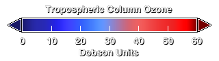
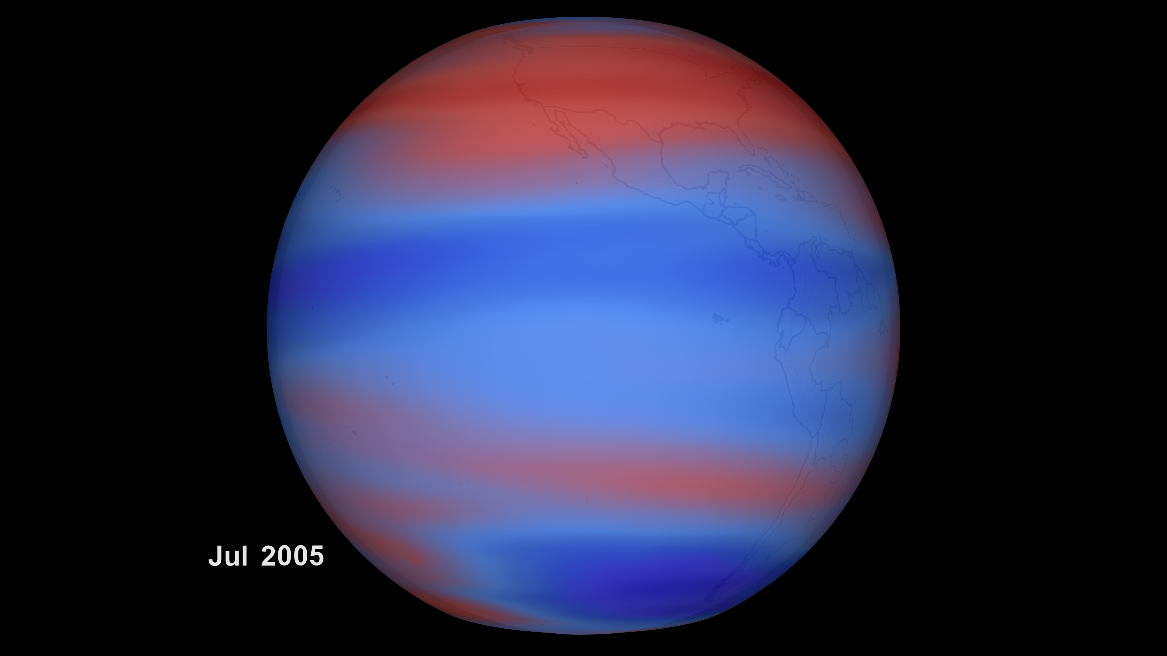
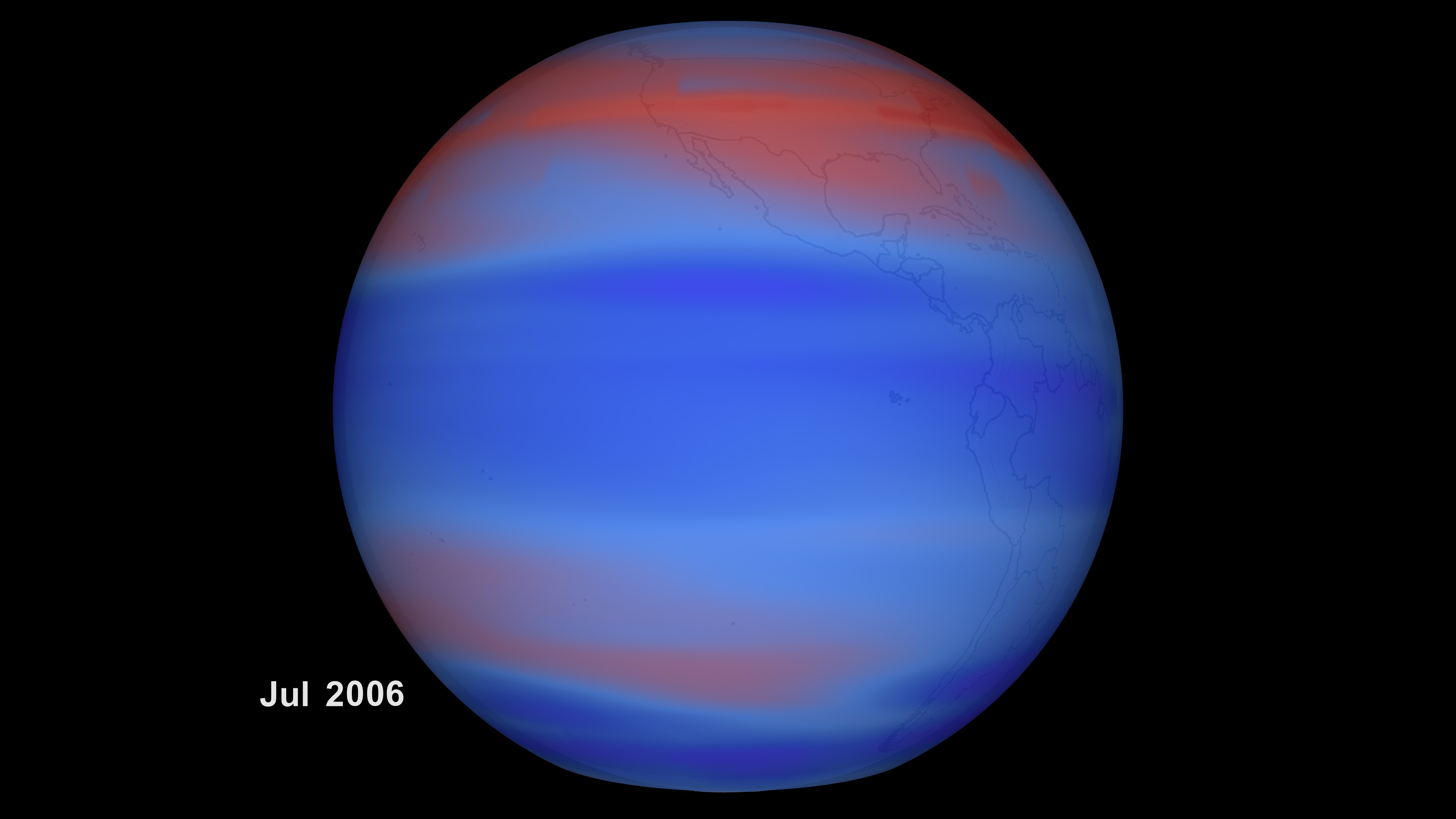
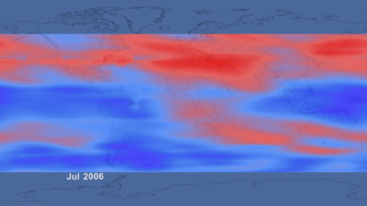
These visuals present retrieved global distribution of tropospheric column ozone from NASA's AURA spacecraft. Tropospheric ozone is close the ground and a component of pollution. This should be distinguished from high-altitude (stratospheric) ozone which shields the Earth's surface from ultraviolet radiation. Ozone measurements from the OMI and MLS instruments on board the Aura satellite are used for deriving global distributions of tropospheric column ozone (TCO). TCO is determined using the tropospheric ozone residual method which involves subtracting measurements of MLS stratospheric column ozone (SCO) from OMI total column ozone after adjusting for intercalibration differences of the two instruments using the convective-cloud differential method. The derived TCO field, which covers one complete year of mostly continuous daily measurements from January 2005 through December 2006, is used for studying the regional and global pollution on a timescale of a few days to months. MLS and OMI are two out of a total of four instruments on board the Aura spacecraft which is flown in a sunsynchronous polar orbit at 705 km altitude with a 98.2 degree inclination. The spacecraft has an equatorial crossing time of 1:45 pm (ascending node) with around 98.8 min per orbit (14.6 orbits per day on average). OMI is a nadir-scanning instrument that at visible (350-500 nm) and UV wavelength channels (UV-1: 270-314 nm; UV-2: 306-380 nm) detects backscattered solar radiance to measure column ozone. The MLS instrument is a thermal-emission microwave limb sounder that measures vertical profiles of mesospheric, stratospheric, and upper tropospheric temperature, ozone and other constituents from limb scans ahead of the Aura satellite. The MLS profile measurements are taken about 7 min before OMI views the same location during ascending (daytime) orbital tracks. These are referred as "collocated" measurements between OMI and MLS. The data shows signals due to convection, biomass burning, stratospheric influence, pollution, and transport. They are capable of capturing the spatiotemporal evolution of tropospheric column ozone. For more information see the links below:
Tropospheric Column Ozone
http://www.nasa.gov/vision/earth/environment/ozone_resource_page.html
Visualization Credits
Please give credit for this item to:
NASA/Goddard Space Flight Center Scientific Visualization Studio
NASA/Goddard Space Flight Center Scientific Visualization Studio
Science Paper:
Ziemke, J. R., S. Chandra, B. N. Duncan, L. Froidevaux, P. K. Bhartia, P. F. Levelt, and J. W. Waters (2006), Tropospheric ozone determined from Aura OMI and MLS: Evaluation of measurements and comparison with the Global Modeling Initiative's Chemical Transport Model, J. Geophys. Res., 111, D19303, doi:10.1029/2006JD007089.
Short URL to share this page:
https://svs.gsfc.nasa.gov/3737
Mission:
Aura
Data Used:
Note: While we identify the data sets used in these visualizations, we do not store any further details nor the data sets themselves on our site.
This item is part of this series:
Tropospheric Ozone
Keywords:
DLESE >> Atmospheric science
DLESE >> Environmental science
SVS >> HDTV
DLESE >> Physical geography
GCMD >> Earth Science >> Atmosphere >> Air Quality >> Tropospheric Ozone
GCMD >> Earth Science >> Land Surface >> Land Use/Land Cover >> Land Cover
NASA Science >> Earth
GCMD keywords can be found on the Internet with the following citation: Olsen, L.M., G. Major, K. Shein, J. Scialdone, S. Ritz, T. Stevens, M. Morahan, A. Aleman, R. Vogel, S. Leicester, H. Weir, M. Meaux, S. Grebas, C.Solomon, M. Holland, T. Northcutt, R. A. Restrepo, R. Bilodeau, 2013. NASA/Global Change Master Directory (GCMD) Earth Science Keywords. Version 8.0.0.0.0
Ziemke, J. R., S. Chandra, B. N. Duncan, L. Froidevaux, P. K. Bhartia, P. F. Levelt, and J. W. Waters (2006), Tropospheric ozone determined from Aura OMI and MLS: Evaluation of measurements and comparison with the Global Modeling Initiative's Chemical Transport Model, J. Geophys. Res., 111, D19303, doi:10.1029/2006JD007089.
Short URL to share this page:
https://svs.gsfc.nasa.gov/3737
Mission:
Aura
Data Used:
Aura/OMI/Ozone
1/1/2005-12/31/2006Aura/MLS/Ozone
1/1/2005 - 12/31/2006This item is part of this series:
Tropospheric Ozone
Keywords:
DLESE >> Atmospheric science
DLESE >> Environmental science
SVS >> HDTV
DLESE >> Physical geography
GCMD >> Earth Science >> Atmosphere >> Air Quality >> Tropospheric Ozone
GCMD >> Earth Science >> Land Surface >> Land Use/Land Cover >> Land Cover
NASA Science >> Earth
GCMD keywords can be found on the Internet with the following citation: Olsen, L.M., G. Major, K. Shein, J. Scialdone, S. Ritz, T. Stevens, M. Morahan, A. Aleman, R. Vogel, S. Leicester, H. Weir, M. Meaux, S. Grebas, C.Solomon, M. Holland, T. Northcutt, R. A. Restrepo, R. Bilodeau, 2013. NASA/Global Change Master Directory (GCMD) Earth Science Keywords. Version 8.0.0.0.0


