Earth
ID: 3565
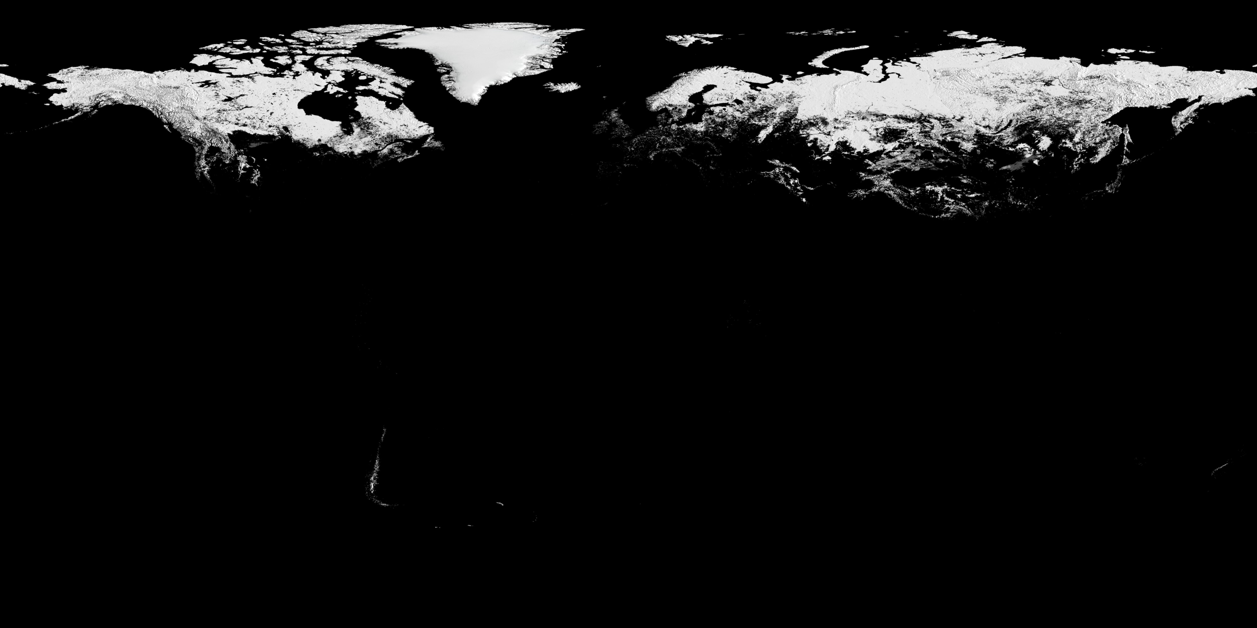
The Moderate Resolution Imaging Spectroradiometer (MODIS) provides data in 36 spectral bands, some of which are used to map global snow cover. However, MODIS can only take measurements of the surface in daylight, cloud-free areas. For this animation, valid snowcover measurements are retained over time during darkness or cloudy days until a subsequent valid measurement is found. This animation shows the dynamic advance and retreat of MODIS daily snow cover from September 1, 2002 through September 20, 2008.
Aqua MODIS: Snow Cover designed for Science On a Sphere (SOS) and WMS
Visualization Credits
Cindy Starr (Global Science and Technology, Inc.): Lead Visualizer
Horace Mitchell (NASA/GSFC): Animator
Victoria Weeks (HTSI): Video Editor
Michael Starobin (HTSI): Producer
Dorothy Hall (NASA/GSFC): Scientist
Horace Mitchell (NASA/GSFC): Animator
Victoria Weeks (HTSI): Video Editor
Michael Starobin (HTSI): Producer
Dorothy Hall (NASA/GSFC): Scientist
Please give credit for this item to:
NASA/Goddard Space Flight Center Scientific Visualization Studio
NASA/Goddard Space Flight Center Scientific Visualization Studio
Short URL to share this page:
https://svs.gsfc.nasa.gov/3565
Mission:
Terra
Data Used:
Note: While we identify the data sets used in these visualizations, we do not store any further details nor the data sets themselves on our site.
This item is part of these series:
Science On a Sphere
SOS Production - FROZEN
Keywords:
DLESE >> Cryology
GCMD >> Earth Science >> Cryosphere >> Sea Ice >> Ice Temperature
GCMD >> Earth Science >> Cryosphere >> Snow/Ice >> Snow Cover
GCMD >> Earth Science >> Hydrosphere >> Snow/Ice >> Snow Cover
SVS >> For Educators
SVS >> Global Ice
NASA Science >> Earth
GCMD keywords can be found on the Internet with the following citation: Olsen, L.M., G. Major, K. Shein, J. Scialdone, S. Ritz, T. Stevens, M. Morahan, A. Aleman, R. Vogel, S. Leicester, H. Weir, M. Meaux, S. Grebas, C.Solomon, M. Holland, T. Northcutt, R. A. Restrepo, R. Bilodeau, 2013. NASA/Global Change Master Directory (GCMD) Earth Science Keywords. Version 8.0.0.0.0
https://svs.gsfc.nasa.gov/3565
Mission:
Terra
Data Used:
Terra and Aqua/MODIS/Blue Marble Land Cover
Credit:
The Blue Marble data is courtesy of Reto Stockli (NASA/GSFC).
The Blue Marble data is courtesy of Reto Stockli (NASA/GSFC).
Aqua/MODIS
2002/09/01 - 2008/09/20This item is part of these series:
Science On a Sphere
SOS Production - FROZEN
Keywords:
DLESE >> Cryology
GCMD >> Earth Science >> Cryosphere >> Sea Ice >> Ice Temperature
GCMD >> Earth Science >> Cryosphere >> Snow/Ice >> Snow Cover
GCMD >> Earth Science >> Hydrosphere >> Snow/Ice >> Snow Cover
SVS >> For Educators
SVS >> Global Ice
NASA Science >> Earth
GCMD keywords can be found on the Internet with the following citation: Olsen, L.M., G. Major, K. Shein, J. Scialdone, S. Ritz, T. Stevens, M. Morahan, A. Aleman, R. Vogel, S. Leicester, H. Weir, M. Meaux, S. Grebas, C.Solomon, M. Holland, T. Northcutt, R. A. Restrepo, R. Bilodeau, 2013. NASA/Global Change Master Directory (GCMD) Earth Science Keywords. Version 8.0.0.0.0


