Earth
ID: 3525
These very high resolution images show a global view of the Earth at different orientations with Arctic sea ice on December 8,2008 and September 15, 2008. The extent of the sea ice was determined by the AMSR-E sea ice concentration data. The terrain shows the average land cover for the related months over the continents. (See Blue Marble Next Generation) The global cloud cover shown was obtained from the original Blue Marble cloud data distributed in 2002. (See Blue Marble:Clouds) A matching star background is provided.
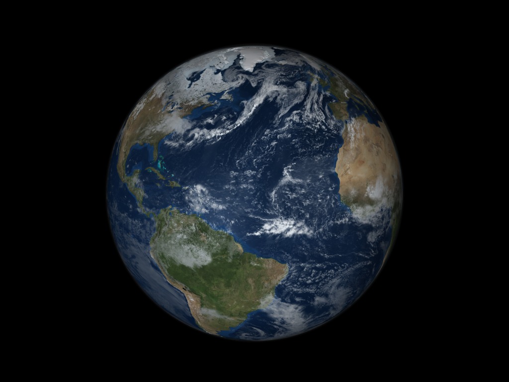

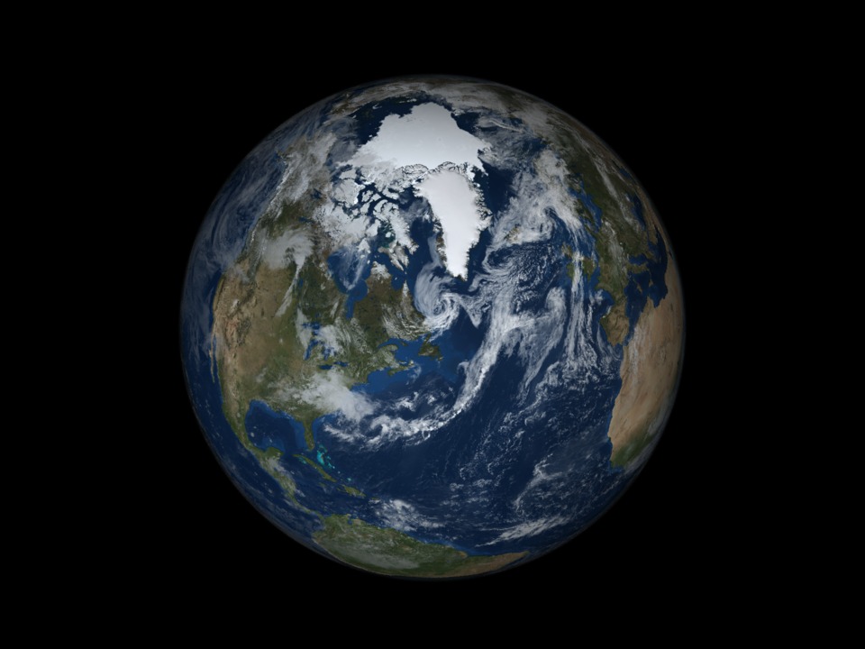

Two Posters of Earth with Sea Ice and Clouds over a Star Background
Visualization Credits
Cindy Starr (Global Science and Technology, Inc.): Lead Visualizer
Please give credit for this item to:
NASA/Goddard Space Flight Center Scientific Visualization Studio The Blue Marble data is courtesy of Reto Stockli (NASA/GSFC).
NASA/Goddard Space Flight Center Scientific Visualization Studio The Blue Marble data is courtesy of Reto Stockli (NASA/GSFC).
Short URL to share this page:
https://svs.gsfc.nasa.gov/3525
Data Used:
Note: While we identify the data sets used in these visualizations, we do not store any further details nor the data sets themselves on our site.
Keywords:
SVS >> Earth
SVS >> For Educators
SVS >> Atmosphere >> Winds >> Circulation
SVS >> Lithosphere
SVS >> Hydrosphere >> Ice
NASA Science >> Earth
https://svs.gsfc.nasa.gov/3525
Data Used:
Hipparcos/Telescope/Tycho 2 Catalogue also referred to as: Tycho Catalogue
DatabaseAqua/AMSR-E/Daily L3 12.5km Tb, Sea Ice Concentration, and Snow Depth also referred to as: Sea Ice Concentration
2008-12-08, 2008-09-15Hipparcos/Telescope/Hipparcos Catalogue
DatabaseKeywords:
SVS >> Earth
SVS >> For Educators
SVS >> Atmosphere >> Winds >> Circulation
SVS >> Lithosphere
SVS >> Hydrosphere >> Ice
NASA Science >> Earth


