Earth
ID: 3281
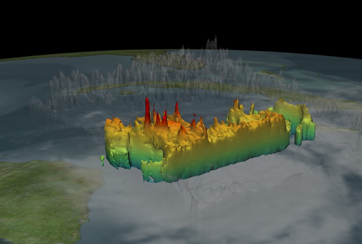
On October 17, 2005 at 1754 Zulu, Wilma was classified as a Tropical Storm with sustained wind speeds of only 45 knots. Forty hours later the storm had increased its intensity to category five status with sustained winds of 150 knots. Spikes in the rain structure known as 'Hot Towers' indicate storm intensity. 'Hot Towers' refers to tall cumulonimbus clouds and has been seen as one of the mechanisms by which the intensity of a tropical cyclone is maintained. Because of the size (1-20 km) and short duration (30 minute to 2 hours) of these hot towers, studies of these events have been limited to descriptive studies from aircraft observations, although a few have attempted to use the presence of hot towers in a predictive capacity. Before TRMM, no data set existed that could show globally and definitively the presence of these hot towers in cyclone systems. Aircraft radar studies of individual storms lack global coverage. Global microwave or infrared sensor observations do not provide the needed spatial resolution. With a ground resolution of 5 km, the TRMM Precipitation Radar provided the needed data set for examining the predictive value of hot towers in cyclone intensification.
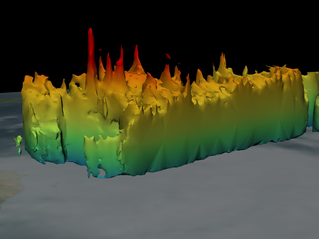
Hurricane Wilma's Hot Towers seen by TRMM 10/17/2005 at 1754Z
Visualization Credits
Please give credit for this item to:
NASA/Goddard Space Flight Center Scientific Visualization Studio
NASA/Goddard Space Flight Center Scientific Visualization Studio
Science Paper:
http://www.nasa.gov/centers/goddard/news/topstory/2004/0112towerclouds.html
Short URL to share this page:
https://svs.gsfc.nasa.gov/3281
Mission:
Tropical Rainfall Measuring Mission - TRMM
Data Used:
Note: While we identify the data sets used in these visualizations, we do not store any further details nor the data sets themselves on our site.
This item is part of these series:
Hurricanes
TRMM 3D Hurricanes
Hurricane Wilma
Keywords:
DLESE >> Atmospheric science
DLESE >> Natural hazards
GCMD >> Earth Science >> Atmosphere >> Atmospheric Phenomena >> Hurricanes
SVS >> Hurricane Frances
NASA Science >> Earth
GCMD keywords can be found on the Internet with the following citation: Olsen, L.M., G. Major, K. Shein, J. Scialdone, S. Ritz, T. Stevens, M. Morahan, A. Aleman, R. Vogel, S. Leicester, H. Weir, M. Meaux, S. Grebas, C.Solomon, M. Holland, T. Northcutt, R. A. Restrepo, R. Bilodeau, 2013. NASA/Global Change Master Directory (GCMD) Earth Science Keywords. Version 8.0.0.0.0
http://www.nasa.gov/centers/goddard/news/topstory/2004/0112towerclouds.html
Short URL to share this page:
https://svs.gsfc.nasa.gov/3281
Mission:
Tropical Rainfall Measuring Mission - TRMM
Data Used:
TRMM/VIRS
2005/10/19TRMM/TMI
2005/10/19TRMM/PR
2005/10/19This item is part of these series:
Hurricanes
TRMM 3D Hurricanes
Hurricane Wilma
Keywords:
DLESE >> Atmospheric science
DLESE >> Natural hazards
GCMD >> Earth Science >> Atmosphere >> Atmospheric Phenomena >> Hurricanes
SVS >> Hurricane Frances
NASA Science >> Earth
GCMD keywords can be found on the Internet with the following citation: Olsen, L.M., G. Major, K. Shein, J. Scialdone, S. Ritz, T. Stevens, M. Morahan, A. Aleman, R. Vogel, S. Leicester, H. Weir, M. Meaux, S. Grebas, C.Solomon, M. Holland, T. Northcutt, R. A. Restrepo, R. Bilodeau, 2013. NASA/Global Change Master Directory (GCMD) Earth Science Keywords. Version 8.0.0.0.0


