Earth
ID: 3185
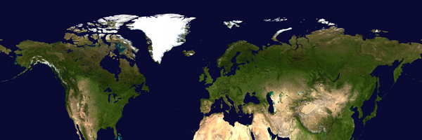
The extent of snow and ice that covers the earth's surface in the northern hemisphere grows and shrinks with the seasons. This animations shows the average snow and ice cover for a given month over a 24-year period, 1979 - 2002. It shows how often a particular point is covered with snow in a given month. The SVS Image Server gives each particular image in the animation the last date for which the data was used in creating that image, even though each of the images covers a span of years for a particular month.
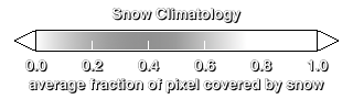
Monthly Snow Climatology, 1979-2002 (WMS)
Visualization Credits
Eric Sokolowsky (GST): Lead Animator
Cindy Starr (Global Science and Technology, Inc.): Visualizer
Walt Meier (NSIDC): Scientist
Cindy Starr (Global Science and Technology, Inc.): Visualizer
Walt Meier (NSIDC): Scientist
Please give credit for this item to:
NASA/Goddard Space Flight Center Scientific Visualization Studio
NASA/Goddard Space Flight Center Scientific Visualization Studio
Short URL to share this page:
https://svs.gsfc.nasa.gov/3185
Data Used:
Note: While we identify the data sets used in these visualizations, we do not store any further details nor the data sets themselves on our site.
This item is part of this series:
WMS
Keywords:
GCMD >> Earth Science >> Atmosphere >> Precipitation >> Snow
GCMD >> Earth Science >> Cryosphere >> Snow/Ice >> Snow Cover
GCMD >> Earth Science >> Hydrosphere >> Snow/Ice >> Snow Cover
NASA Science >> Earth
GCMD keywords can be found on the Internet with the following citation: Olsen, L.M., G. Major, K. Shein, J. Scialdone, S. Ritz, T. Stevens, M. Morahan, A. Aleman, R. Vogel, S. Leicester, H. Weir, M. Meaux, S. Grebas, C.Solomon, M. Holland, T. Northcutt, R. A. Restrepo, R. Bilodeau, 2013. NASA/Global Change Master Directory (GCMD) Earth Science Keywords. Version 8.0.0.0.0
https://svs.gsfc.nasa.gov/3185
Data Used:
DMSP/SSM/I
1979-2002
Defense Meteorological Satellite Program Special Sensor Microwave Imager
Nimbus-7/SMMR
1979-2002This item is part of this series:
WMS
Keywords:
GCMD >> Earth Science >> Atmosphere >> Precipitation >> Snow
GCMD >> Earth Science >> Cryosphere >> Snow/Ice >> Snow Cover
GCMD >> Earth Science >> Hydrosphere >> Snow/Ice >> Snow Cover
NASA Science >> Earth
GCMD keywords can be found on the Internet with the following citation: Olsen, L.M., G. Major, K. Shein, J. Scialdone, S. Ritz, T. Stevens, M. Morahan, A. Aleman, R. Vogel, S. Leicester, H. Weir, M. Meaux, S. Grebas, C.Solomon, M. Holland, T. Northcutt, R. A. Restrepo, R. Bilodeau, 2013. NASA/Global Change Master Directory (GCMD) Earth Science Keywords. Version 8.0.0.0.0


