Earth
ID: 3020
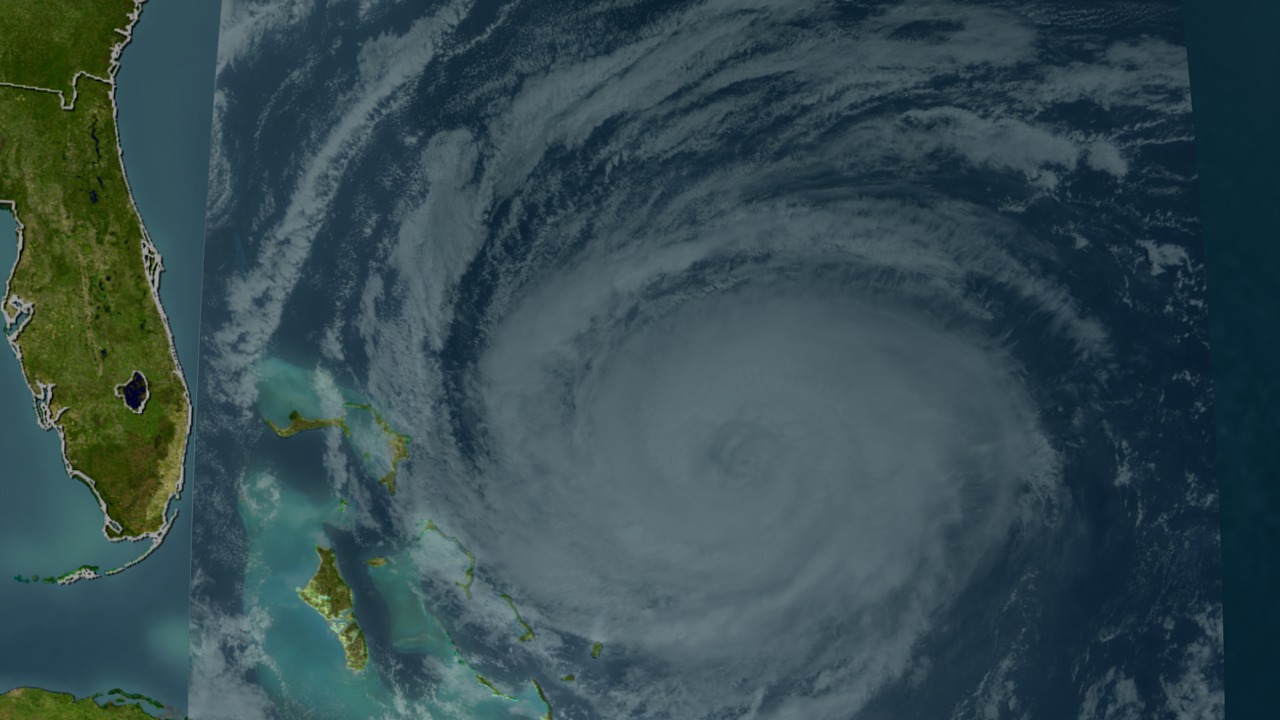
The Terra Satellite with the help of the MODIS instrument is able to get high resolution imagery of Hurricane Jeanne.

Up Close and Personal with Hurricane Jeanne
Visualization Credits
Please give credit for this item to:
NASA/Goddard Space Flight Center Scientific Visualization Studio
NASA/Goddard Space Flight Center Scientific Visualization Studio
Short URL to share this page:
https://svs.gsfc.nasa.gov/3020
Mission:
Terra
Data Used:
Note: While we identify the data sets used in these visualizations, we do not store any further details nor the data sets themselves on our site.
This item is part of this series:
Hurricane Jeanne
Keywords:
SVS >> HDTV
GCMD >> Earth Science >> Atmosphere >> Precipitation
GCMD >> Earth Science >> Atmosphere >> Atmospheric Phenomena >> Hurricanes
GCMD >> Earth Science >> Human Dimensions >> Natural Hazards >> Fires
GCMD >> Location >> Gulf Of Mexico
GCMD >> Location >> Florida
SVS >> Hurricane Jeanne
SVS >> For Educators
SVS >> Atmospheric Circulation
SVS >> Atmospheric Science
SVS >> Meteorological Phenomenon
SVS >> Cloud Cover >> Type
SVS >> Hurricanes >> Jeanne
SVS >> Cloud Cover >> Frequency
NASA Science >> Earth
GCMD keywords can be found on the Internet with the following citation: Olsen, L.M., G. Major, K. Shein, J. Scialdone, S. Ritz, T. Stevens, M. Morahan, A. Aleman, R. Vogel, S. Leicester, H. Weir, M. Meaux, S. Grebas, C.Solomon, M. Holland, T. Northcutt, R. A. Restrepo, R. Bilodeau, 2013. NASA/Global Change Master Directory (GCMD) Earth Science Keywords. Version 8.0.0.0.0
https://svs.gsfc.nasa.gov/3020
Mission:
Terra
Data Used:
Terra/MODIS
2004/09/24This item is part of this series:
Hurricane Jeanne
Keywords:
SVS >> HDTV
GCMD >> Earth Science >> Atmosphere >> Precipitation
GCMD >> Earth Science >> Atmosphere >> Atmospheric Phenomena >> Hurricanes
GCMD >> Earth Science >> Human Dimensions >> Natural Hazards >> Fires
GCMD >> Location >> Gulf Of Mexico
GCMD >> Location >> Florida
SVS >> Hurricane Jeanne
SVS >> For Educators
SVS >> Atmospheric Circulation
SVS >> Atmospheric Science
SVS >> Meteorological Phenomenon
SVS >> Cloud Cover >> Type
SVS >> Hurricanes >> Jeanne
SVS >> Cloud Cover >> Frequency
NASA Science >> Earth
GCMD keywords can be found on the Internet with the following citation: Olsen, L.M., G. Major, K. Shein, J. Scialdone, S. Ritz, T. Stevens, M. Morahan, A. Aleman, R. Vogel, S. Leicester, H. Weir, M. Meaux, S. Grebas, C.Solomon, M. Holland, T. Northcutt, R. A. Restrepo, R. Bilodeau, 2013. NASA/Global Change Master Directory (GCMD) Earth Science Keywords. Version 8.0.0.0.0


