Shrinking Aral Sea
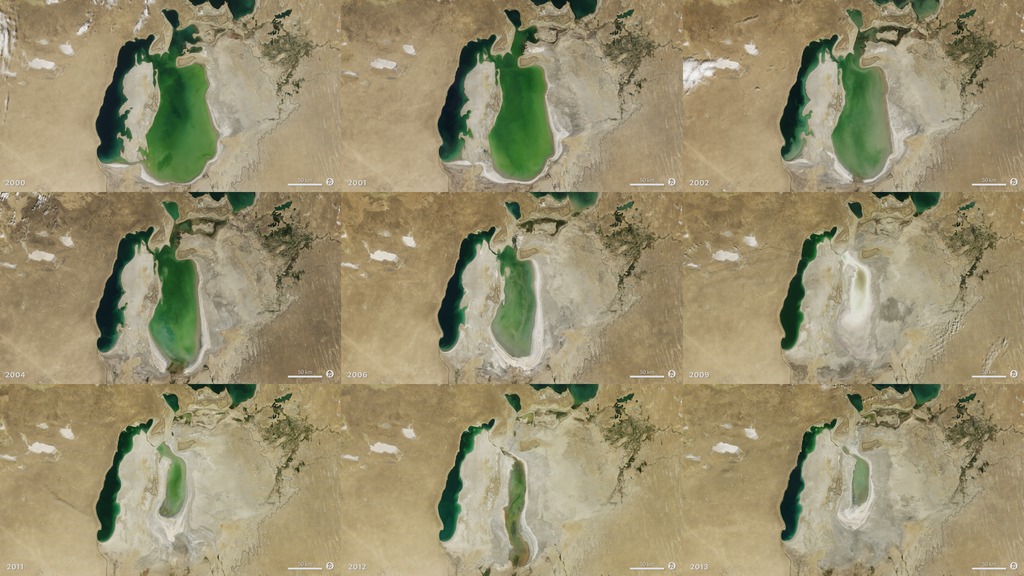
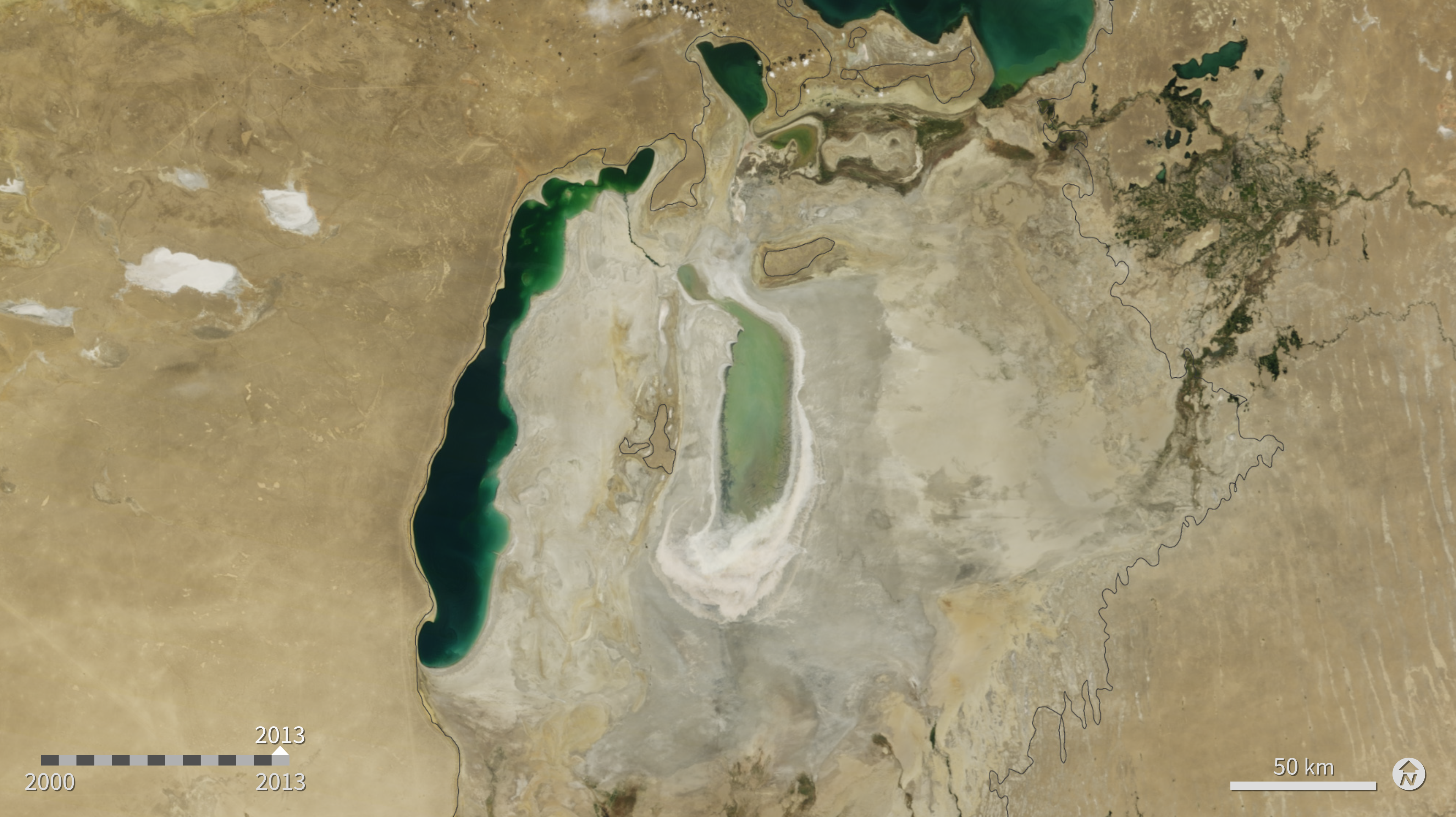
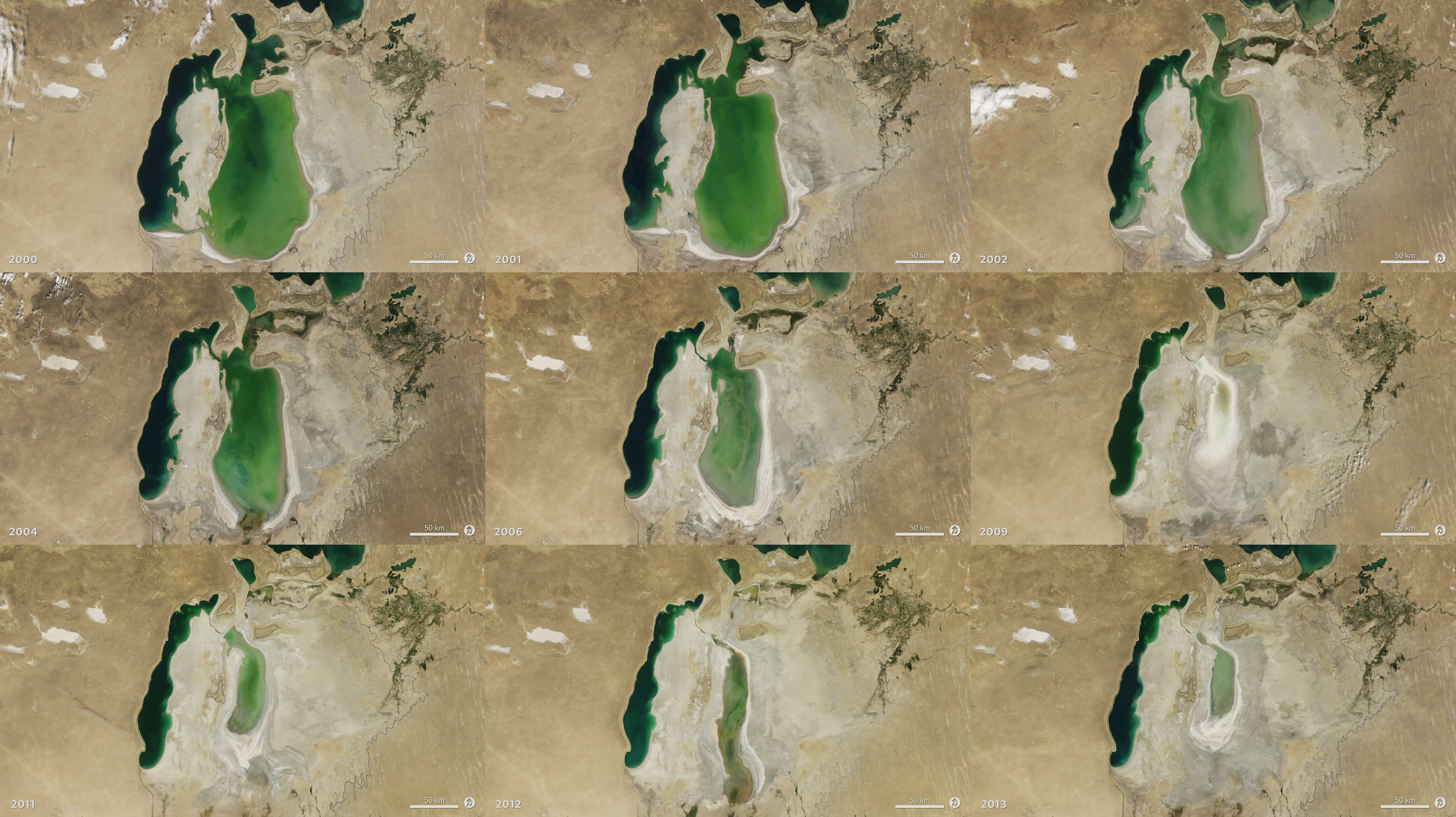
At the start of the series in 2000, the lake was already a fraction of its 1960 extent (black line). The Northern Aral Sea (small) had separated from the Southern (large) Aral Sea. The Southern Aral Sea had split into an eastern and a western lobe that remained tenuously connected at both ends. By 2001, the southern connection had been severed, and the shallower eastern part retreated rapidly over the next several years. After Kazakhstan built a dam between the northern and southern parts of the Aral Sea, all of the water flowing into the desert basin from the Syr Darya stayed in the Northern Aral Sea. The differences in water color are due to changes in sediment.
Images acquired from the Moderate Resolution Imaging Spectroradiometer (MODIS) on NASA’s Terra satellite
Reference: NASA’s Earth Observatory

For More Information
Credits
NASA/Goddard Space Flight Center
https://svs.gsfc.nasa.gov/30165
Mission:
Terra
Data Used:
Terra/MODIS
This item is part of this series:
World of Change
Keywords:
SVS >> HDTV
SVS >> Hyperwall
NASA Science >> Earth
SVS >> Presentation


