Earth
ID: 30039
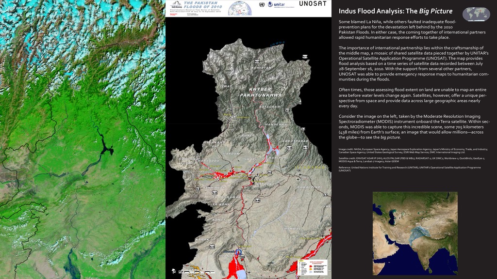
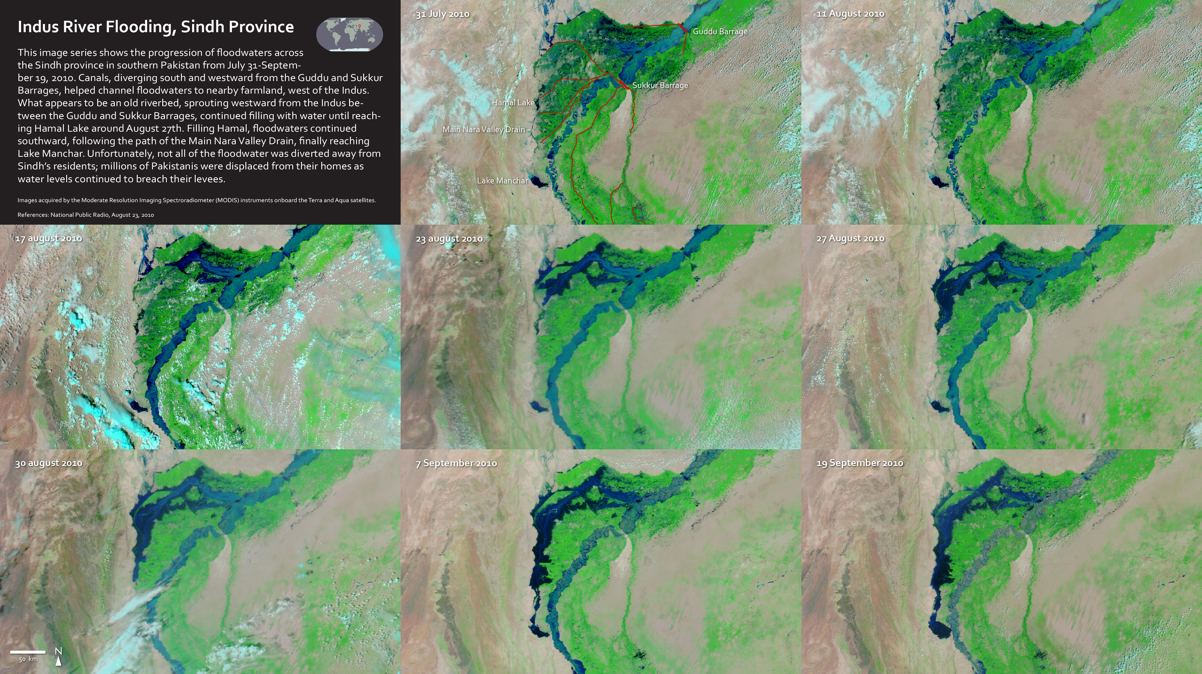
Some blamed La Niña, while others faulted inadequate flood-prevention plans for the devastation left behind by the 2010 Pakistan Floods. In either case, the coming together of international partners allowed rapid humanitarian response efforts to take place. The importance of international partnership lies within the craftsmanship of the middle map, a mosaic of shared satellite data pieced together by UNITAR’s Operational Satellite Application Programme (UNOSAT). The map provides flood analysis based on a time series of satellite data recorded between July 28-September 16, 2010. With the support from several other partners, UNOSAT was able to provide emergency response maps to humanitarian communities during the floods. Often times, those assessing flood extent on land are unable to map an entire area before water levels change again. Satellites, however, offer a unique perspective from space and provide data across large geographic areas nearly every day.


2010 Indus Floods
Credits
Marit Jentoft-Nilsen (Wyle Information Systems): Lead Animator
Mark Malanoski (GST): Project Support
Heather Hanson (GST): Writer
Mark Malanoski (GST): Project Support
Heather Hanson (GST): Writer
Please give credit for this item to:
NASA's Goddard Space Flight Center
NASA's Goddard Space Flight Center
Short URL to share this page:
https://svs.gsfc.nasa.gov/30039
Keywords:
DLESE >> Hydrology
DLESE >> Natural hazards
GCMD >> Earth Science >> Hydrosphere >> Surface Water >> Floods
SVS >> Hyperwall
NASA Science >> Earth
SVS >> Presentation
GCMD keywords can be found on the Internet with the following citation: Olsen, L.M., G. Major, K. Shein, J. Scialdone, S. Ritz, T. Stevens, M. Morahan, A. Aleman, R. Vogel, S. Leicester, H. Weir, M. Meaux, S. Grebas, C.Solomon, M. Holland, T. Northcutt, R. A. Restrepo, R. Bilodeau, 2013. NASA/Global Change Master Directory (GCMD) Earth Science Keywords. Version 8.0.0.0.0


