Earth
ID: 30011
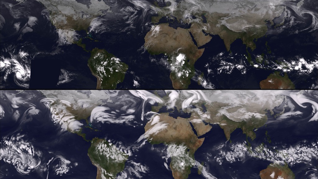
This animation compares data taken by several geostationary weather satellites, including the Geostationary Operational Environmental Satellites (GOES), and the Goddard Earth Observing System Model, Version 5 (GEOS-5). GEOS-5 is an assimilation model that starts from observations taken by satellites such as GOES and then builds a forecast for some days into the future. The period of time shown here is during February 2010 which brought record snowfall to the east coast of the United States.
Comparision of GOES and GEOS-5
Credits
Leann Johnson (Global Science and Technology, Inc.): Project Support
Eric Sokolowsky (GST): Project Support
Eric Sokolowsky (GST): Project Support
Please give credit for this item to:
NASA/Goddard Space Flight Center
NASA/Goddard Space Flight Center
Short URL to share this page:
https://svs.gsfc.nasa.gov/30011
Keywords:
SVS >> HDTV
SVS >> Hyperwall
SVS >> GEOS
NASA Science >> Earth
https://svs.gsfc.nasa.gov/30011
Keywords:
SVS >> HDTV
SVS >> Hyperwall
SVS >> GEOS
NASA Science >> Earth


