Earth
ID: 2974
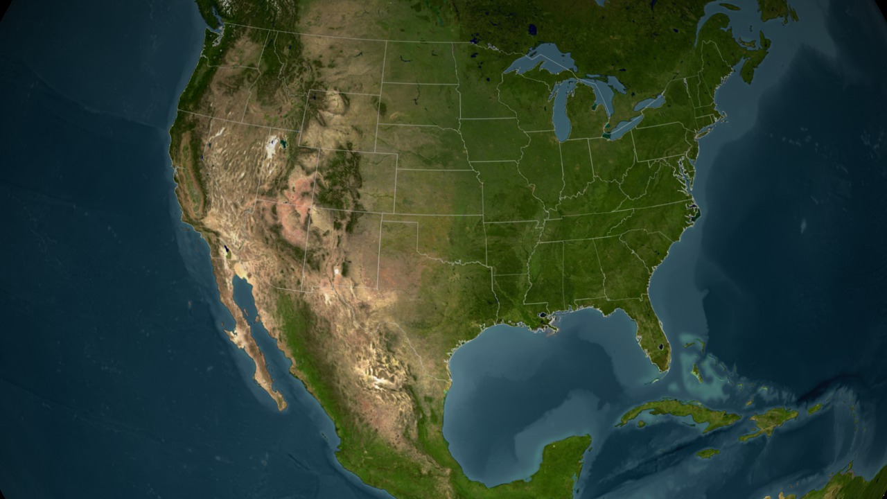
NASA satellites are keeping an eye on Hurricane Frances journey across the Atlantic Ocean. MODIS Instrument on board NASA's Aqua and Terra satellites captured a series of high resolution images of Hurricane Frances.

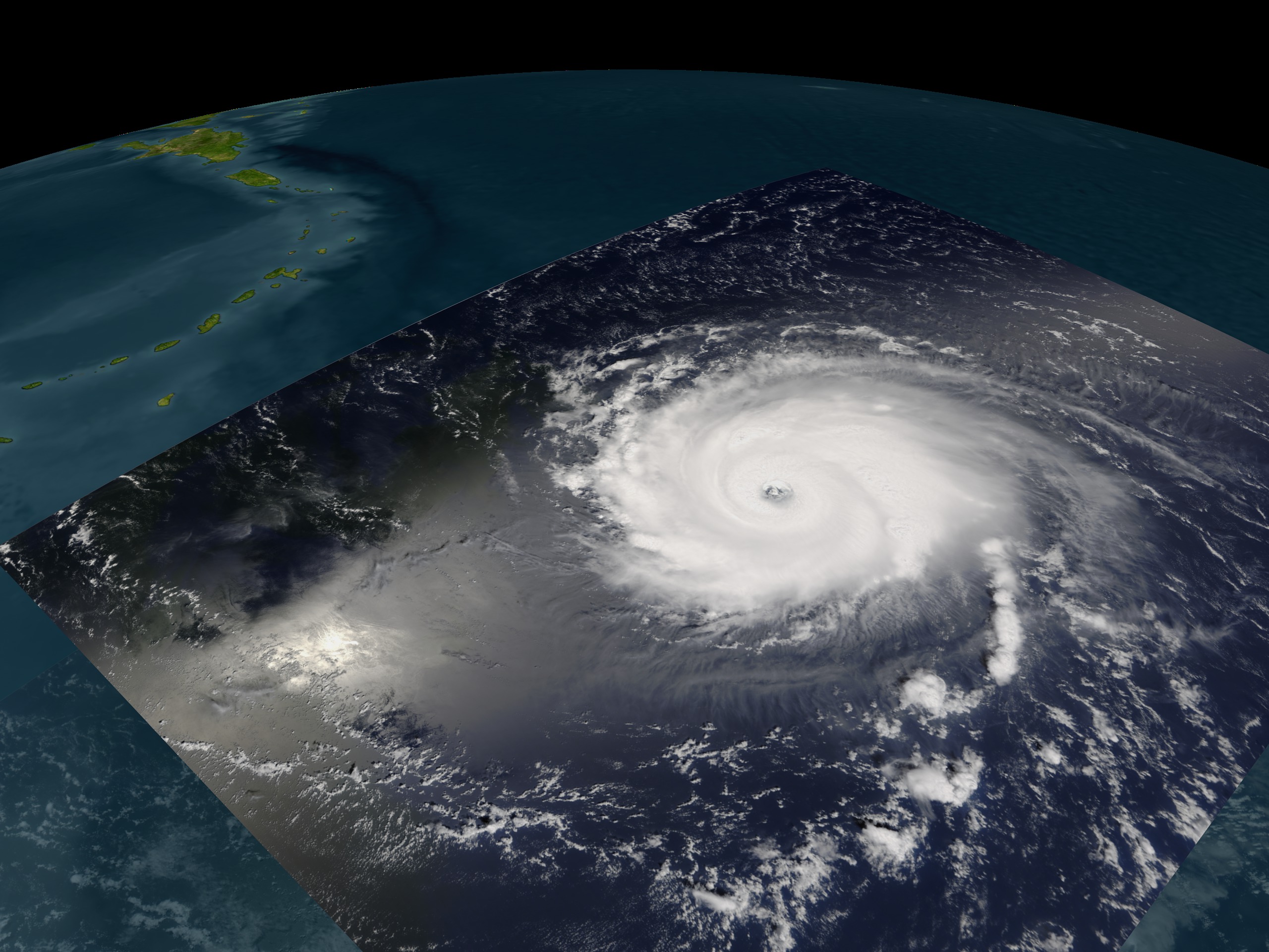
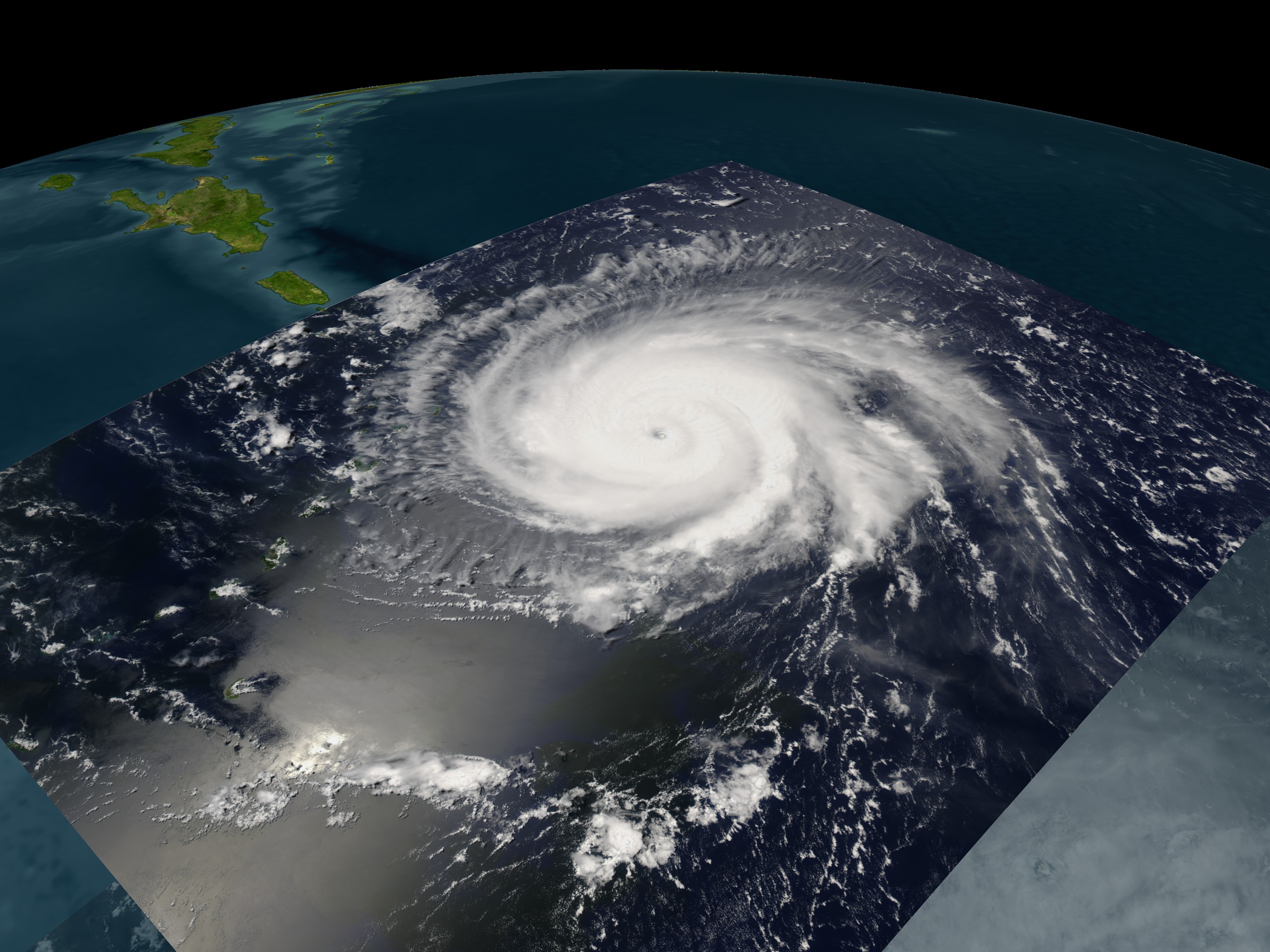

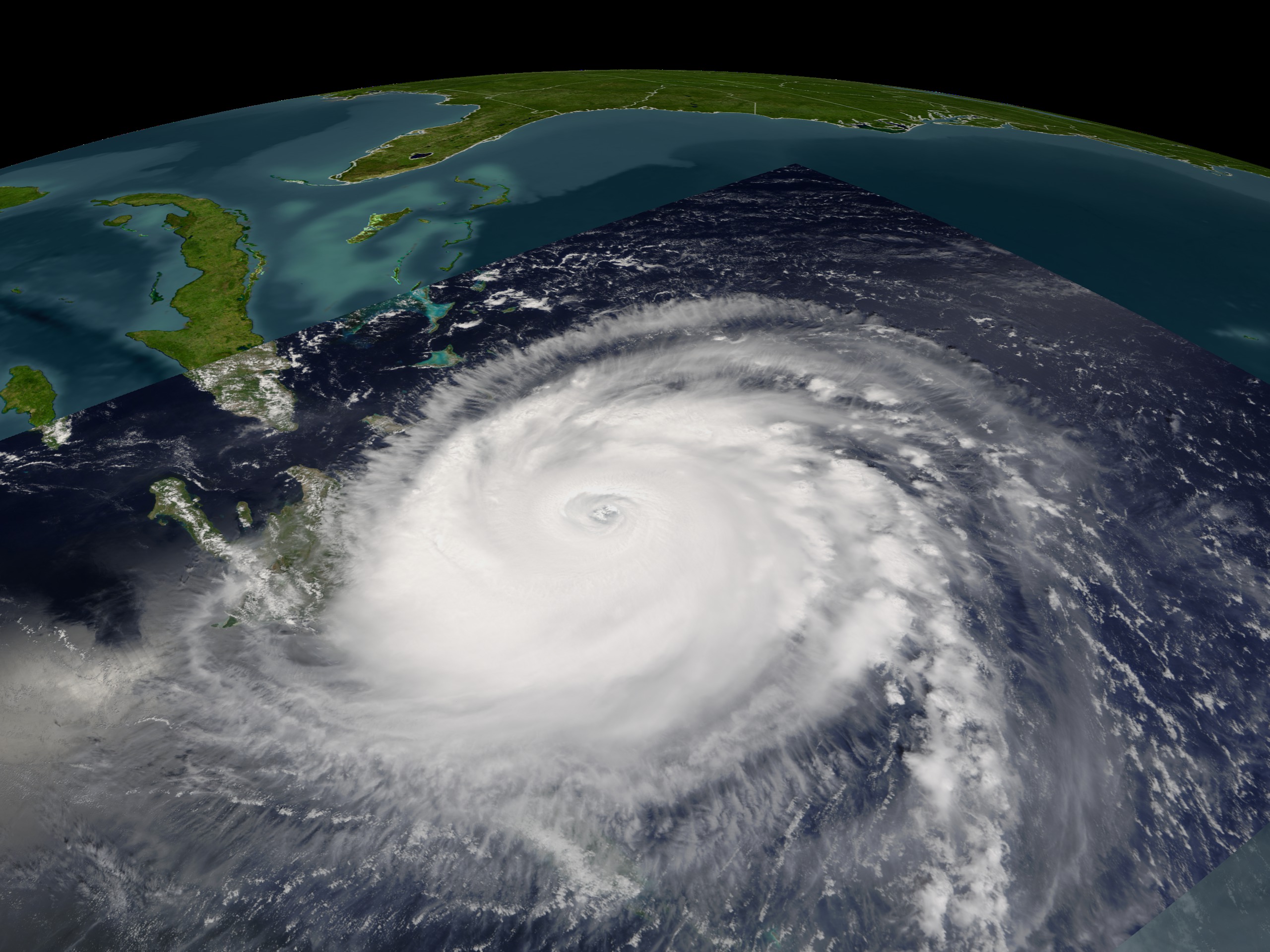
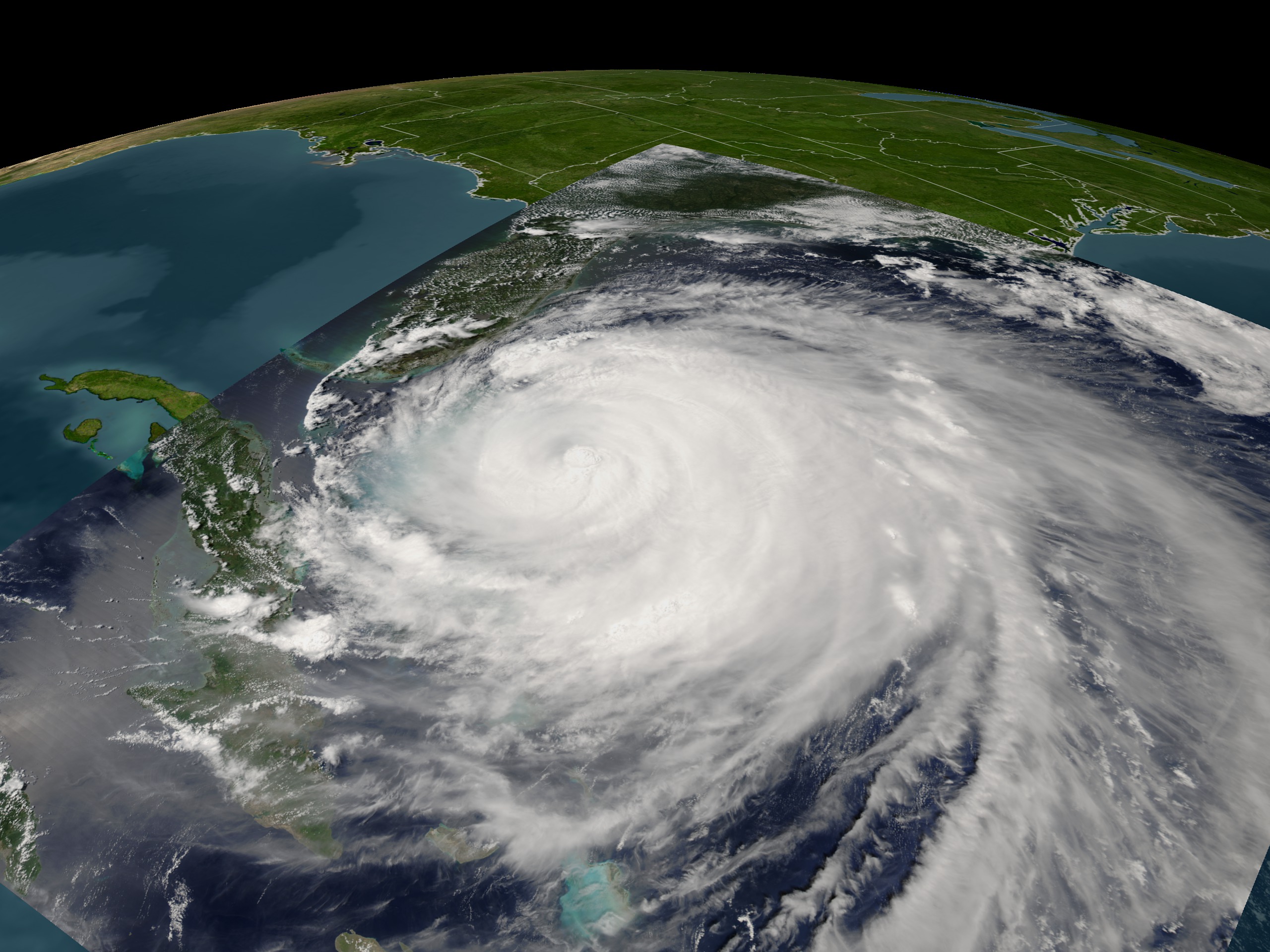
Hurricane Frances Progression
Visualization Credits
Stuart A. Snodgrass (GST): Lead Animator
Lori Perkins (NASA/GSFC): Animator
Jacques Descloitres (NASA/GSFC): Scientist
Lori Perkins (NASA/GSFC): Animator
Jacques Descloitres (NASA/GSFC): Scientist
Please give credit for this item to:
NASA/Goddard Space Flight Center Scientific Visualization Studio
NASA/Goddard Space Flight Center Scientific Visualization Studio
Short URL to share this page:
https://svs.gsfc.nasa.gov/2974
Mission:
Terra
Data Used:
Note: While we identify the data sets used in these visualizations, we do not store any further details nor the data sets themselves on our site.
This item is part of these series:
Hurricanes
Hurricane Frances
Goddard TV Tape:
G2004-036
Keywords:
SVS >> HDTV
GCMD >> Earth Science >> Atmosphere >> Atmospheric Phenomena >> Hurricanes
GCMD >> Earth Science >> Human Dimensions >> Natural Hazards >> Meteorological Hazards
SVS >> Hurricane Frances
SVS >> For Educators
SVS >> Cloud Cover >> Amount
SVS >> Atmospheric Circulation
SVS >> Wind Patterns
SVS >> Meteorological Phenomenon
SVS >> Cloud Cover >> Frequency
NASA Science >> Earth
GCMD keywords can be found on the Internet with the following citation: Olsen, L.M., G. Major, K. Shein, J. Scialdone, S. Ritz, T. Stevens, M. Morahan, A. Aleman, R. Vogel, S. Leicester, H. Weir, M. Meaux, S. Grebas, C.Solomon, M. Holland, T. Northcutt, R. A. Restrepo, R. Bilodeau, 2013. NASA/Global Change Master Directory (GCMD) Earth Science Keywords. Version 8.0.0.0.0
https://svs.gsfc.nasa.gov/2974
Mission:
Terra
Data Used:
Aqua/MODIS
2004/08/27, 2004/09/03Terra/MODIS
2004/08/28, 2004/08/30, 2004/08/31, 2004/09/01This item is part of these series:
Hurricanes
Hurricane Frances
Goddard TV Tape:
G2004-036
Keywords:
SVS >> HDTV
GCMD >> Earth Science >> Atmosphere >> Atmospheric Phenomena >> Hurricanes
GCMD >> Earth Science >> Human Dimensions >> Natural Hazards >> Meteorological Hazards
SVS >> Hurricane Frances
SVS >> For Educators
SVS >> Cloud Cover >> Amount
SVS >> Atmospheric Circulation
SVS >> Wind Patterns
SVS >> Meteorological Phenomenon
SVS >> Cloud Cover >> Frequency
NASA Science >> Earth
GCMD keywords can be found on the Internet with the following citation: Olsen, L.M., G. Major, K. Shein, J. Scialdone, S. Ritz, T. Stevens, M. Morahan, A. Aleman, R. Vogel, S. Leicester, H. Weir, M. Meaux, S. Grebas, C.Solomon, M. Holland, T. Northcutt, R. A. Restrepo, R. Bilodeau, 2013. NASA/Global Change Master Directory (GCMD) Earth Science Keywords. Version 8.0.0.0.0


