Earth
ID: 2894
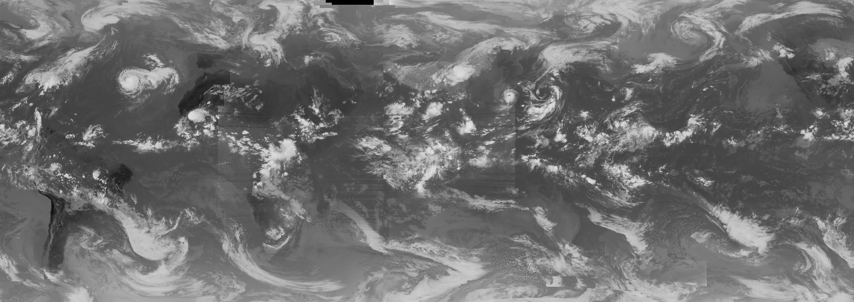
This animation is a mosaic of cloud cover data taken by several different satellites in the infrared band. One of the most prominent cloud features during this time was Hurricane Erin near the Atlantic coast of the United States.
Global Infrared Cloud Cover, September 2001 (WMS)
Visualization Credits
Eric Sokolowsky (GST): Lead Animator
Alex Kekesi (Global Science and Technology, Inc.): Animator
Dennis Chesters (NASA/GSFC): Scientist
Alex Kekesi (Global Science and Technology, Inc.): Animator
Dennis Chesters (NASA/GSFC): Scientist
Please give credit for this item to:
NASA/Goddard Space Flight Center Scientific Visualization Studio
NASA/Goddard Space Flight Center Scientific Visualization Studio
Short URL to share this page:
https://svs.gsfc.nasa.gov/2894
Data Used:
Note: While we identify the data sets used in these visualizations, we do not store any further details nor the data sets themselves on our site.
This item is part of this series:
WMS
Keywords:
DLESE >> Atmospheric science
SVS >> Cloud Cover
SVS >> HDTV
SVS >> Infrared
DLESE >> Natural hazards
GCMD >> Earth Science >> Atmosphere >> Clouds >> Cloud Amount/Frequency
GCMD >> Earth Science >> Spectral/Engineering >> Infrared Wavelengths >> Infrared Imagery
SVS >> Hurricane Erin
SVS >> GOES
SVS >> For Educators
SVS >> Cloud Cover >> Amount
NASA Science >> Earth
GCMD keywords can be found on the Internet with the following citation: Olsen, L.M., G. Major, K. Shein, J. Scialdone, S. Ritz, T. Stevens, M. Morahan, A. Aleman, R. Vogel, S. Leicester, H. Weir, M. Meaux, S. Grebas, C.Solomon, M. Holland, T. Northcutt, R. A. Restrepo, R. Bilodeau, 2013. NASA/Global Change Master Directory (GCMD) Earth Science Keywords. Version 8.0.0.0.0
https://svs.gsfc.nasa.gov/2894
Data Used:
METEOSAT-6/VISSR
2001/09/01 - 2001/09/15GOES-9/Imager
2001/09/01 - 2001/09/15GOES-8/Imager
2001/09/01 - 2001/09/15GMS-4/VISSR
2001/09/01 - 2001/09/15This item is part of this series:
WMS
Keywords:
DLESE >> Atmospheric science
SVS >> Cloud Cover
SVS >> HDTV
SVS >> Infrared
DLESE >> Natural hazards
GCMD >> Earth Science >> Atmosphere >> Clouds >> Cloud Amount/Frequency
GCMD >> Earth Science >> Spectral/Engineering >> Infrared Wavelengths >> Infrared Imagery
SVS >> Hurricane Erin
SVS >> GOES
SVS >> For Educators
SVS >> Cloud Cover >> Amount
NASA Science >> Earth
GCMD keywords can be found on the Internet with the following citation: Olsen, L.M., G. Major, K. Shein, J. Scialdone, S. Ritz, T. Stevens, M. Morahan, A. Aleman, R. Vogel, S. Leicester, H. Weir, M. Meaux, S. Grebas, C.Solomon, M. Holland, T. Northcutt, R. A. Restrepo, R. Bilodeau, 2013. NASA/Global Change Master Directory (GCMD) Earth Science Keywords. Version 8.0.0.0.0


