Earth
ID: 2744
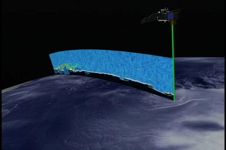
The GLAS laser system on ICESat is making unique measurements of the heights of clouds and their global distribution. In addition, ICESat can 'see' the distributions of aerosols from sources such as dust storms and forest fires. This animation shows the distribution of cloud layers as seens from the bird's eye perspective of the ICESat spacecraft.
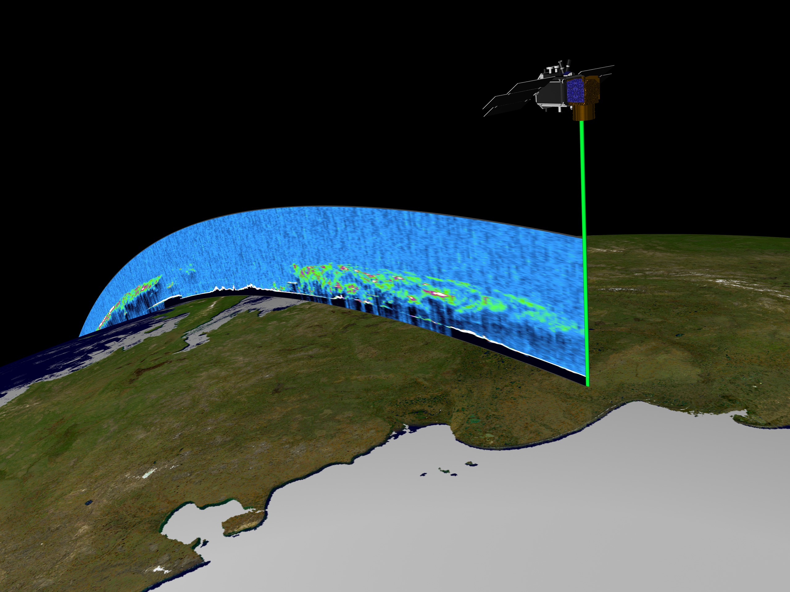
ICESat First Light Release: A Continuous View of Clouds
Visualization Credits
Greg Shirah (NASA/GSFC): Lead Animator
Alex Kekesi (Global Science and Technology, Inc.): Animator
Christopher Shuman (NASA/GSFC): Scientist
Jay Zwally (NASA/GSFC): Scientist
Alex Kekesi (Global Science and Technology, Inc.): Animator
Christopher Shuman (NASA/GSFC): Scientist
Jay Zwally (NASA/GSFC): Scientist
Please give credit for this item to:
NASA/Goddard Space Flight Center Scientific Visualization Studio, Canadian Space Agency, RADARSAT International Inc.
NASA/Goddard Space Flight Center Scientific Visualization Studio, Canadian Space Agency, RADARSAT International Inc.
Short URL to share this page:
https://svs.gsfc.nasa.gov/2744
Missions:
Ice, Cloud, and land Elevation Satellite (ICESat)
Terra
Data Used:
Note: While we identify the data sets used in these visualizations, we do not store any further details nor the data sets themselves on our site.
Keywords:
DLESE >> Atmospheric science
SVS >> Clouds
DLESE >> Technology
NASA Science >> Earth
https://svs.gsfc.nasa.gov/2744
Missions:
Ice, Cloud, and land Elevation Satellite (ICESat)
Terra
Data Used:
RADARSAT-1/SAR
Credit:
Additional credit goes to Canadian Space Agency, RADARSAT International Inc.
Additional credit goes to Canadian Space Agency, RADARSAT International Inc.
Terra/MODIS
ICESat/GLAS/L2 Global Cloud Heights for Multi-layer Clouds (GLA09)
2003/03/02Keywords:
DLESE >> Atmospheric science
SVS >> Clouds
DLESE >> Technology
NASA Science >> Earth


