Earth
Universe
ID: 2663
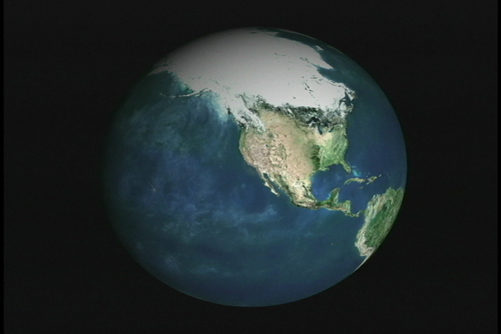
Using data from different spacecraft and some powerful computer technology, visualizers at the Goddard Space Flight Center present you with a collection of American cities in a way you have never seen them before. Starting with our camera high above the Earth, we rush in towards the surface at what would be an impossible speed for any known vehicle. Passing though layers of atmosphere, the colors of our destinations shimmer with their own unique characteristics, and suddenly we find ourselves floating in virtual space just above the ground.
This particular zoom was created in support of a JASON project video for NASA/GSFC/Code 935.
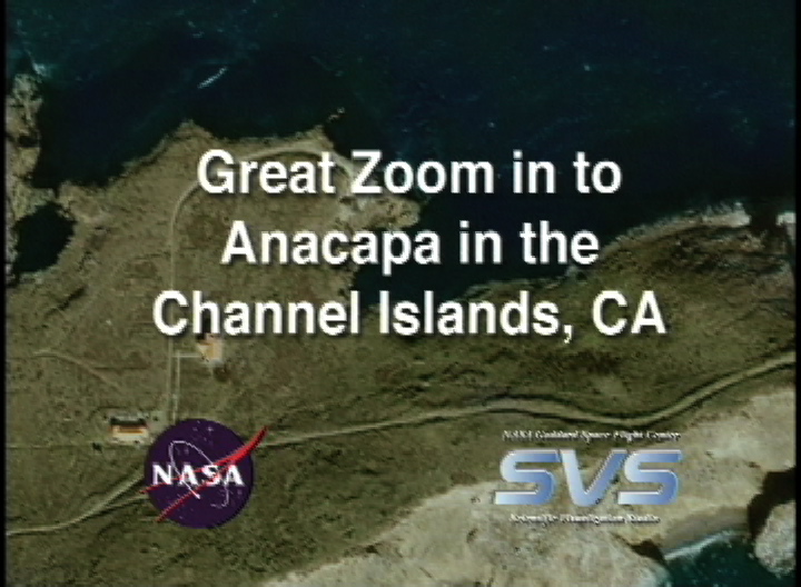
Great Zoom into Channel Islands, CA (Anacapa Island)
This particular zoom was created in support of a JASON project video for NASA/GSFC/Code 935.
Visualization Credits
Greg Shirah (NASA/GSFC): Lead Animator
Horace Mitchell (NASA/GSFC): Animator
Marte Newcombe (GST): Animator
Darrel Williams (NASA/GSFC): Scientist
Horace Mitchell (NASA/GSFC): Animator
Marte Newcombe (GST): Animator
Darrel Williams (NASA/GSFC): Scientist
Please give credit for this item to:
NASA/Goddard Space Flight Center Scientific Visualization Studio. Additional credit to Reto Stöckli for the Blue Marble.
NASA/Goddard Space Flight Center Scientific Visualization Studio. Additional credit to Reto Stöckli for the Blue Marble.
Short URL to share this page:
https://svs.gsfc.nasa.gov/2663
Missions:
Landsat
Terra
Data Used:
Note: While we identify the data sets used in these visualizations, we do not store any further details nor the data sets themselves on our site.
This item is part of this series:
Great Zooms
Keywords:
SVS >> Anacapa Island
DLESE >> Human geography
DLESE >> Physical geography
SVS >> Zoom
GCMD >> Location >> Channel Islands
GCMD >> Location >> California
NASA Science >> Earth
NASA Science >> Universe
GCMD keywords can be found on the Internet with the following citation: Olsen, L.M., G. Major, K. Shein, J. Scialdone, S. Ritz, T. Stevens, M. Morahan, A. Aleman, R. Vogel, S. Leicester, H. Weir, M. Meaux, S. Grebas, C.Solomon, M. Holland, T. Northcutt, R. A. Restrepo, R. Bilodeau, 2013. NASA/Global Change Master Directory (GCMD) Earth Science Keywords. Version 8.0.0.0.0
https://svs.gsfc.nasa.gov/2663
Missions:
Landsat
Terra
Data Used:
IKONOS
12/11/2001, 1/5/2002Landsat-7/ETM+
2/4/2001 (mostly), 9/20/1999 (small lower right section)Terra/MODIS
2000/12/25This item is part of this series:
Great Zooms
Keywords:
SVS >> Anacapa Island
DLESE >> Human geography
DLESE >> Physical geography
SVS >> Zoom
GCMD >> Location >> Channel Islands
GCMD >> Location >> California
NASA Science >> Earth
NASA Science >> Universe
GCMD keywords can be found on the Internet with the following citation: Olsen, L.M., G. Major, K. Shein, J. Scialdone, S. Ritz, T. Stevens, M. Morahan, A. Aleman, R. Vogel, S. Leicester, H. Weir, M. Meaux, S. Grebas, C.Solomon, M. Holland, T. Northcutt, R. A. Restrepo, R. Bilodeau, 2013. NASA/Global Change Master Directory (GCMD) Earth Science Keywords. Version 8.0.0.0.0


