Earth
ID: 2500
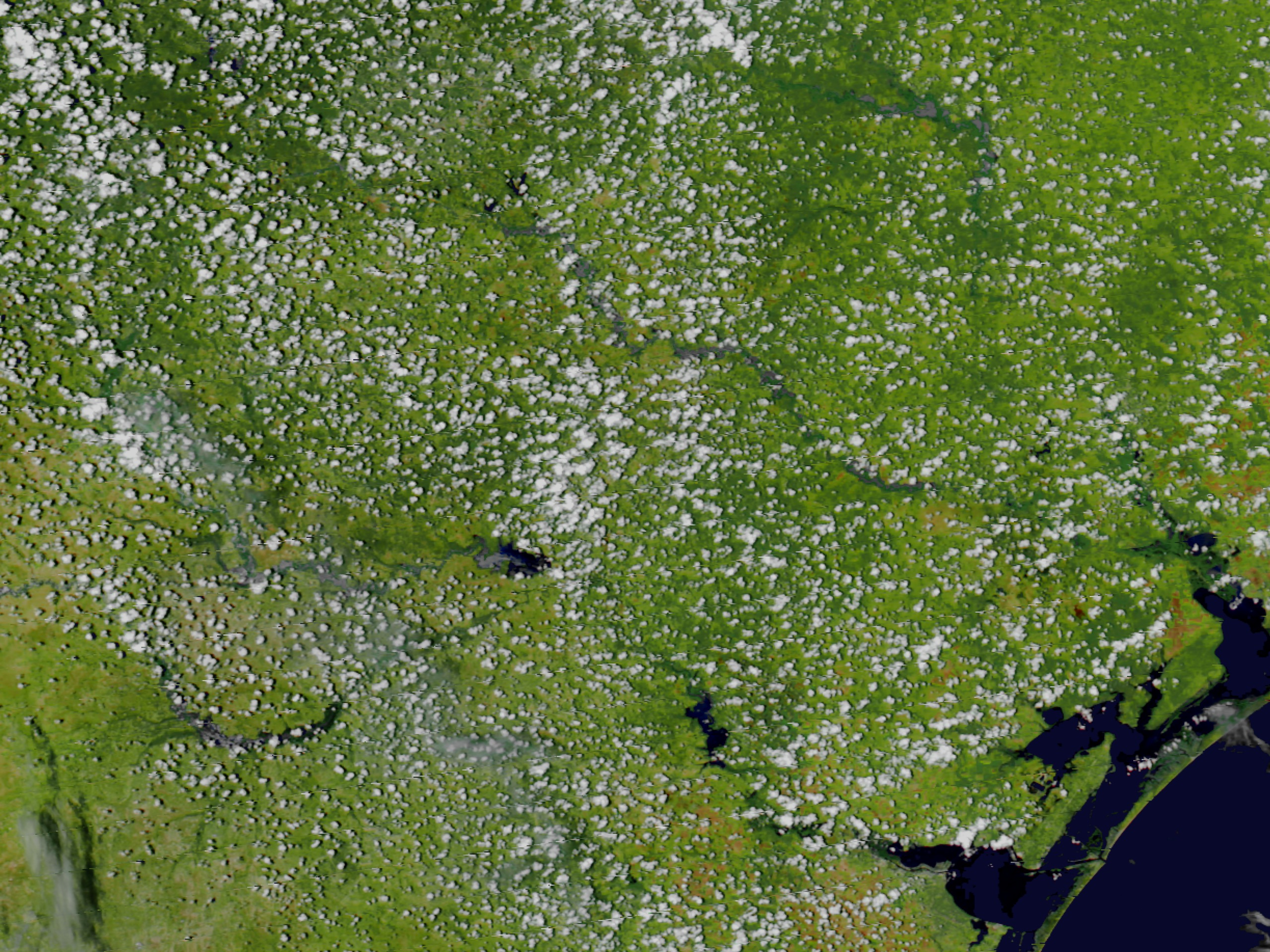
Southeast of San Antonio, Texas, rivers that were barely discernible in satellite imagery acquired in late June 2002 by Terra MODIS stand out clearly this Aqua MODIS image from July 24, 2002. Heavy rains during the first week of July brought as much as 2 feet of rain to some places in southeastern Texas, resulting in massive flooding of three major river systems along the Gulf of Mexico. Please note that this story is in relation to the 'Before the Flooding in Southeast Texas' story and is match-framed for dissolves in post production.

Flooding in Southeast Texas
Visualization Credits
Please give credit for this item to:
NASA/Goddard Space Flight Center Scientific Visualization Studio
NASA/Goddard Space Flight Center Scientific Visualization Studio
Short URL to share this page:
https://svs.gsfc.nasa.gov/2500
Data Used:
Note: While we identify the data sets used in these visualizations, we do not store any further details nor the data sets themselves on our site.
This item is part of this series:
Aqua First Light
Keywords:
DLESE >> Hydrology
DLESE >> Natural hazards
GCMD >> Earth Science >> Hydrosphere >> Surface Water >> Floods
GCMD >> Location >> Texas
NASA Science >> Earth
GCMD >> Earth Science >> Human Dimensions >> Natural Hazards >> Floods
GCMD keywords can be found on the Internet with the following citation: Olsen, L.M., G. Major, K. Shein, J. Scialdone, S. Ritz, T. Stevens, M. Morahan, A. Aleman, R. Vogel, S. Leicester, H. Weir, M. Meaux, S. Grebas, C.Solomon, M. Holland, T. Northcutt, R. A. Restrepo, R. Bilodeau, 2013. NASA/Global Change Master Directory (GCMD) Earth Science Keywords. Version 8.0.0.0.0
https://svs.gsfc.nasa.gov/2500
Data Used:
Aqua/MODIS
July 24, 2002This item is part of this series:
Aqua First Light
Keywords:
DLESE >> Hydrology
DLESE >> Natural hazards
GCMD >> Earth Science >> Hydrosphere >> Surface Water >> Floods
GCMD >> Location >> Texas
NASA Science >> Earth
GCMD >> Earth Science >> Human Dimensions >> Natural Hazards >> Floods
GCMD keywords can be found on the Internet with the following citation: Olsen, L.M., G. Major, K. Shein, J. Scialdone, S. Ritz, T. Stevens, M. Morahan, A. Aleman, R. Vogel, S. Leicester, H. Weir, M. Meaux, S. Grebas, C.Solomon, M. Holland, T. Northcutt, R. A. Restrepo, R. Bilodeau, 2013. NASA/Global Change Master Directory (GCMD) Earth Science Keywords. Version 8.0.0.0.0


