Earth
ID: 2482
A physical model of this visualization is on display at the National Geographic Explorers Hall Museum in Washington D.C.
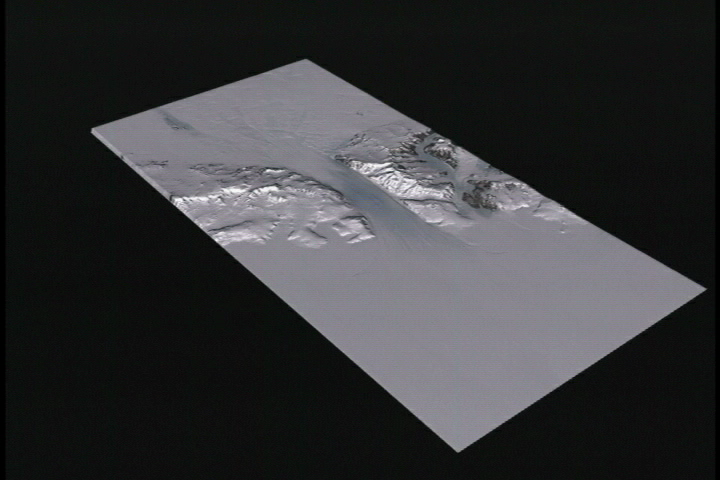
'Byrd Glacier plunges through a deep valley in the Transatlantic Mountains and onto the Ross Ice Shelf, dropping more than 4,300 feet over a distance of 112 miles. It remains a distinct ice stream all the way to the edge of the shelf, some 260 miles from the foot of the mountains to the open sea.' -National Geographic Magazine, February 2002

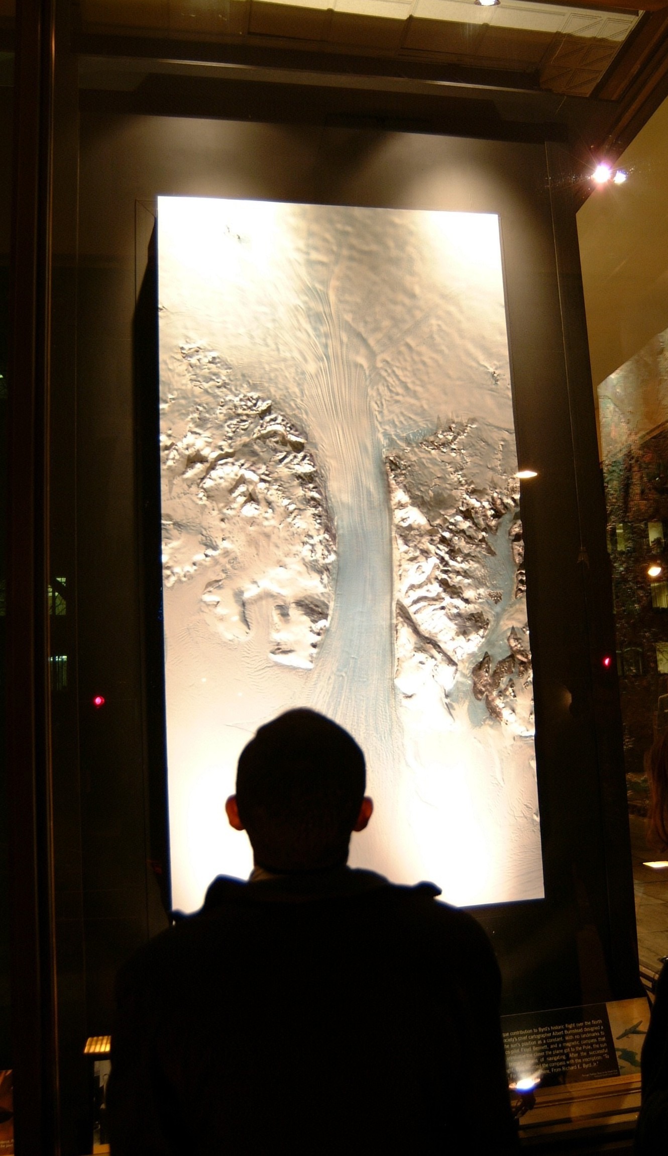

Byrd Glacier Exhibit
'Byrd Glacier plunges through a deep valley in the Transatlantic Mountains and onto the Ross Ice Shelf, dropping more than 4,300 feet over a distance of 112 miles. It remains a distinct ice stream all the way to the edge of the shelf, some 260 miles from the foot of the mountains to the open sea.' -National Geographic Magazine, February 2002
Visualization Credits
Alex Kekesi (Global Science and Technology, Inc.): Lead Animator
Bob Bindschadler (NASA/GSFC): Scientist
Ken Jezek (Ohio State University): Scientist
National Geographic Society: Writer
Bob Bindschadler (NASA/GSFC): Scientist
Ken Jezek (Ohio State University): Scientist
National Geographic Society: Writer
Please give credit for this item to:
NASA/Goddard Space Flight Center Scientific Visualization Studio, U.S. Geological Survey, Byrd Polar Research Center - The Ohio State University, Canadian Space Agency, RADARSAT International Inc.
NASA/Goddard Space Flight Center Scientific Visualization Studio, U.S. Geological Survey, Byrd Polar Research Center - The Ohio State University, Canadian Space Agency, RADARSAT International Inc.
Short URL to share this page:
https://svs.gsfc.nasa.gov/2482
Mission:
Landsat
Data Used:
Note: While we identify the data sets used in these visualizations, we do not store any further details nor the data sets themselves on our site.
Keywords:
GCMD >> Location >> Antarctica
NASA Science >> Earth
GCMD keywords can be found on the Internet with the following citation: Olsen, L.M., G. Major, K. Shein, J. Scialdone, S. Ritz, T. Stevens, M. Morahan, A. Aleman, R. Vogel, S. Leicester, H. Weir, M. Meaux, S. Grebas, C.Solomon, M. Holland, T. Northcutt, R. A. Restrepo, R. Bilodeau, 2013. NASA/Global Change Master Directory (GCMD) Earth Science Keywords. Version 8.0.0.0.0
Places you might have seen this:
National Geographic Magazine February 2002 Antarctica Map Supplement, RADARSAT-1 Annual Review 2001-2002
https://svs.gsfc.nasa.gov/2482
Mission:
Landsat
Data Used:
Landsat-7/ETM+
2000/01/117.5-Minute DEM
Model - USGS - 2001/03/22Keywords:
GCMD >> Location >> Antarctica
NASA Science >> Earth
GCMD keywords can be found on the Internet with the following citation: Olsen, L.M., G. Major, K. Shein, J. Scialdone, S. Ritz, T. Stevens, M. Morahan, A. Aleman, R. Vogel, S. Leicester, H. Weir, M. Meaux, S. Grebas, C.Solomon, M. Holland, T. Northcutt, R. A. Restrepo, R. Bilodeau, 2013. NASA/Global Change Master Directory (GCMD) Earth Science Keywords. Version 8.0.0.0.0
Places you might have seen this:
National Geographic Magazine February 2002 Antarctica Map Supplement, RADARSAT-1 Annual Review 2001-2002


