Earth
ID: 2466
Using the world's first space-based rain radar aboard NASA's Tropical Rainfall Measuring Mission (TRMM) satellite, NASA scientists found that mean monthly rainfall rates within 30-60 kilometers (18 to 36 miles) downwind of some cities were, on average, about 28 percent greater than the upwind region. In some cities, the downwind area exhibited increases as high as 51 percent.
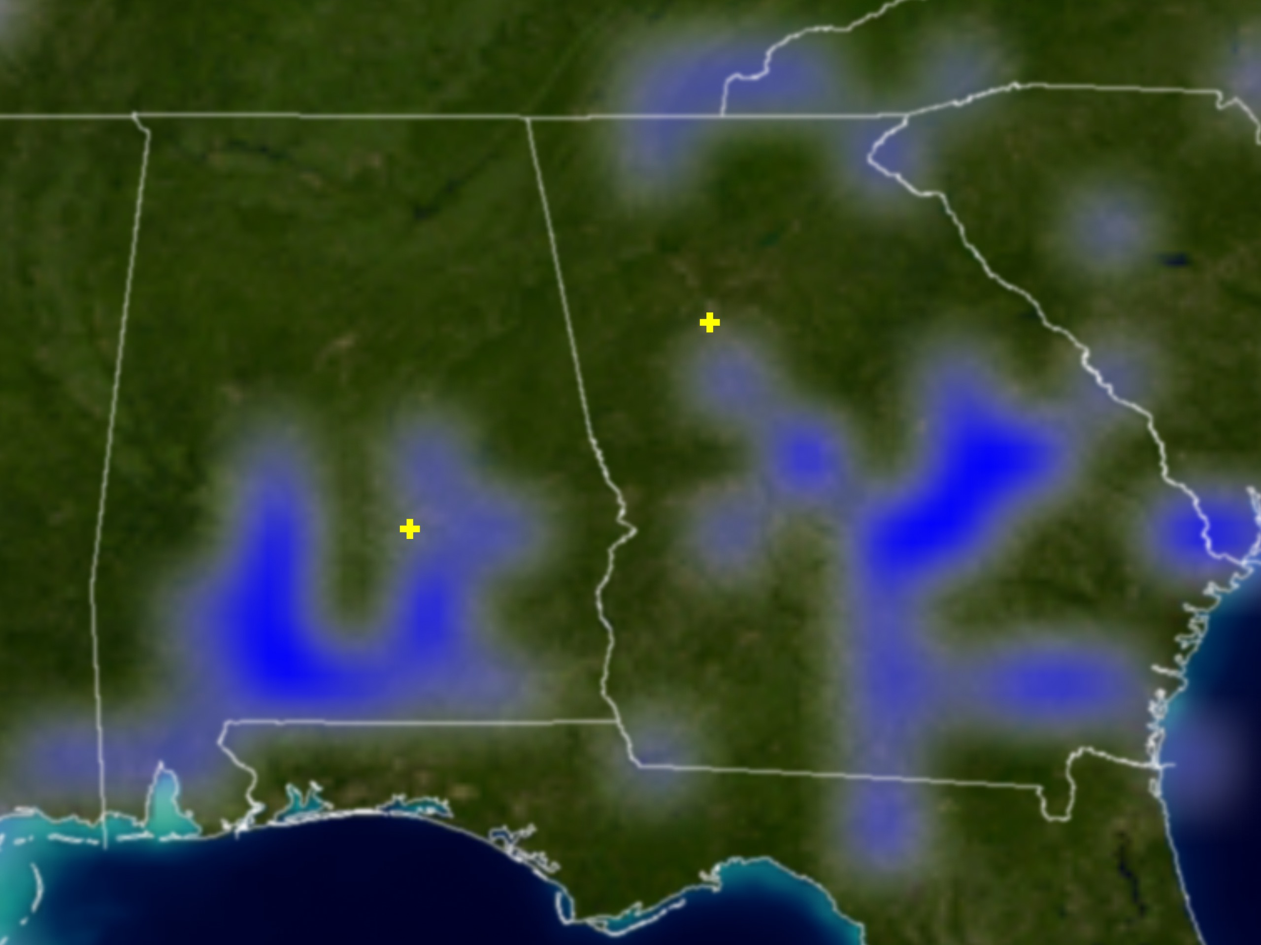
Urban Modifications of Rainfall, Alabama and Georgia
Visualization Credits
Please give credit for this item to:
NASA/Goddard Space Flight Center Scientific Visualization Studio
NASA/Goddard Space Flight Center Scientific Visualization Studio
Short URL to share this page:
https://svs.gsfc.nasa.gov/2466
Missions:
Terra
Tropical Rainfall Measuring Mission - TRMM
Data Used:
Note: While we identify the data sets used in these visualizations, we do not store any further details nor the data sets themselves on our site.
This item is part of this series:
TRMM
Keywords:
SVS >> Rainfall
SVS >> Urban
NASA Science >> Earth
https://svs.gsfc.nasa.gov/2466
Missions:
Terra
Tropical Rainfall Measuring Mission - TRMM
Data Used:
TRMM/PR
6-9/1998, 6-9/1999, 6-9/2000Terra/MODIS/Blue Marble
Credit:
The Blue Marble data is courtesy of Reto Stockli (NASA/GSFC).
The Blue Marble data is courtesy of Reto Stockli (NASA/GSFC).
Terra/MODIS/Land Cover also referred to as: Grasslands, Woody Savannas, Savannas, and Wetlands
This item is part of this series:
TRMM
Keywords:
SVS >> Rainfall
SVS >> Urban
NASA Science >> Earth


