Earth
ID: 2405
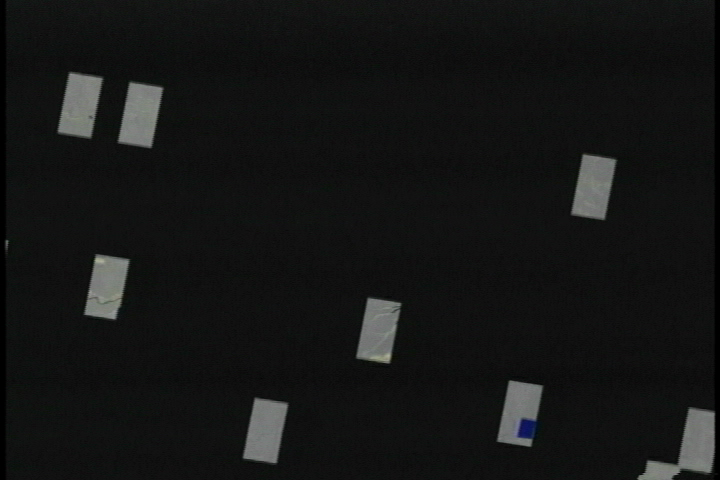
A satellite can cover the Amazon in just two months. The mapping team chose a Japanese satellite outfitted with synthetic aperture radar, or SAR for short. SAR is a natural fit for the Amazon. It can penetrate the clouds that pour rain for half of the year and the smoke from trees burned by farmers to clear land. SAR even works at night. As you might imagine, the satellite collects a pile of data. In raw form, these observations are gibberish. Focusing them requires a supercomputer to crunch fifteen hundred trillion calculations. The output is rich images of the Amazon. Scientists listed worked as a team on Mosaicking Software and Mosaic Production.
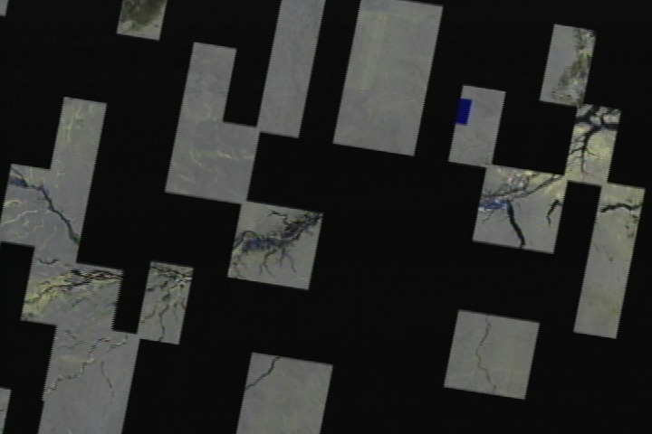
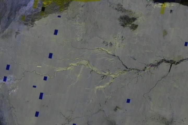
Mapping the Amazon: Mosaic tiles animation
Visualization Credits
Stuart A. Snodgrass (GST): Lead Animator
Tom Bridgman (Global Science and Technology, Inc.): Animator
Randall Jones (GST): Animator
Bruce Chapman (NASA/JPL CalTech): Scientist
David Curkendall (NASA/JPL CalTech): Scientist
Tony Freeman (NASA/JPL CalTech): Scientist
Craig Miller (NASA/JPL CalTech): Scientist
Herb Siegel (NASA/JPL CalTech): Scientist
Paul Siqueira (NASA/JPL CalTech): Scientist
Kathya Zamora (NASA/JPL CalTech): Scientist
Please give credit for this item to:
NASA/Goddard Space Flight Center Scientific Visualization Studio. Data Processing was done by Alaska SAR Facility, Advanced Computing Technology Applications for SAR Interferometry and Imaging Science http://pat.jpl.nasa.gov/public/SAR/, Global Rainforest Mapping Project CD-ROM Requests http://www.eorc.nasda.go.jp/Sciences/Forest/order.html
NASA/Goddard Space Flight Center Scientific Visualization Studio. Data Processing was done by Alaska SAR Facility, Advanced Computing Technology Applications for SAR Interferometry and Imaging Science http://pat.jpl.nasa.gov/public/SAR/, Global Rainforest Mapping Project CD-ROM Requests http://www.eorc.nasda.go.jp/Sciences/Forest/order.html
Short URL to share this page:
https://svs.gsfc.nasa.gov/2405
Data Used:
Note: While we identify the data sets used in these visualizations, we do not store any further details nor the data sets themselves on our site.
This item is part of this series:
Journeys through Earth and Space
Keywords:
DLESE >> Agricultural science
DLESE >> Environmental science
DLESE >> Forestry
DLESE >> Human geography
SVS >> Mosaic
GCMD >> Location >> Amazonia
NASA Science >> Earth
GCMD keywords can be found on the Internet with the following citation: Olsen, L.M., G. Major, K. Shein, J. Scialdone, S. Ritz, T. Stevens, M. Morahan, A. Aleman, R. Vogel, S. Leicester, H. Weir, M. Meaux, S. Grebas, C.Solomon, M. Holland, T. Northcutt, R. A. Restrepo, R. Bilodeau, 2013. NASA/Global Change Master Directory (GCMD) Earth Science Keywords. Version 8.0.0.0.0
https://svs.gsfc.nasa.gov/2405
Data Used:
JERS-1
1995, 1996This item is part of this series:
Journeys through Earth and Space
Keywords:
DLESE >> Agricultural science
DLESE >> Environmental science
DLESE >> Forestry
DLESE >> Human geography
SVS >> Mosaic
GCMD >> Location >> Amazonia
NASA Science >> Earth
GCMD keywords can be found on the Internet with the following citation: Olsen, L.M., G. Major, K. Shein, J. Scialdone, S. Ritz, T. Stevens, M. Morahan, A. Aleman, R. Vogel, S. Leicester, H. Weir, M. Meaux, S. Grebas, C.Solomon, M. Holland, T. Northcutt, R. A. Restrepo, R. Bilodeau, 2013. NASA/Global Change Master Directory (GCMD) Earth Science Keywords. Version 8.0.0.0.0


