Earth
ID: 2191
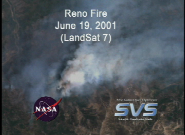
This animation is a simple zoom into the June 19, 2001 fire in Reno, Nevada. The original image is a Landsat 7 true color image of the fire between Lake Tahoe, Nevada and Reno, Nevada. Reno is under the smoke cloud.

Reno Fire from Landsat: June 19, 2001
Visualization Credits
Please give credit for this item to:
NASA/Goddard Space Flight Center Scientific Visualization Studio, Landsat 7 Project, USGS EROS Data Center
NASA/Goddard Space Flight Center Scientific Visualization Studio, Landsat 7 Project, USGS EROS Data Center
Short URL to share this page:
https://svs.gsfc.nasa.gov/2191
Mission:
Landsat
Data Used:
Note: While we identify the data sets used in these visualizations, we do not store any further details nor the data sets themselves on our site.
This item is part of this series:
Landsat 7
Keywords:
GCMD >> Earth Science >> Biosphere >> Ecological Dynamics >> Fire Occurrence
GCMD >> Location >> Nevada
NASA Science >> Earth
GCMD keywords can be found on the Internet with the following citation: Olsen, L.M., G. Major, K. Shein, J. Scialdone, S. Ritz, T. Stevens, M. Morahan, A. Aleman, R. Vogel, S. Leicester, H. Weir, M. Meaux, S. Grebas, C.Solomon, M. Holland, T. Northcutt, R. A. Restrepo, R. Bilodeau, 2013. NASA/Global Change Master Directory (GCMD) Earth Science Keywords. Version 8.0.0.0.0
https://svs.gsfc.nasa.gov/2191
Mission:
Landsat
Data Used:
Landsat-7/ETM+
2001/06/19This item is part of this series:
Landsat 7
Keywords:
GCMD >> Earth Science >> Biosphere >> Ecological Dynamics >> Fire Occurrence
GCMD >> Location >> Nevada
NASA Science >> Earth
GCMD keywords can be found on the Internet with the following citation: Olsen, L.M., G. Major, K. Shein, J. Scialdone, S. Ritz, T. Stevens, M. Morahan, A. Aleman, R. Vogel, S. Leicester, H. Weir, M. Meaux, S. Grebas, C.Solomon, M. Holland, T. Northcutt, R. A. Restrepo, R. Bilodeau, 2013. NASA/Global Change Master Directory (GCMD) Earth Science Keywords. Version 8.0.0.0.0


