Earth
ID: 2133
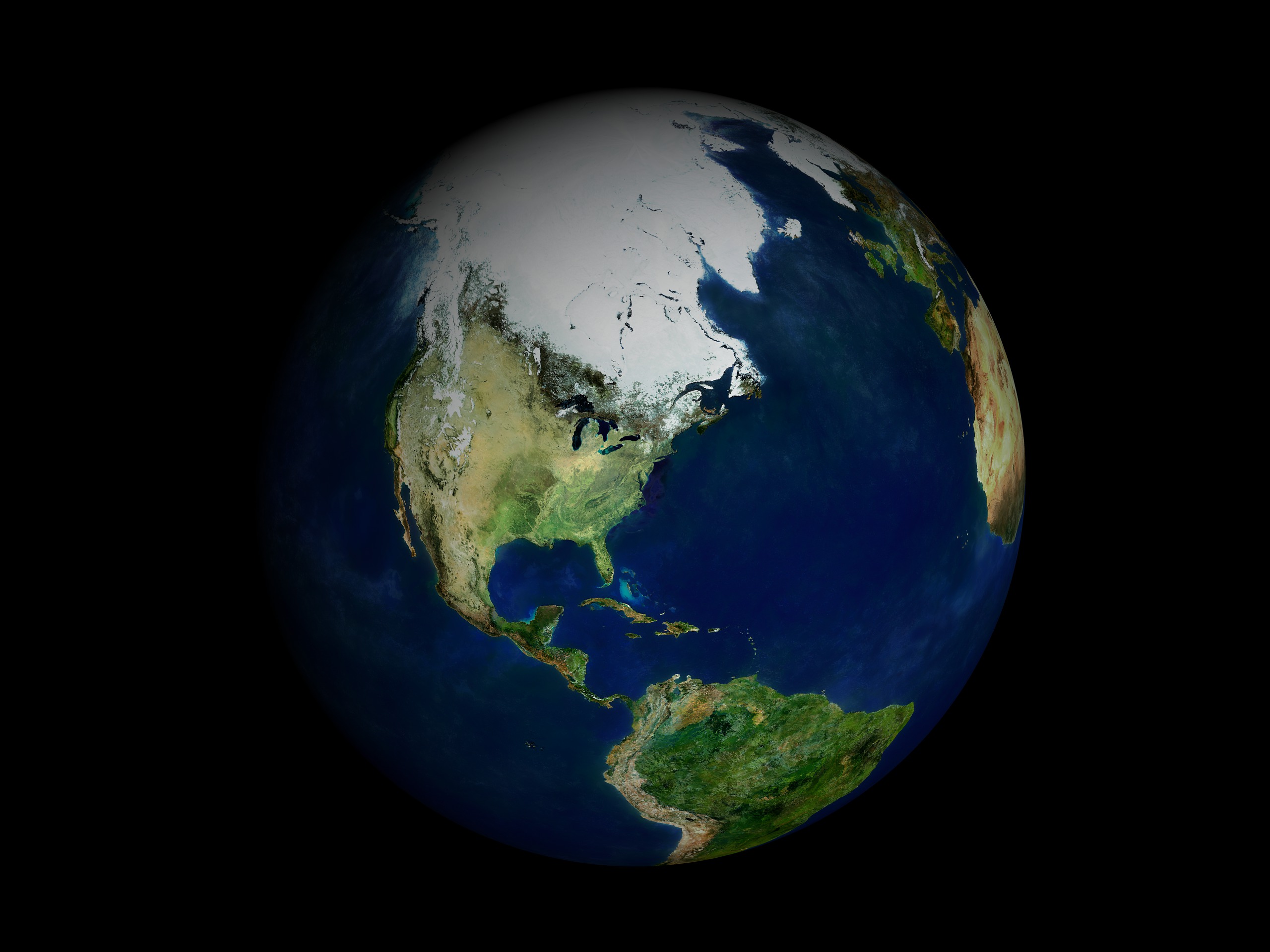
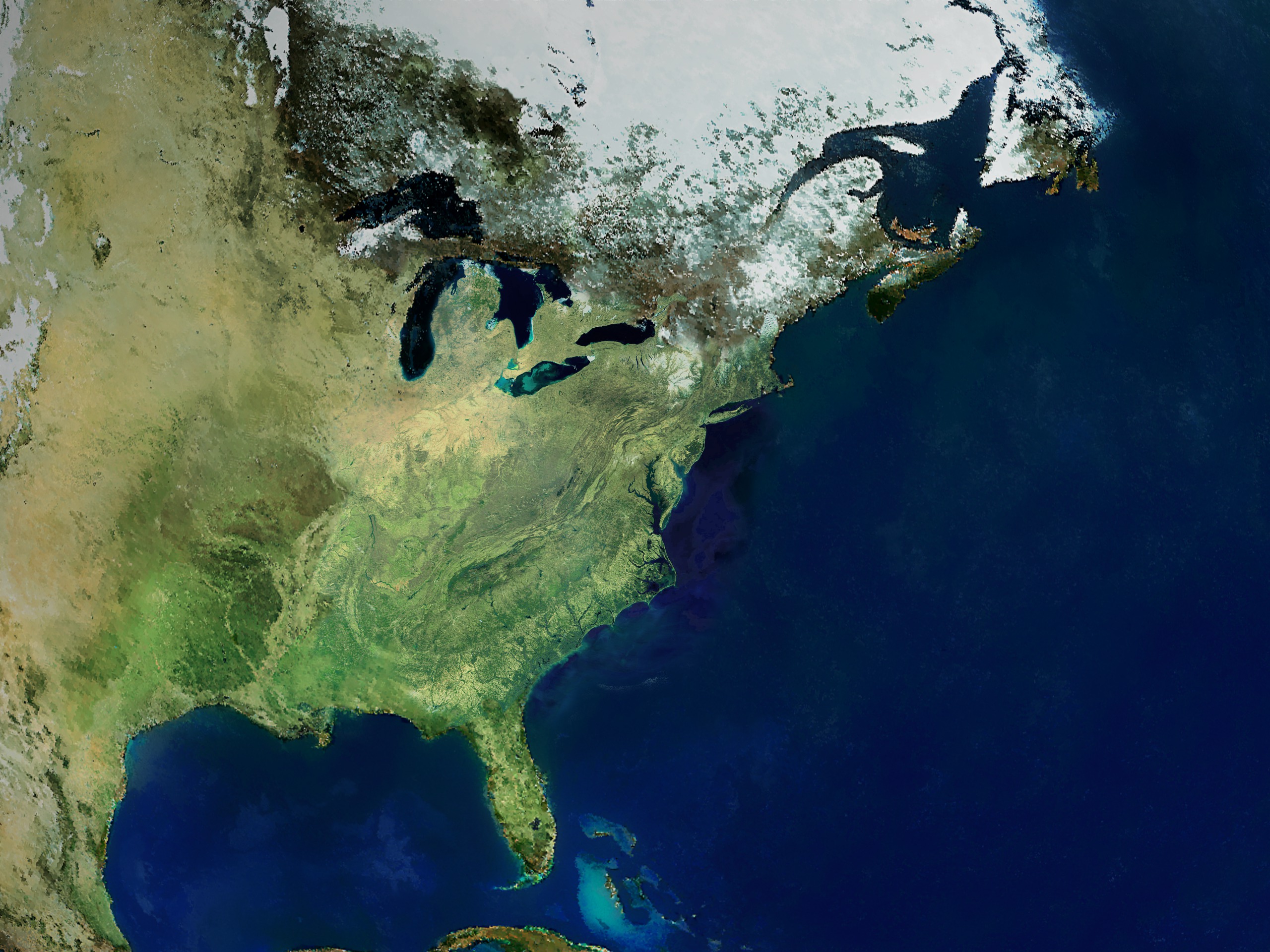
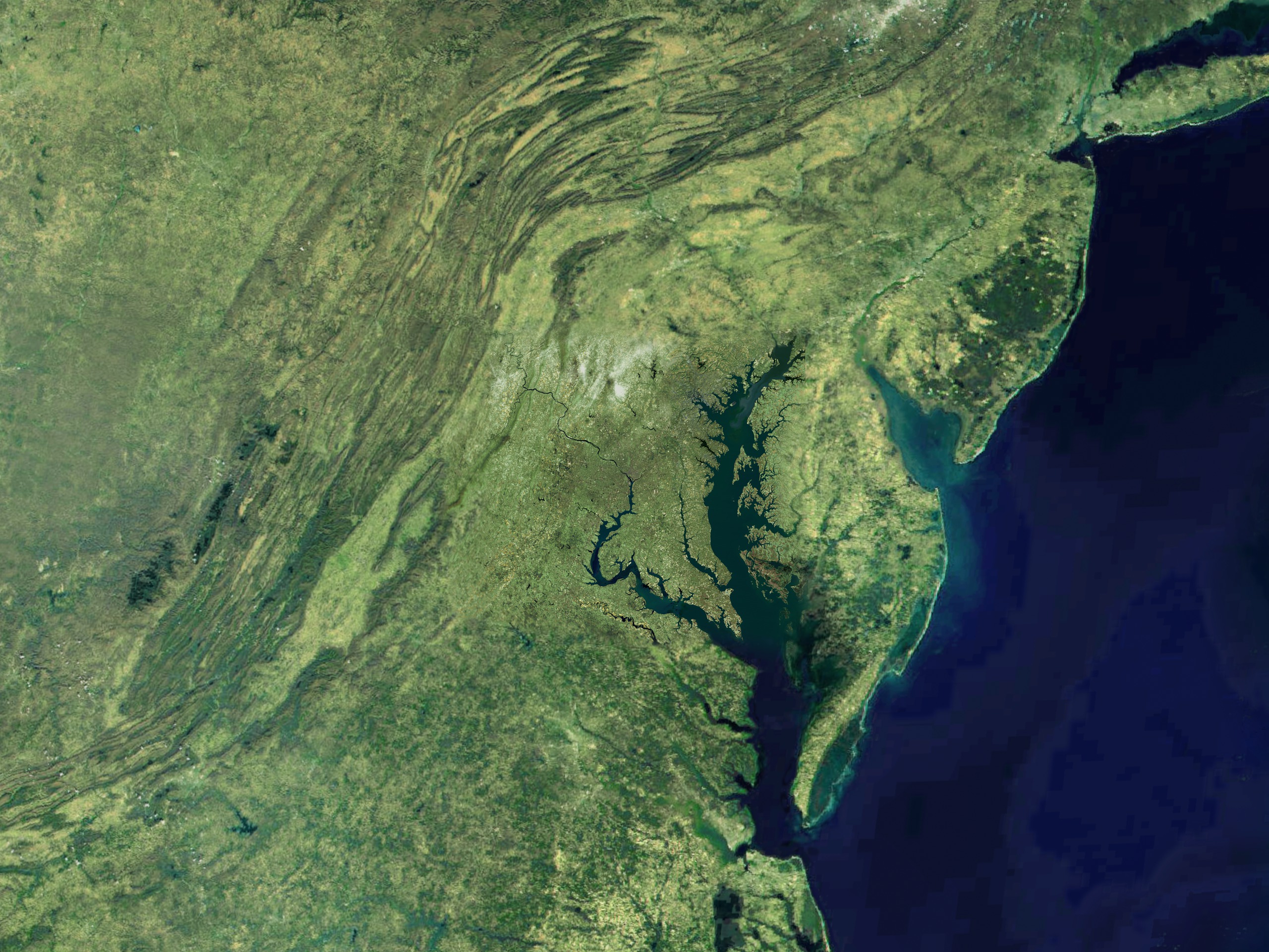
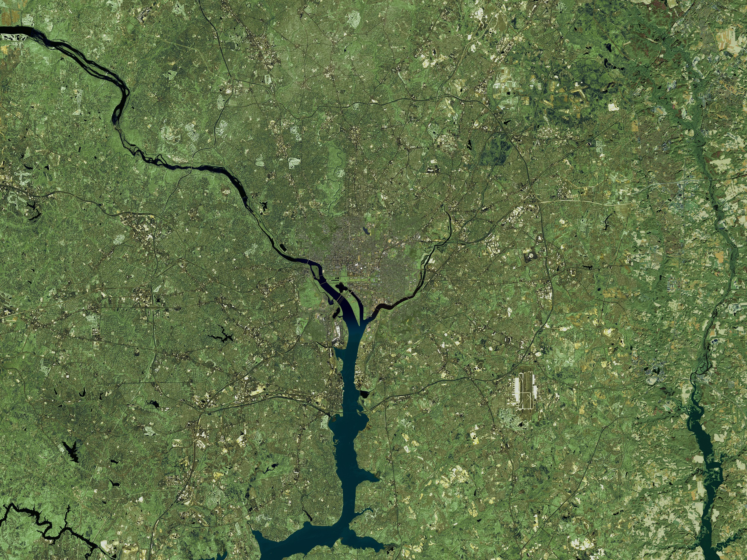
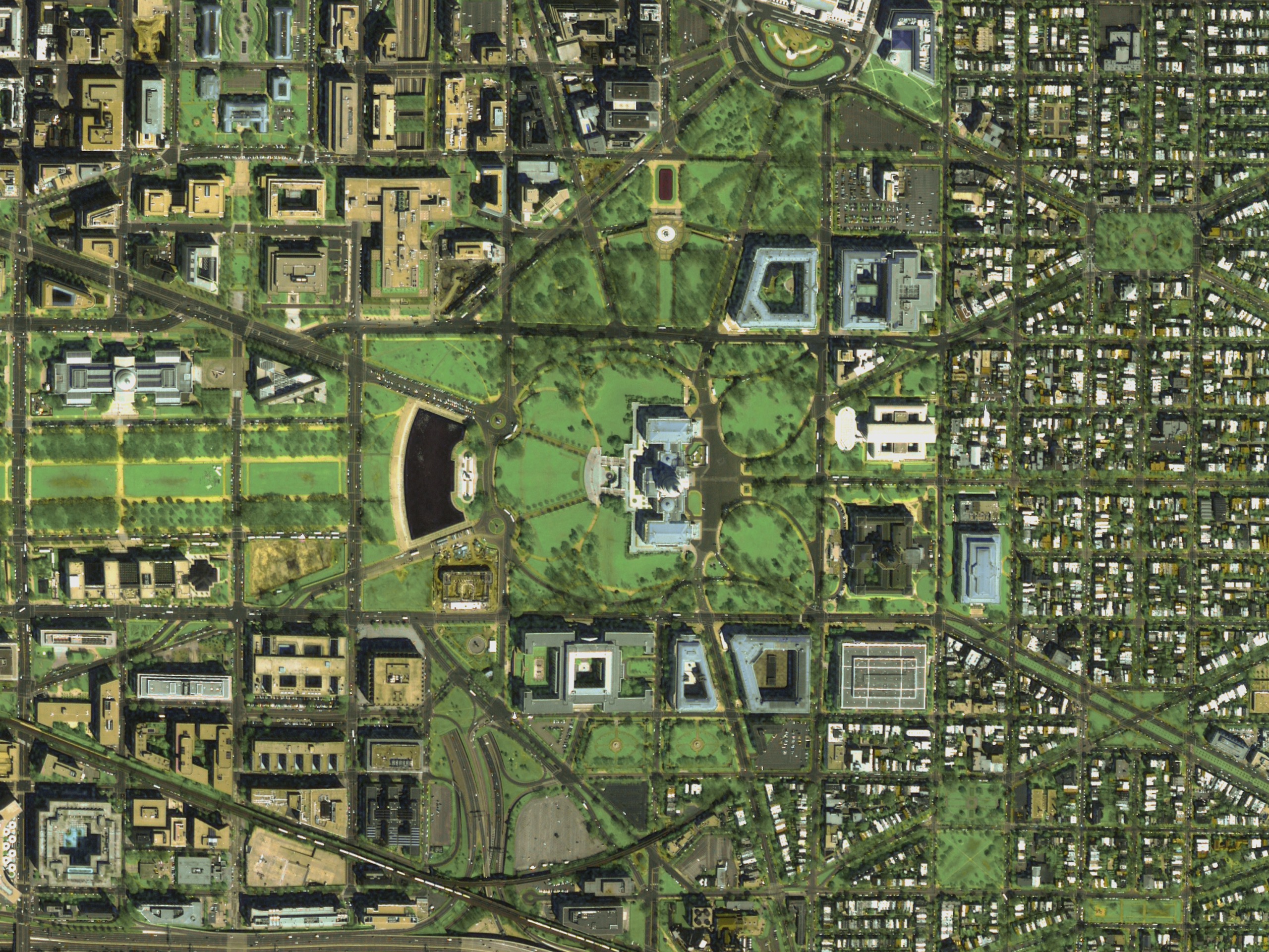
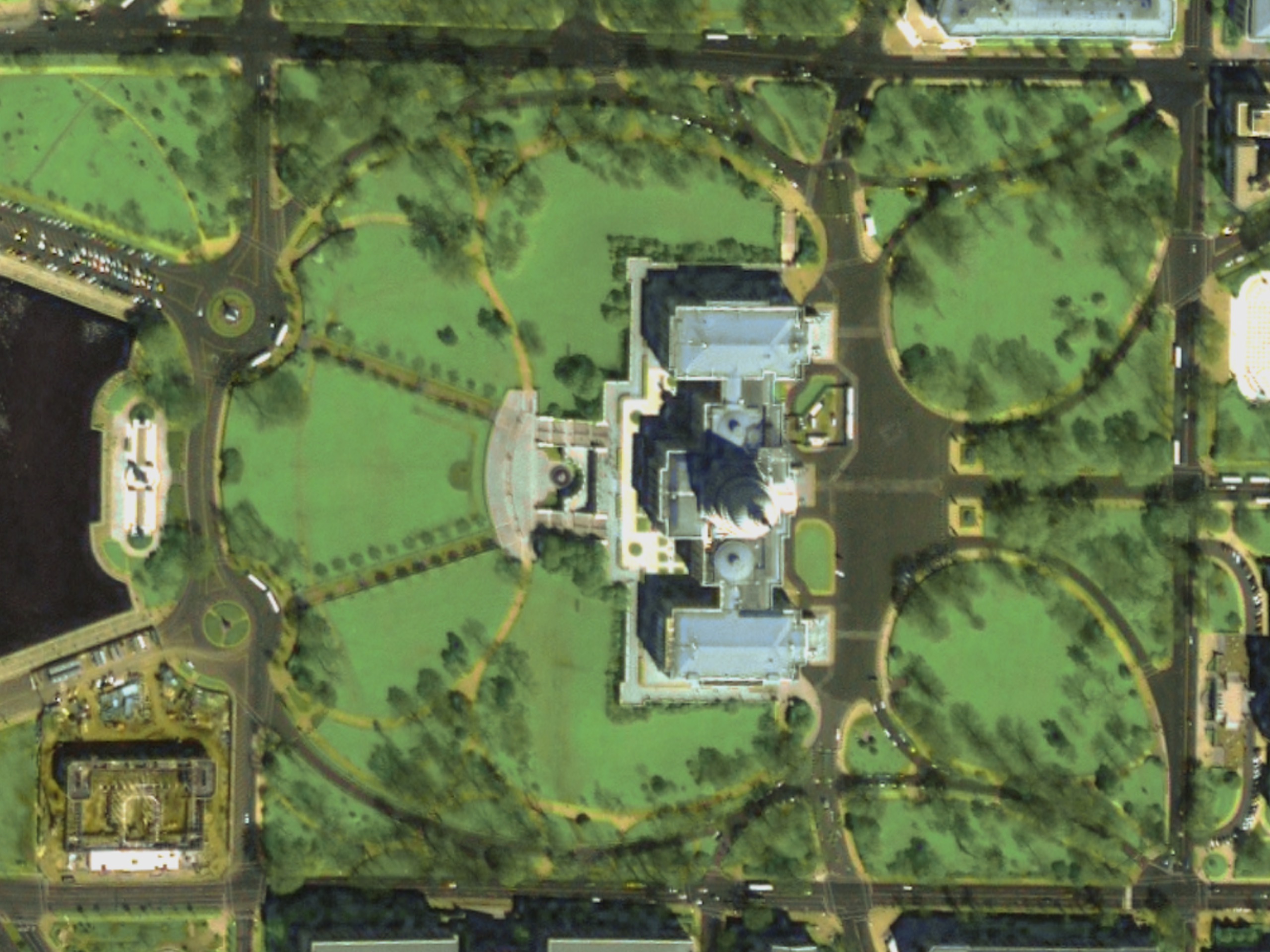
Capital Zoom is a seamless, cloudless zoom-in from a global view down to the nation's Capitol building that is composed entirely of satellite data. This data includes IKONOS 1 meter data, Landsat-7 15/30 meter data, Terra/MODIS 250 meter data, and Terra/MODIS 8 kilometer data. The visualization first zooms
in seamlessly, then zooms out/in showing where the different data set layers reside.
This visualization has been accepted to SIGGRAPH 2001. It includes narration. This visualization was created using Maya for motion control, Renderman for
rendering, IDL for pre-processing of the data, Imagine for image registration, and Photoshop for color matching.
Capitol Zoom - SIGGRAPH 2001 Final Submission
in seamlessly, then zooms out/in showing where the different data set layers reside.
This visualization has been accepted to SIGGRAPH 2001. It includes narration. This visualization was created using Maya for motion control, Renderman for
rendering, IDL for pre-processing of the data, Imagine for image registration, and Photoshop for color matching.
Visualization Credits
Greg Shirah (NASA/GSFC): Lead Animator
Horace Mitchell (NASA/GSFC): Animator
Marte Newcombe (GST): Animator
Michael Mangos (GST): Animator
James W. Williams (GST): Animator
Alex Kekesi (Global Science and Technology, Inc.): Animator
Stuart A. Snodgrass (GST): Animator
Mike Velle (HTSI): Animator
Marte Newcombe (GST): Narrator
Darrel Williams (NASA/GSFC): Scientist
Jarrett Cohen (GST): Writer
Please give credit for this item to:
NASA/Goddard Space Flight Center Scientific Visualization Studio
NASA/Goddard Space Flight Center Scientific Visualization Studio
Science Paper:
SIGGRAPH 2001 Animation Festival
Short URL to share this page:
https://svs.gsfc.nasa.gov/2133
Missions:
Landsat
Terra
Data Used:
Note: While we identify the data sets used in these visualizations, we do not store any further details nor the data sets themselves on our site.
This item is part of these series:
Great Zooms
Narrated Movies
Keywords:
DLESE >> Human geography
DLESE >> Physical geography
SVS >> SIGGRAPH
SVS >> Zoom
DLESE >> Narrated
SVS >> Voice Over Talent
NASA Science >> Earth
Places you might have seen this:
Shown at the SIGGRAPH Computer Animation Festival August 12-17 2001 in Los Angeles California.
SIGGRAPH 2001 Animation Festival
Short URL to share this page:
https://svs.gsfc.nasa.gov/2133
Missions:
Landsat
Terra
Data Used:
IKONOS
2000/04/01Landsat-7/ETM+
1999/05/11Terra/MODIS
2000/03/06This item is part of these series:
Great Zooms
Narrated Movies
Keywords:
DLESE >> Human geography
DLESE >> Physical geography
SVS >> SIGGRAPH
SVS >> Zoom
DLESE >> Narrated
SVS >> Voice Over Talent
NASA Science >> Earth
Places you might have seen this:
Shown at the SIGGRAPH Computer Animation Festival August 12-17 2001 in Los Angeles California.


