Earth
ID: 20044
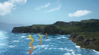
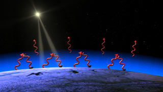
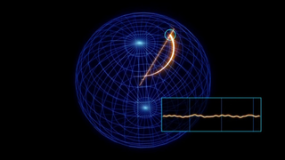
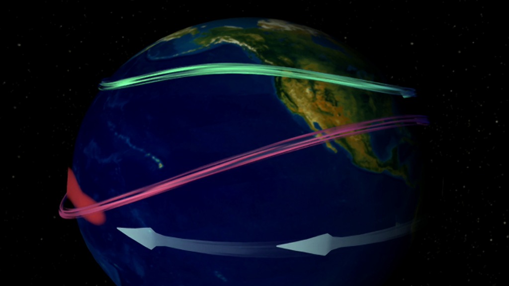
This animation shows El Niño's and La Niña's mulitiple personalites. The sequence begins with normal jet streams, normal sea surface temperatures, and normal wind patterns. The first change illustrates what occurs when a very strong El Niño strikes surface waters in the Central equatorial Pacific Ocean. Warm water anomalies (red) develop in the Central Pacific Ocean while normal westerly winds weaken and allow easterly winds to push the warm water up against the South American Coast. The second change in the animation illustrates typical La Niña conditions. Cold water anomalies (blue) develop as stronger than normal trade winds bring cold water up to the ocean surface. The third change in the animation illustrates the current, weaker El Niño. Warmer waters develop in the central Pacific Ocean and stay in place due to westerly and easterly wind patterns.
Indecisive El Niño
Related
Animation Credits
Susan Twardy (HTSI): Lead Animator
David Adamec (NASA/GSFC): Scientist
Rani Chohan (NASA/GSFC): Writer
David Adamec (NASA/GSFC): Scientist
Rani Chohan (NASA/GSFC): Writer
Please give credit for this item to:
NASA/Goddard Space Flight Center Conceptual Image Lab
NASA/Goddard Space Flight Center Conceptual Image Lab
Short URL to share this page:
https://svs.gsfc.nasa.gov/20044
Goddard TV Tape:
G2004-056
Keywords:
SVS >> El Nino
SVS >> Gonnelli
SVS >> HDTV
GCMD >> Earth Science
NASA Science >> Earth
GCMD keywords can be found on the Internet with the following citation: Olsen, L.M., G. Major, K. Shein, J. Scialdone, S. Ritz, T. Stevens, M. Morahan, A. Aleman, R. Vogel, S. Leicester, H. Weir, M. Meaux, S. Grebas, C.Solomon, M. Holland, T. Northcutt, R. A. Restrepo, R. Bilodeau, 2013. NASA/Global Change Master Directory (GCMD) Earth Science Keywords. Version 8.0.0.0.0