Earth
ID: 1397
Landsat Thematic Mapper views the Pearl River in China in 1988, 1992, and 1995. The band combination used in these images is 432. They are false color and include the infrared band. To view related animations, please see animations 942, 1396, 1398, and 1399.
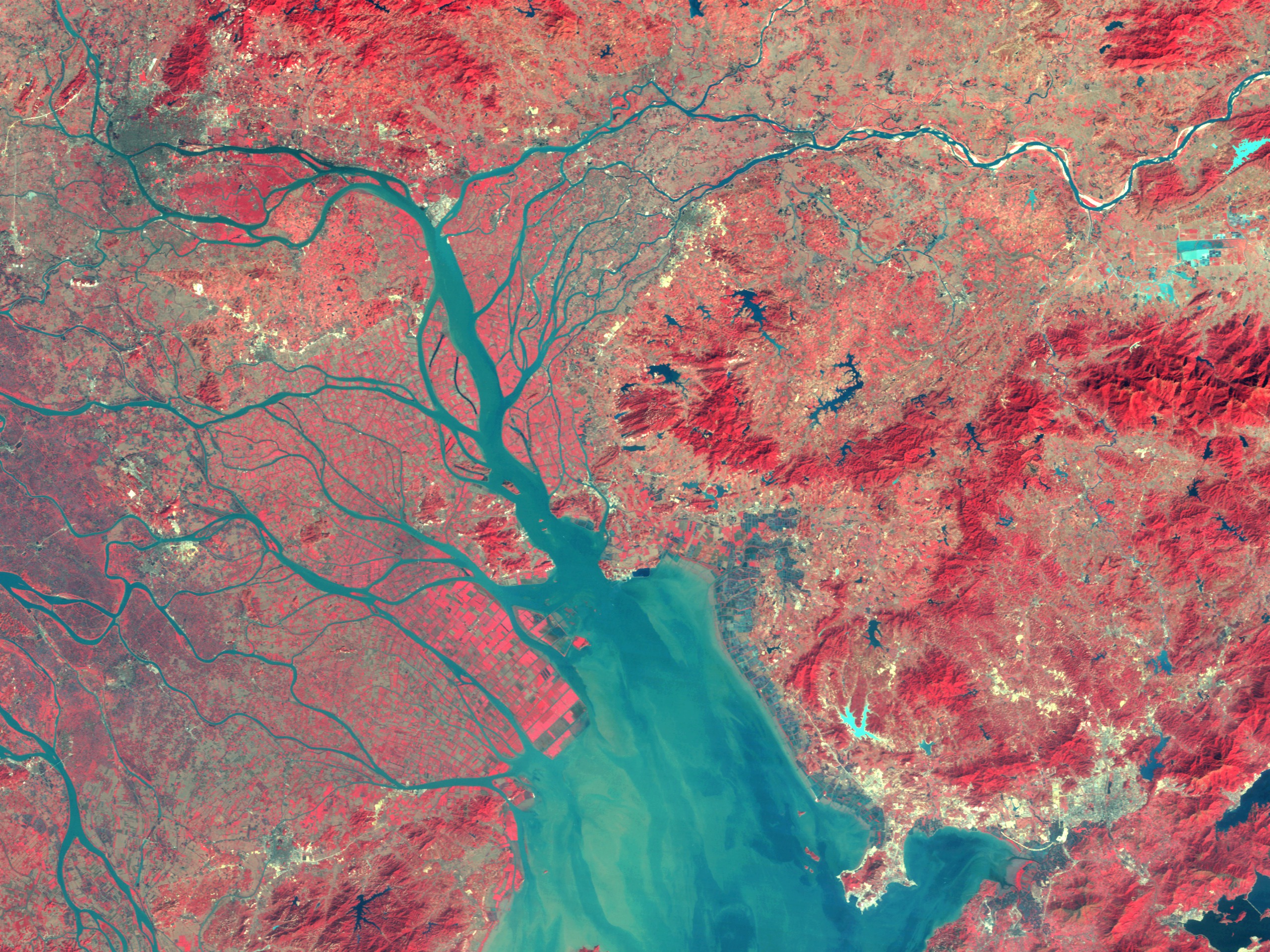
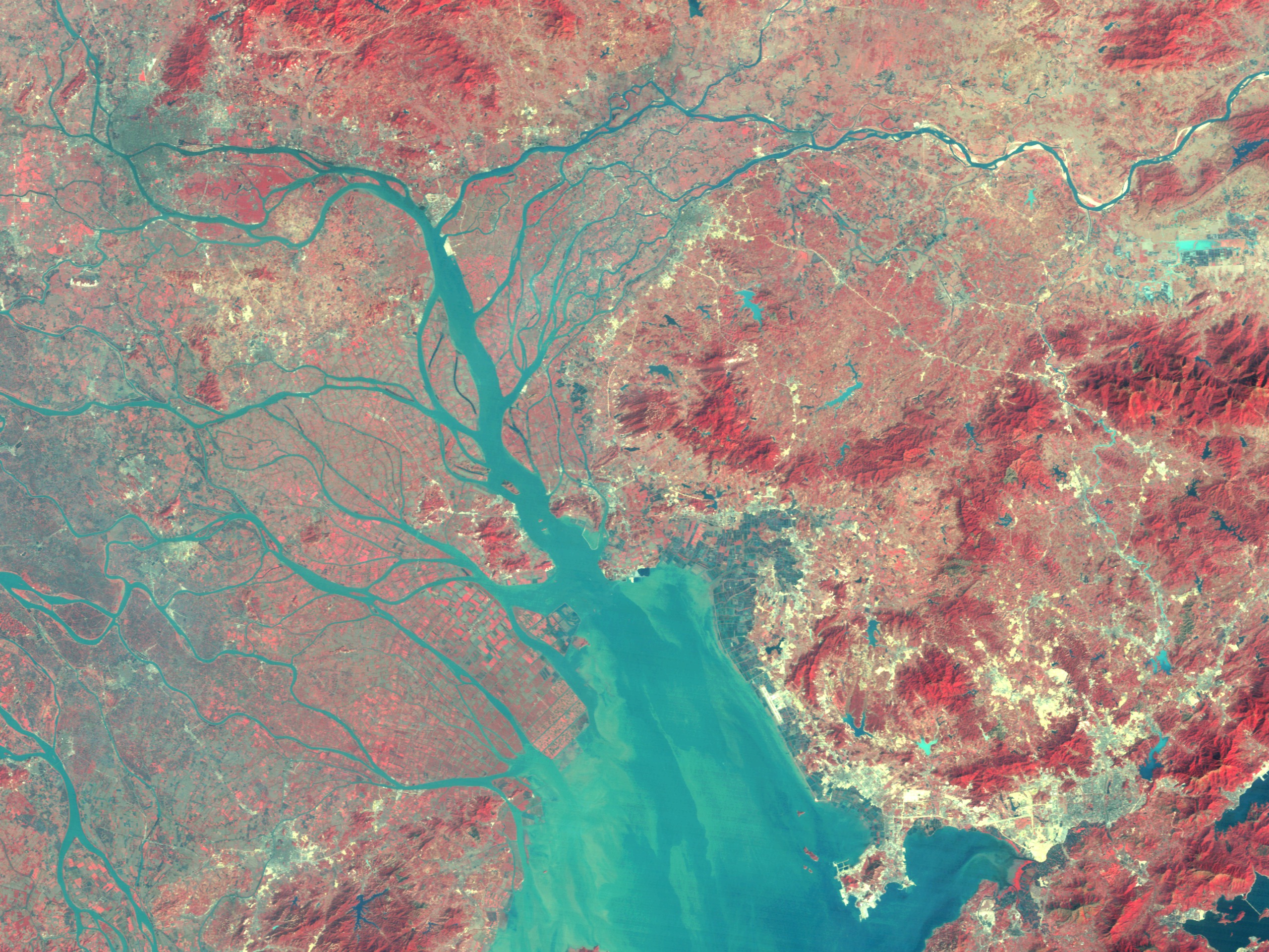
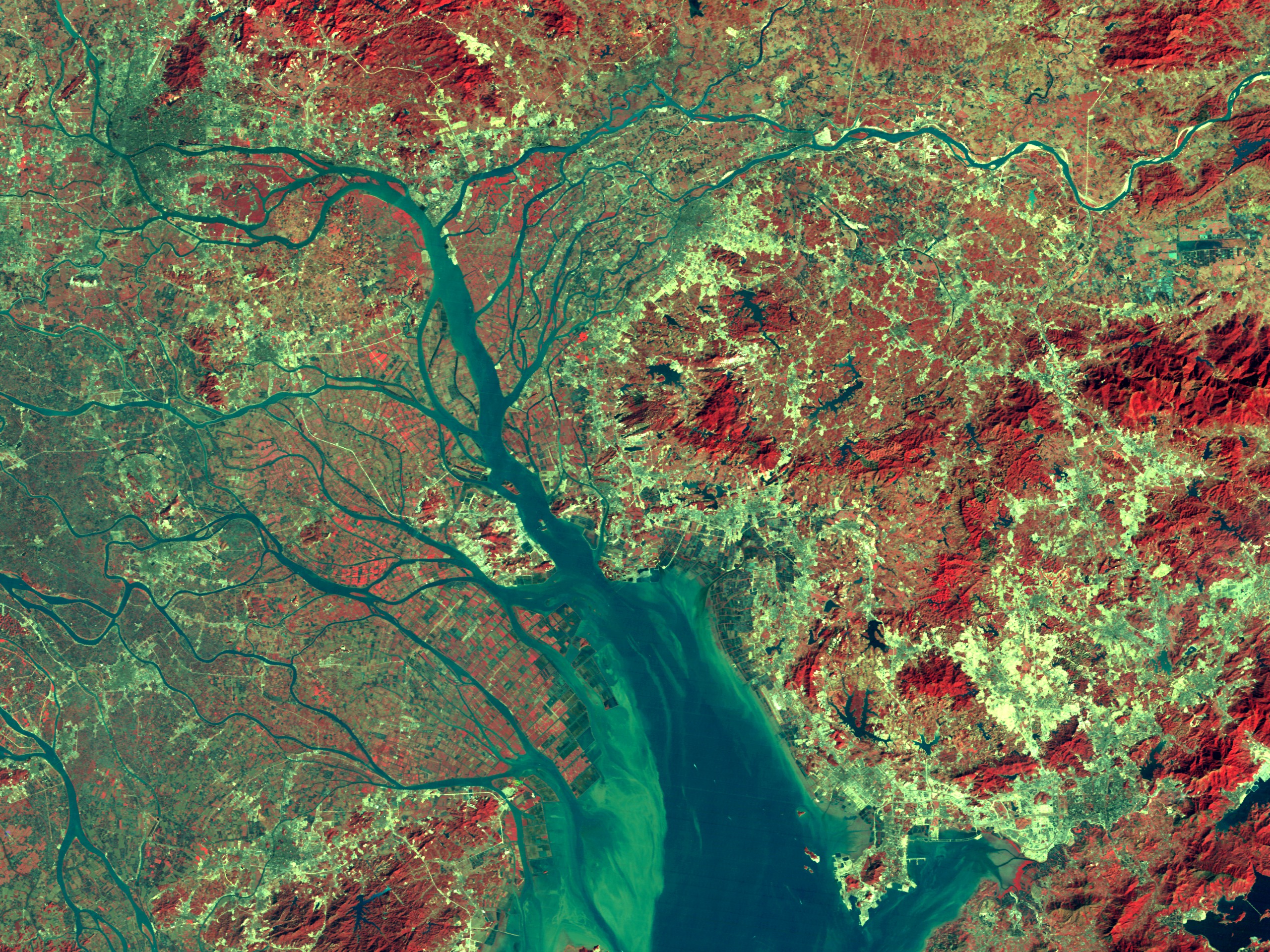
Landsat Changes Over Time: Pearl River, China (False Color)
For More Information
Visualization Credits
Please give credit for this item to:
NASA/Goddard Space Flight Center Scientific Visualization Studio
NASA/Goddard Space Flight Center Scientific Visualization Studio
Short URL to share this page:
https://svs.gsfc.nasa.gov/1397
Mission:
Landsat
Data Used:
Note: While we identify the data sets used in these visualizations, we do not store any further details nor the data sets themselves on our site.
Keywords:
DLESE >> Human geography
SVS >> Pearl River
DLESE >> Physical geography
NASA Science >> Earth
https://svs.gsfc.nasa.gov/1397
Mission:
Landsat
Data Used:
Landsat-5/TM
1988/12/10, 1992/01/20, 1995/12/30Keywords:
DLESE >> Human geography
SVS >> Pearl River
DLESE >> Physical geography
NASA Science >> Earth


