Earth
ID: 1310
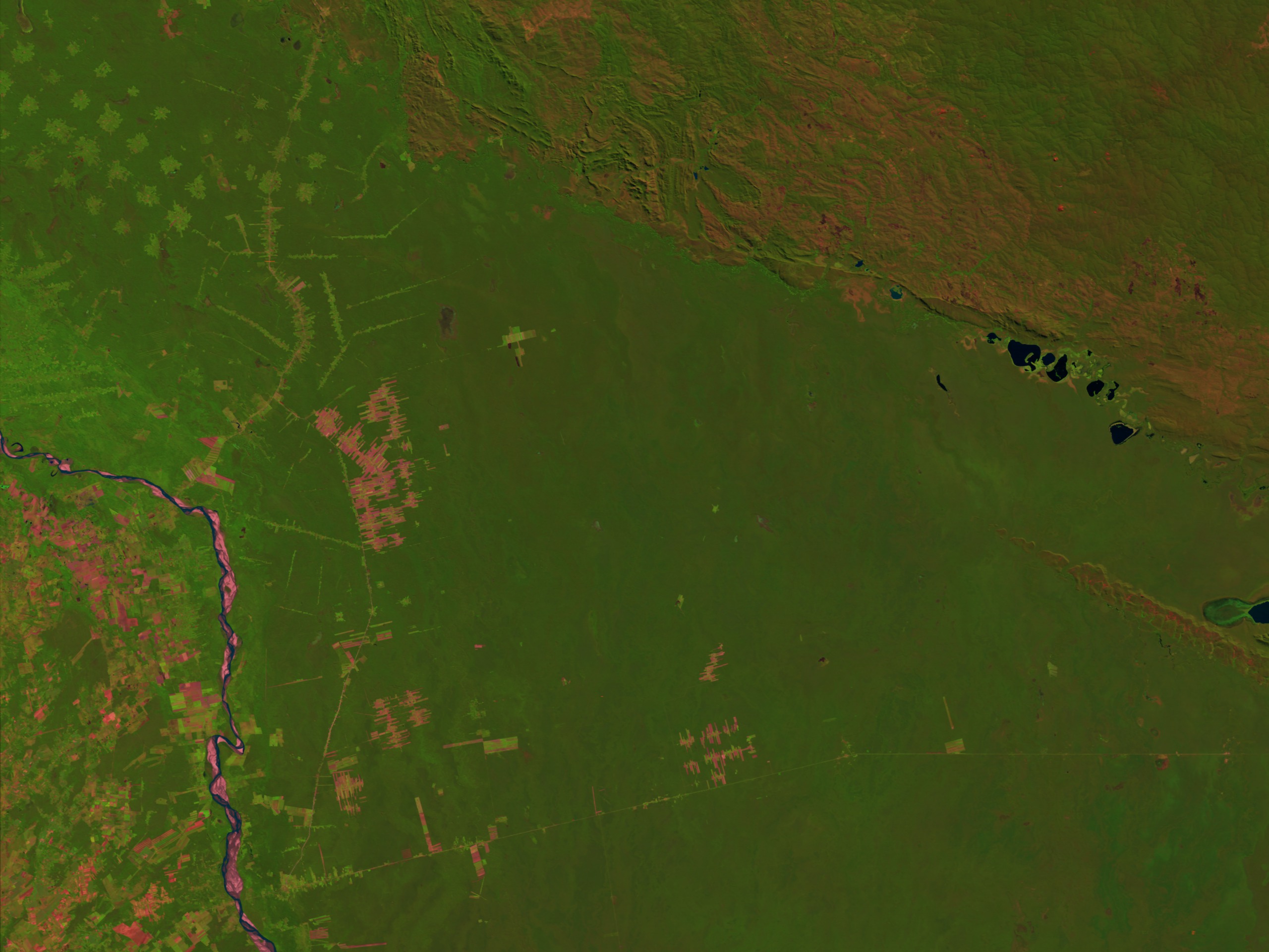
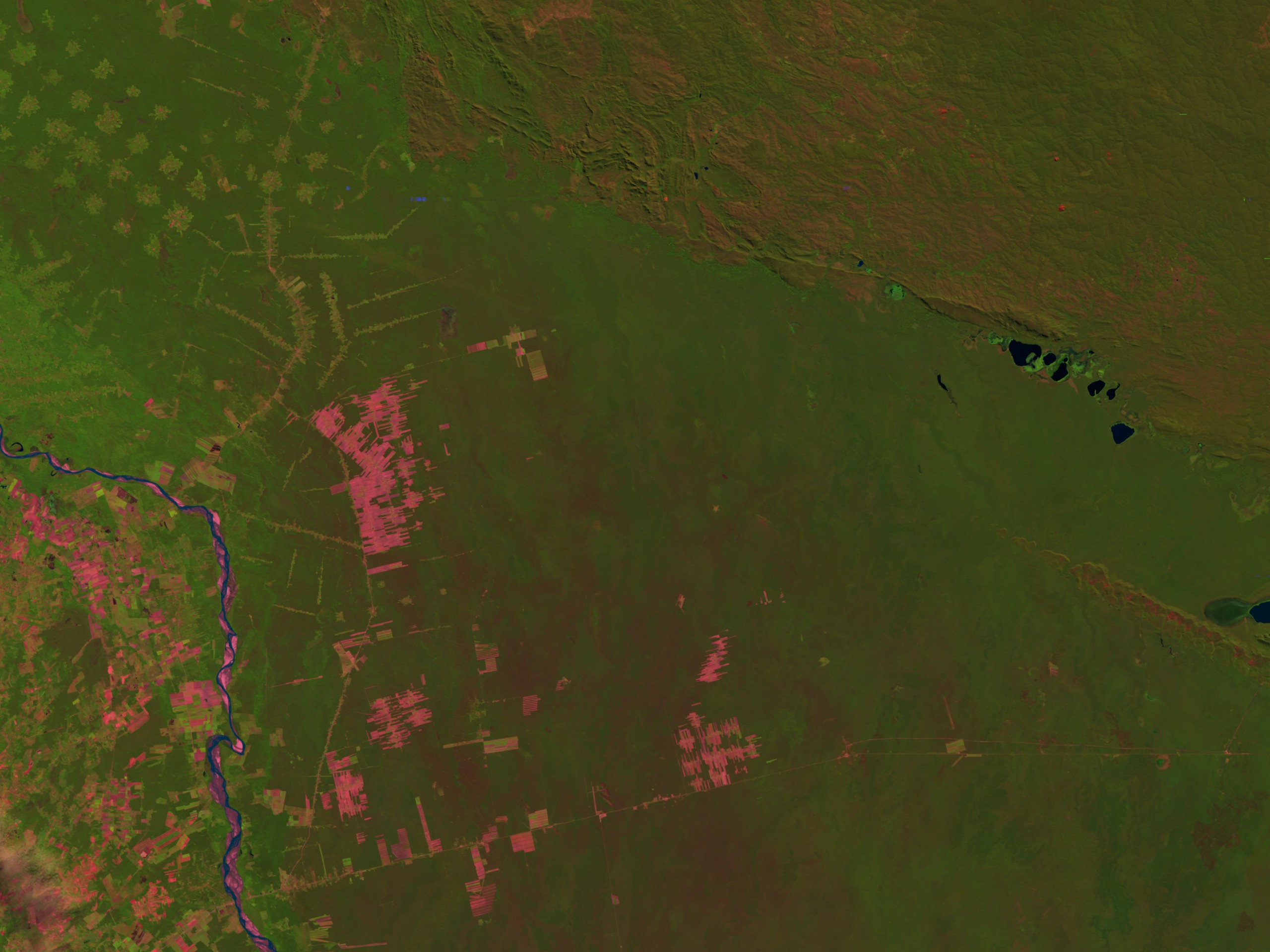
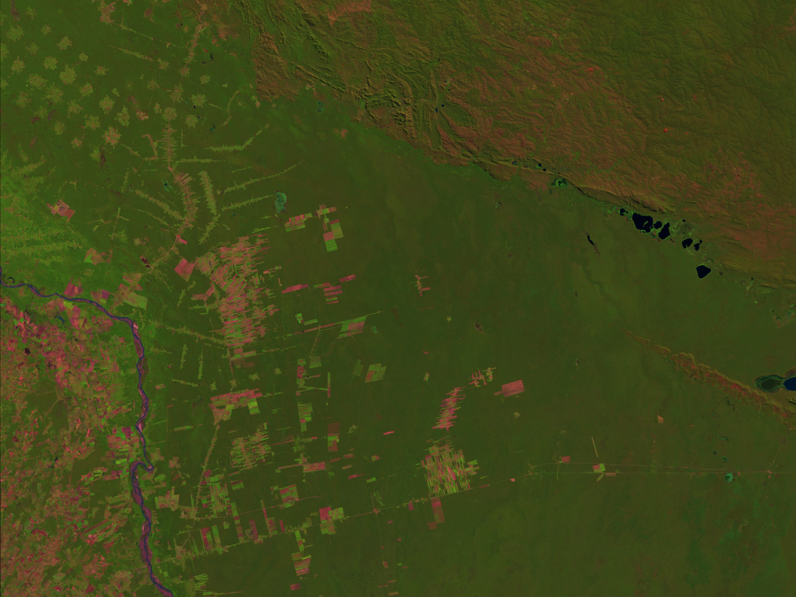
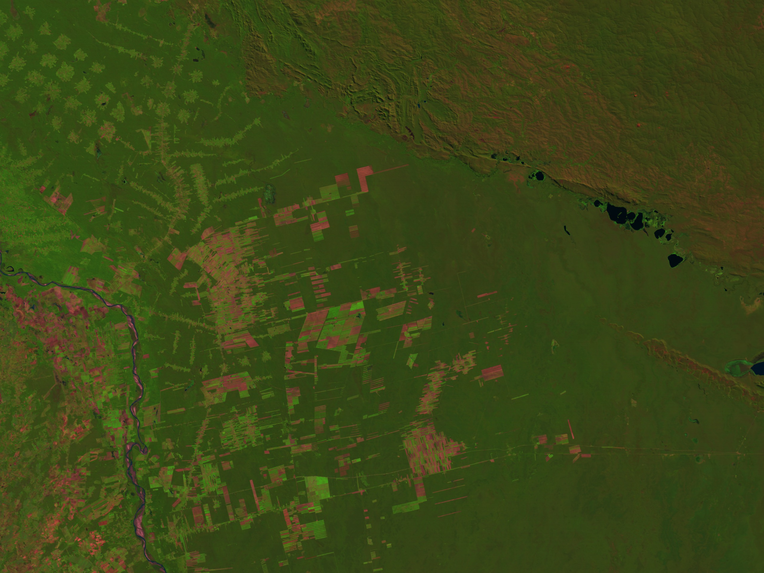
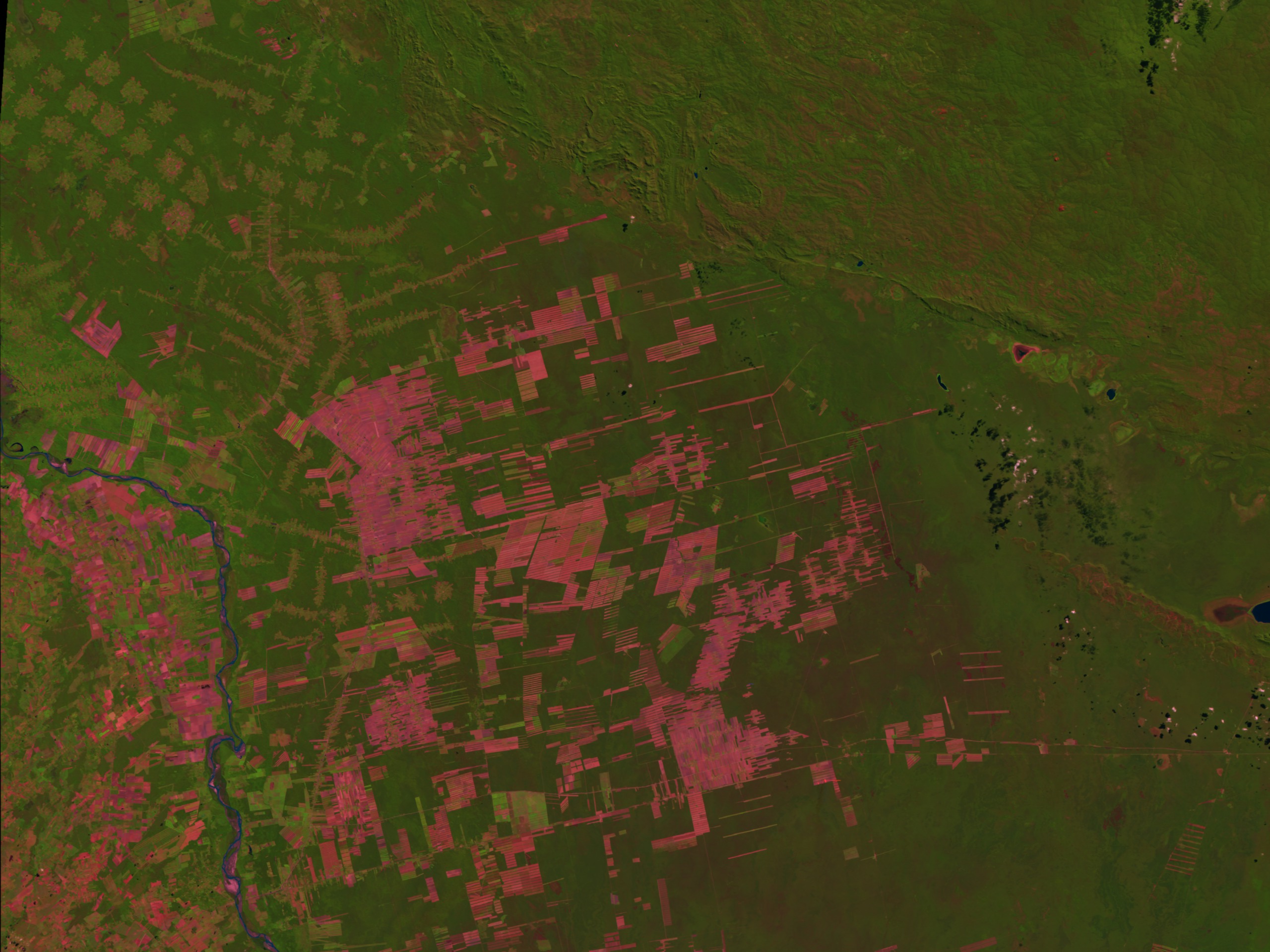
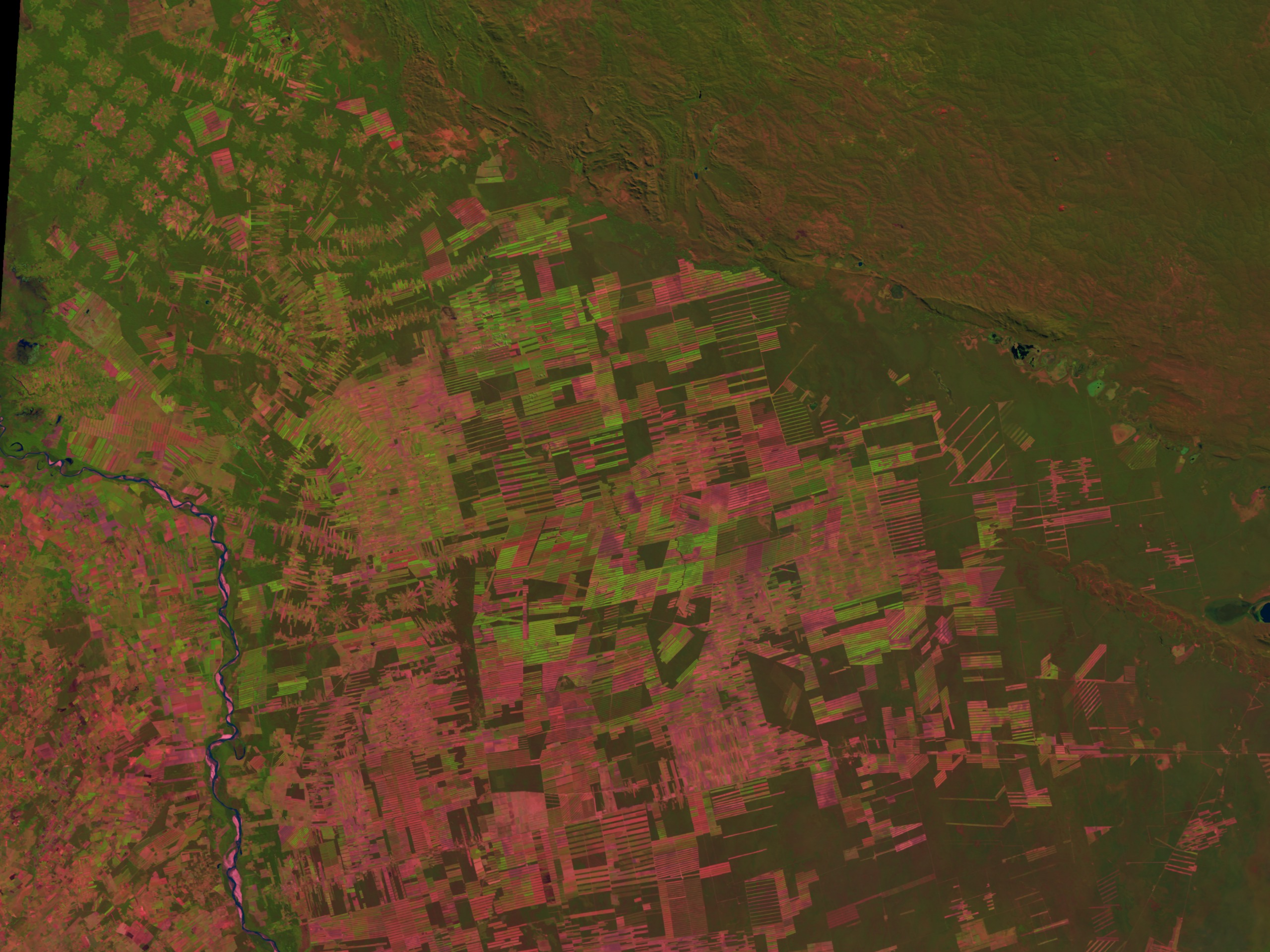
These images show deforestation near Santa Cruz, Bolivia from 1984 to 1998. In the initial 1984 scene, some clearing has already occurred in the humid forest and chaparral. The long striped clearings in the center of the scene are predominately from soybean farms created by Mennonite and Japanese farmers. The more circular patterns, appears in a grid pattern to the North (up) and West (left), are government-run and 'national' farms. The scene is roughly 150 miles tall and 200 miles wide. The city of Santa Cruz lies to the west of the river cutting through the scene.


Bolivian Deforestation 1984-1998: Fast Dissolve without Dates
Alternate Version
For More Information
Visualization Credits
Please give credit for this item to:
NASA/Goddard Space Flight Center Scientific Visualization Studio
NASA/Goddard Space Flight Center Scientific Visualization Studio
Short URL to share this page:
https://svs.gsfc.nasa.gov/1310
Mission:
Landsat
Data Used:
Note: While we identify the data sets used in these visualizations, we do not store any further details nor the data sets themselves on our site.
This item is part of this series:
Bolivian Deforestation
Keywords:
DLESE >> Environmental science
DLESE >> Forestry
DLESE >> Human geography
GCMD >> Earth Science >> Human Dimensions >> Habitat Conversion/Fragmentation >> Deforestation
GCMD >> Location >> Bolivia
NASA Science >> Earth
GCMD keywords can be found on the Internet with the following citation: Olsen, L.M., G. Major, K. Shein, J. Scialdone, S. Ritz, T. Stevens, M. Morahan, A. Aleman, R. Vogel, S. Leicester, H. Weir, M. Meaux, S. Grebas, C.Solomon, M. Holland, T. Northcutt, R. A. Restrepo, R. Bilodeau, 2013. NASA/Global Change Master Directory (GCMD) Earth Science Keywords. Version 8.0.0.0.0
https://svs.gsfc.nasa.gov/1310
Mission:
Landsat
Data Used:
Landsat-5/TM
1984, 1986, 1988, 1990, 1992, 1994, 1996, 1998This item is part of this series:
Bolivian Deforestation
Keywords:
DLESE >> Environmental science
DLESE >> Forestry
DLESE >> Human geography
GCMD >> Earth Science >> Human Dimensions >> Habitat Conversion/Fragmentation >> Deforestation
GCMD >> Location >> Bolivia
NASA Science >> Earth
GCMD keywords can be found on the Internet with the following citation: Olsen, L.M., G. Major, K. Shein, J. Scialdone, S. Ritz, T. Stevens, M. Morahan, A. Aleman, R. Vogel, S. Leicester, H. Weir, M. Meaux, S. Grebas, C.Solomon, M. Holland, T. Northcutt, R. A. Restrepo, R. Bilodeau, 2013. NASA/Global Change Master Directory (GCMD) Earth Science Keywords. Version 8.0.0.0.0


