Earth
ID: 11930
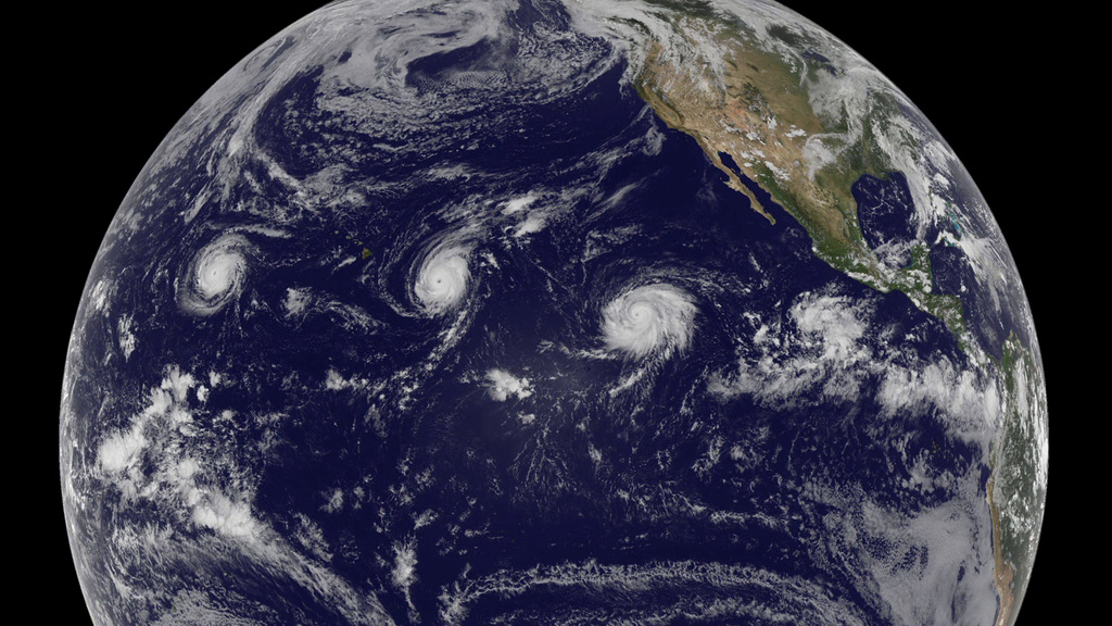
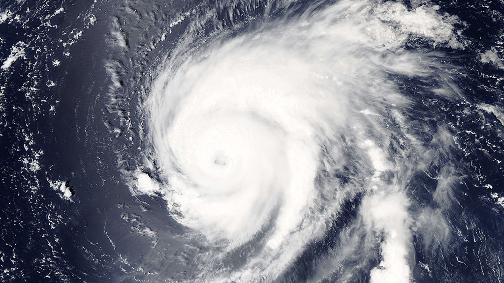
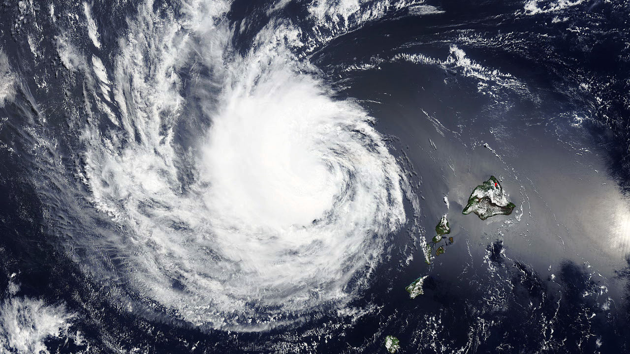
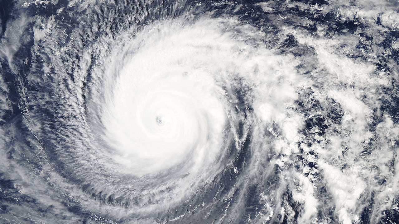
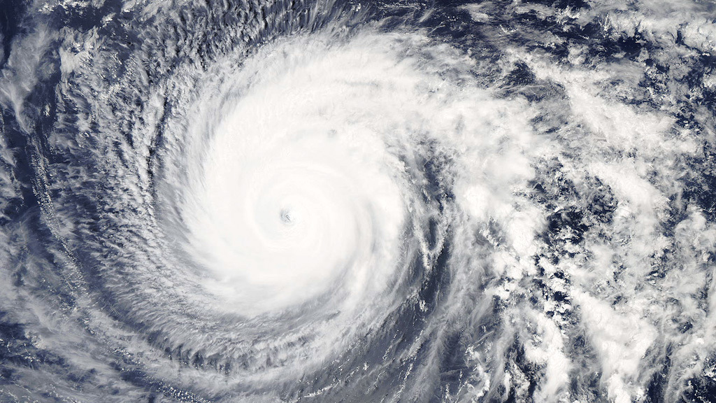
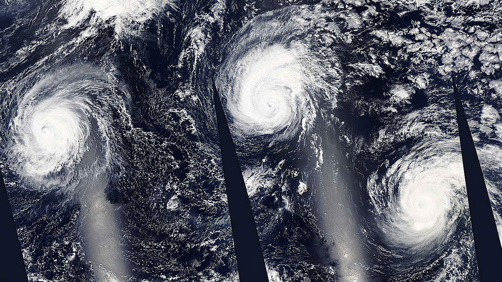
In late August 2015, NASA satellites saw not one but three storms develop in the Pacific Ocean and intensify into Category 4 hurricanes with maximum sustained winds of up to 150 mph. The storms, named Kilo, Ignacio, and Jimena, formed in the eastern Pacific Ocean and initially headed west toward the Hawaiian Islands. Satellites spotted Kilo on August 21, followed by Ignacio on August 25, and Jimena on August 26. Both Ignacio and Jimena have since petered out. But after more than 21 days, Kilo continues on. Scientists say Kilo is one of the longest-lasting storms observed since satellite records began in the early 1960s. Explore the images for views of each storm captured from space.


Hurricane Crossing
Story Credits
Please give credit for this item to:
NASA's Goddard Space Flight Center
Cover image courtesy of NOAA-NASA GOES Project
Satellite images courtesy of NASA/GSFC/MODIS Rapid Response Team
NASA's Goddard Space Flight Center
Cover image courtesy of NOAA-NASA GOES Project
Satellite images courtesy of NASA/GSFC/MODIS Rapid Response Team
Short URL to share this page:
https://svs.gsfc.nasa.gov/11930
Keywords:
SVS >> App
NASA Science >> Earth
https://svs.gsfc.nasa.gov/11930
Keywords:
SVS >> App
NASA Science >> Earth


