Earth
ID: 11740
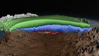
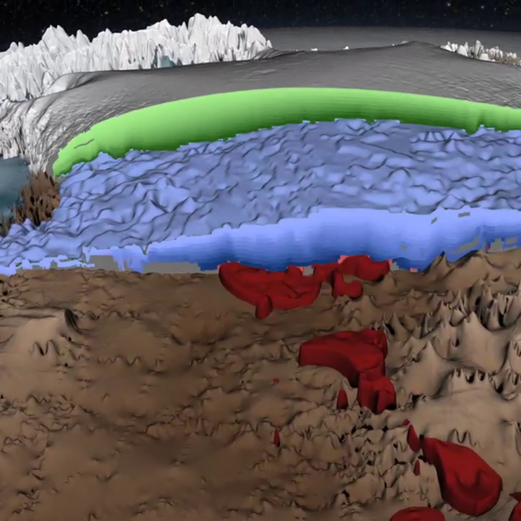
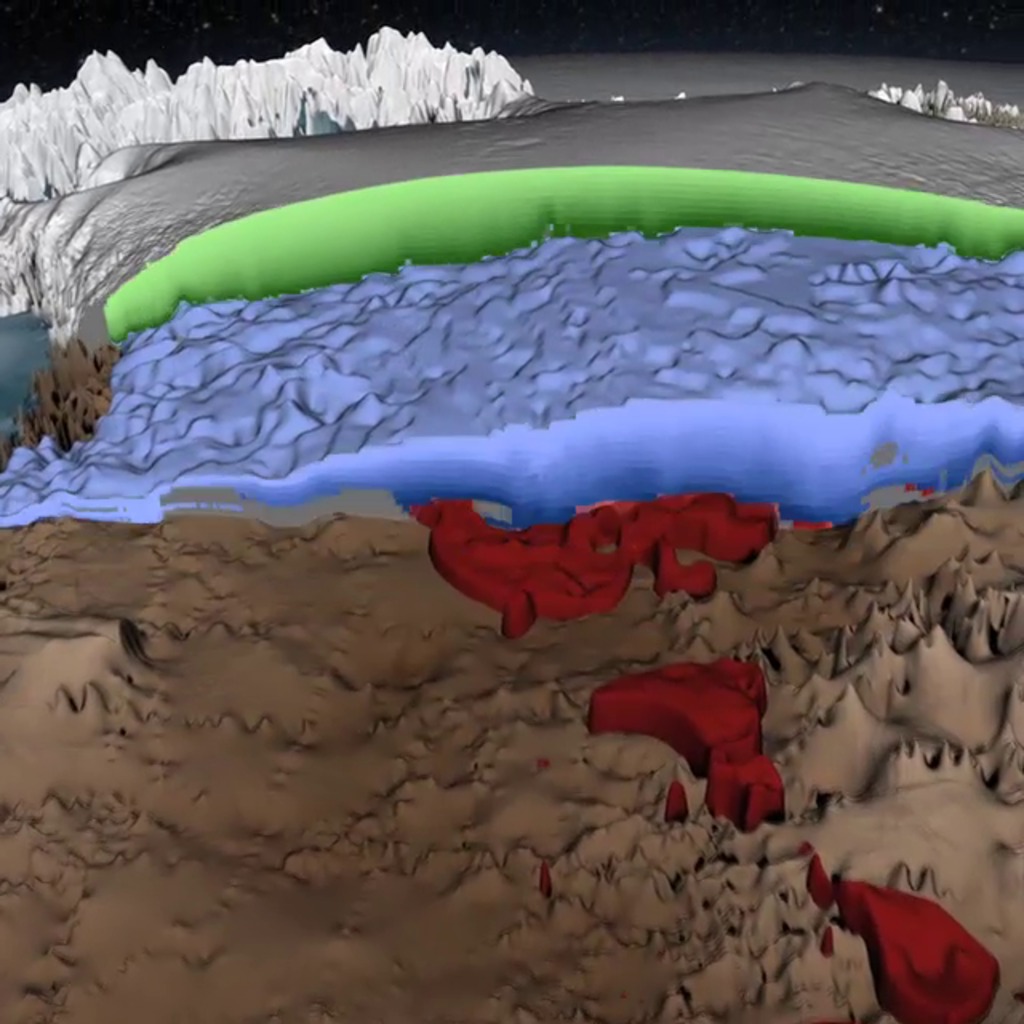
For nearly a century, scientists have been studying the form and flow of the Greenland Ice Sheet. They have measured the change in the elevation of the surface over time using satellites. They have drilled ice cores in the field to reveal a record of what the past climate was like. They have flown aircraft over the surface of the ice sheet laden with instruments to gleen information about the interior of the ice sheet and the bedrock below.
Instagram: The Greenland Ice Sheet In 3-D
Now a new analysis of this data has revealed a three dimensional map of the age of the ice sheet. This animation shows this new 3D age map of the Greenland Ice Sheet, explains how it was created and describes the three distinct periods of climate that are evident within the ice sheet.
Related
For More Information
Credits
Jefferson Beck (USRA): Producer
Cindy Starr (Global Science and Technology, Inc.): Data Visualizer
Joy Ng (USRA): Narrator
Cindy Starr (Global Science and Technology, Inc.): Data Visualizer
Joy Ng (USRA): Narrator
Please give credit for this item to:
NASA's Goddard Space Flight Center
NASA's Goddard Space Flight Center
Short URL to share this page:
https://svs.gsfc.nasa.gov/11740
This item is part of this series:
Narrated Movies
Keyword:
NASA Science >> Earth
https://svs.gsfc.nasa.gov/11740
This item is part of this series:
Narrated Movies
Keyword:
NASA Science >> Earth


