Earth
ID: 11669
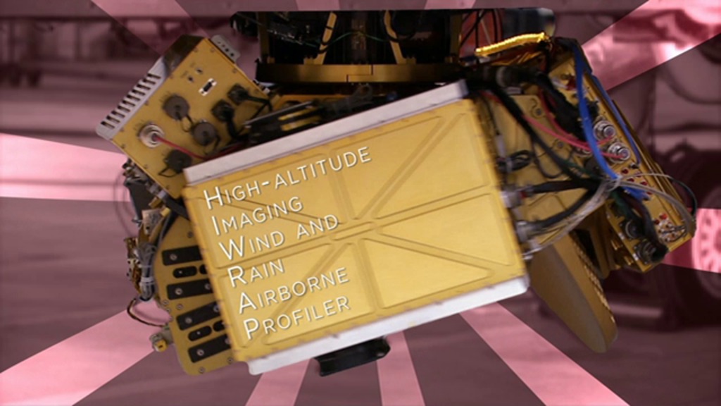
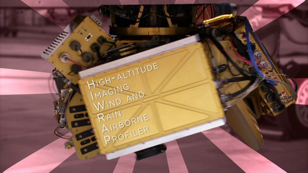
The HIWRAP is the High-Altitude Imaging Wind and Rain Airborne Profiler, a "conically scanning" Doppler radar, meaning it scans in a cone-shaped manner. Wind measurements are crucial for understanding and forecasting tropical storms since they are closely tied to the overall dynamics of the storm. The HIWRAP instrument is able to measure line-of-sight (along the radar beam) and because it scans in a cone beneath the aircraft, it gets two looks at most parts of the storm, allowing calculations of the 3-dimensional wind and rain fields. In the absence of rain, it can also measure ocean surface winds.
HIWRAP Instrument
Credits
Lori Perkins (NASA/GSFC): Lead Animator
Ryan Fitzgibbons (USRA): Animator
Ryan Fitzgibbons (USRA): Video Editor
Scott Braun (NASA/GSFC): Interviewee
Ryan Fitzgibbons (USRA): Narration
Rob Gutro (NASA/GSFC): Narration
Rob Gutro (NASA/GSFC): Narrator
Ryan Fitzgibbons (USRA): Producer
Scott Braun (NASA/GSFC): Scientist
Aaron E. Lepsch (ADNET Systems, Inc.): Project Support
Rob Andreoli (Advocates in Manpower Management, Inc.): Videographer
Dave Fratello: Videographer
Ellen T. Gray (ADNET Systems, Inc.): Writer
Rob Gutro (NASA/GSFC): Writer
Please give credit for this item to:
NASA's Goddard Space Flight Center
NASA's Goddard Space Flight Center
Short URL to share this page:
https://svs.gsfc.nasa.gov/11669
This item is part of this series:
Narrated Movies
Goddard TV Tape:
G2014-089 -- HS3 HIWRAP Instrument
Keywords:
SVS >> HDTV
GCMD >> Earth Science >> Spectral/Engineering >> Radar
GCMD >> Earth Science >> Atmosphere >> Atmospheric Phenomena >> Hurricanes
NASA Science >> Earth
GCMD keywords can be found on the Internet with the following citation: Olsen, L.M., G. Major, K. Shein, J. Scialdone, S. Ritz, T. Stevens, M. Morahan, A. Aleman, R. Vogel, S. Leicester, H. Weir, M. Meaux, S. Grebas, C.Solomon, M. Holland, T. Northcutt, R. A. Restrepo, R. Bilodeau, 2013. NASA/Global Change Master Directory (GCMD) Earth Science Keywords. Version 8.0.0.0.0


