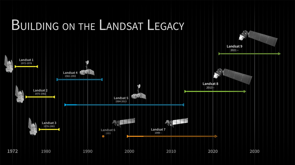
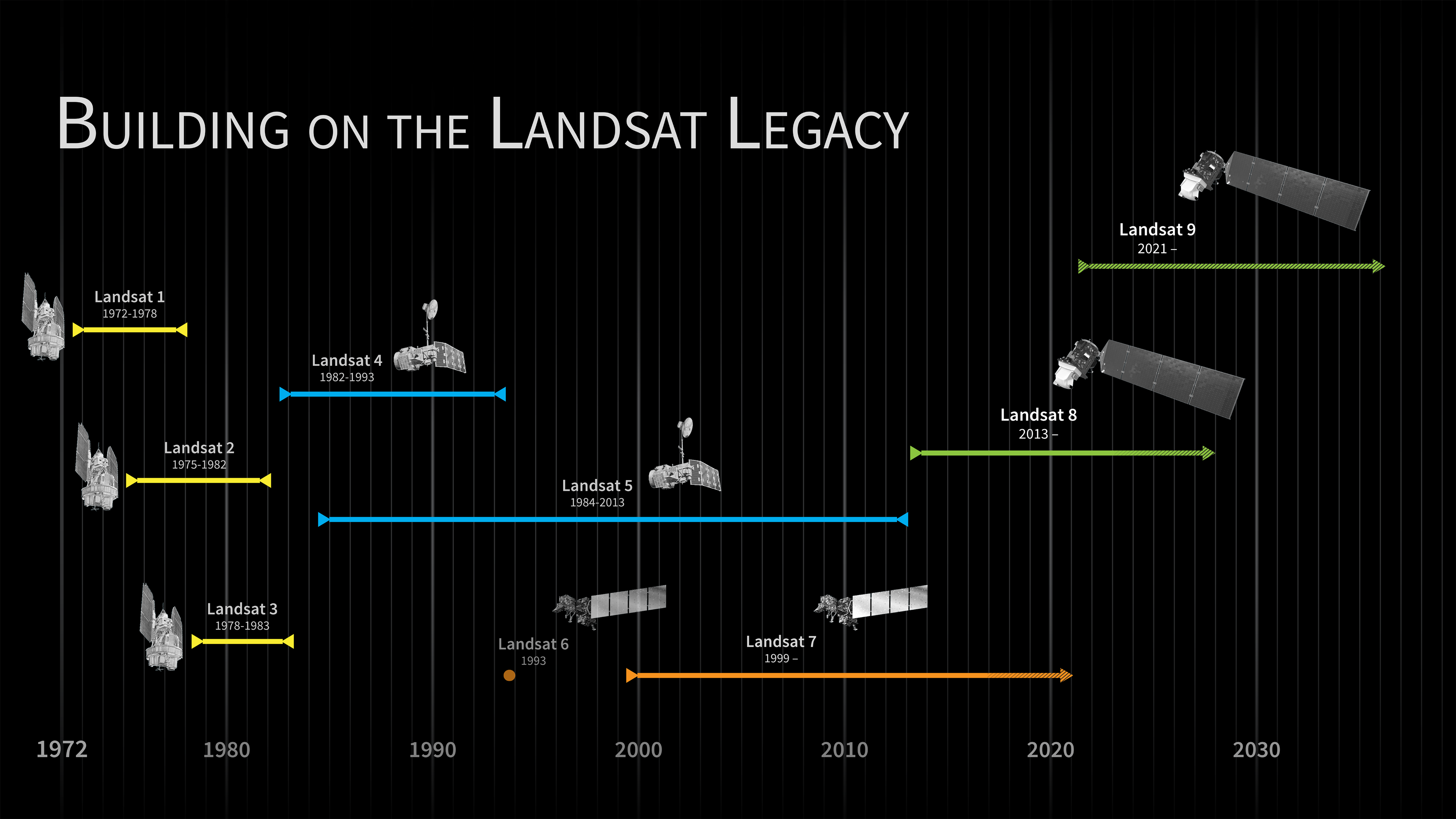
Landsat Program Timeline
In 1975, NASA Administrator Dr. James Fletcher predicted that if one space age development would save the world, it would be Landsat and its successor satellites. Since the early 1970s, Landsat has continuously and consistently archived images of Earth; this unparalleled data archive gives scientist the ability to assess changes in Earth’s landscape.
For over 40 years, the Landsat program has collected spectral information from Earth’s surface, creating a historical archive unmatched in quality, detail, coverage, and length.
“It was the granddaddy of them all, as far as starting the trend of repetitive, calibrated observations of the Earth at a spatial resolution where one can detect man’s interaction with the environment,” Dr. Darrel Williams, the Landsat 7 Project Scientist, states about Landsat.
Landsat sensors have a moderate spatial-resolution. You cannot see individual houses on a Landsat image, but you can see large man-made objects such as highways. This is an important spatial resolution because it is coarse enough for global coverage, yet detailed enough to characterize human-scale processes such as urban growth, deforestation, agriculture water use, and more.

Used Elsewhere In
Related

Related Documentation
landsat_timeline_20200318_issues.pdf
landsat_timeline_20160707-toL9.pdf
landsat_timeline_20200318.pdf
Credits
NASA's Scientific Visualization Studio
https://svs.gsfc.nasa.gov/11433
Missions:
Landsat
Landsat 7
Landsat 8
Landsat 9
This item is part of these series:
Landsat 7
Landsat
LDCM
Keywords:
SVS >> Hyperwall
NASA Science >> Earth


