Earth
ID: 11123

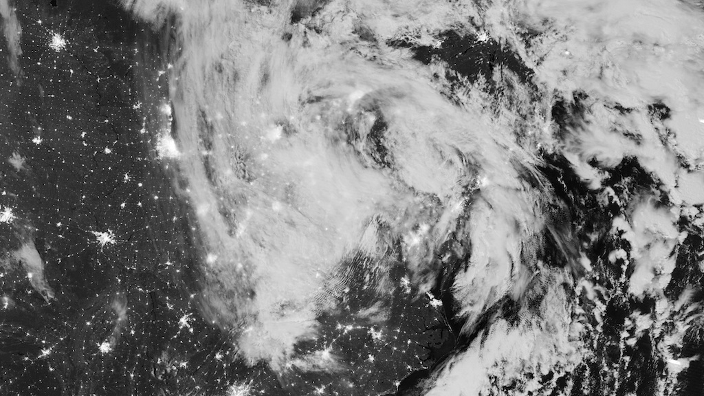
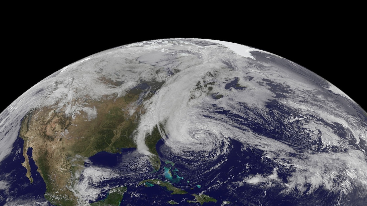
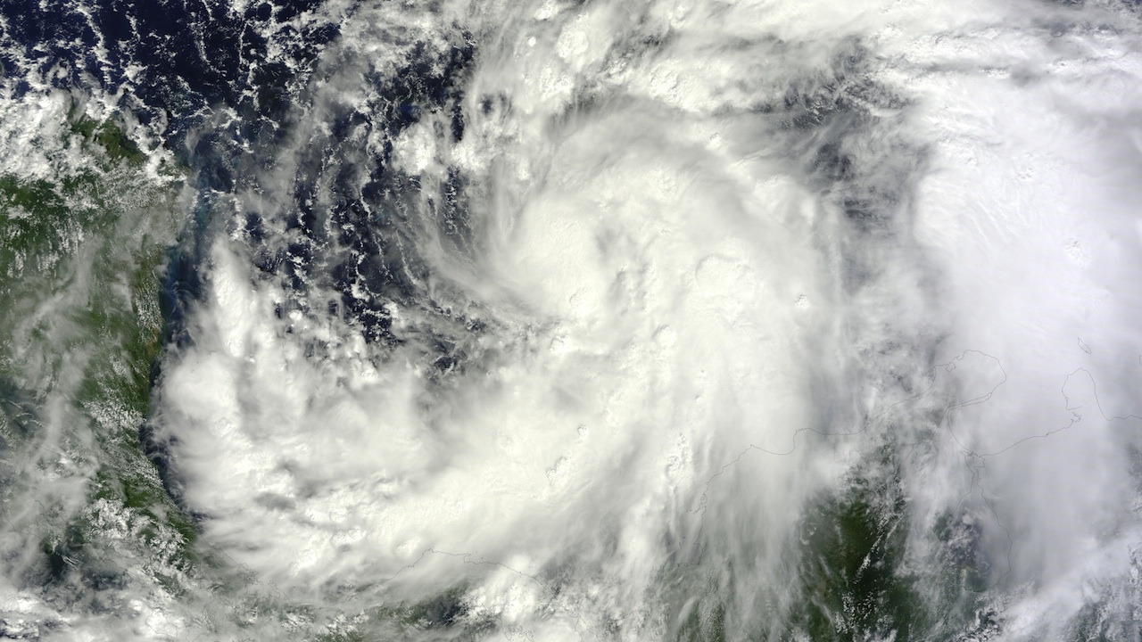
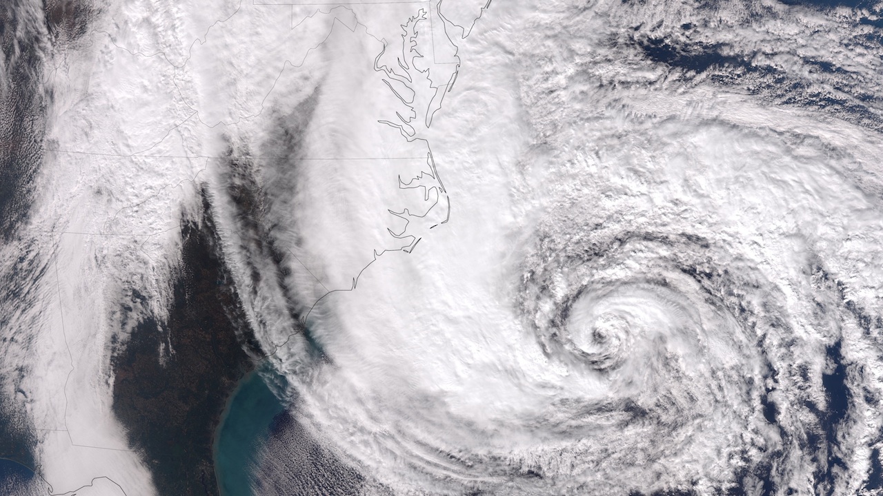
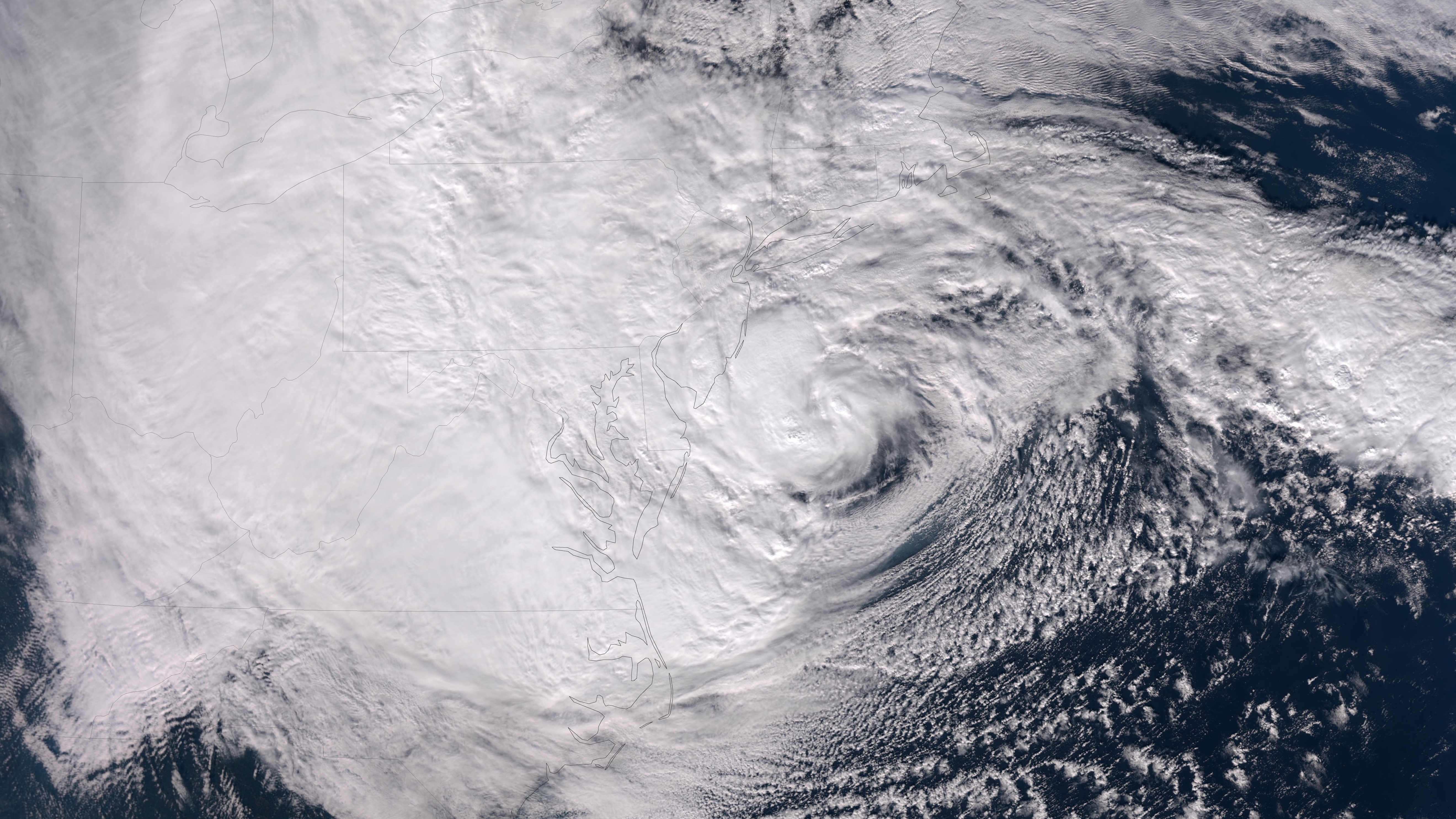
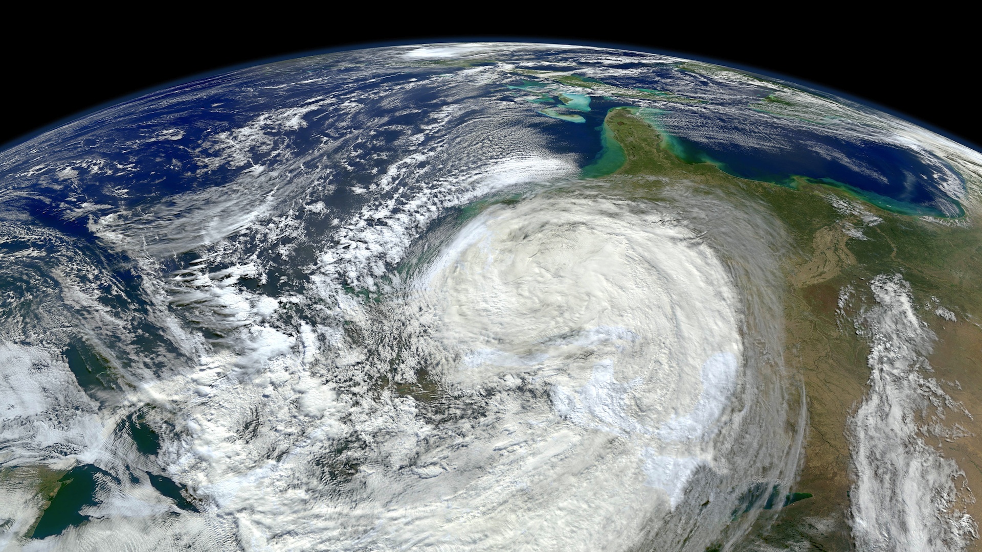
Throughout the last week of October 2012, the U.S. closely followed Hurricane Sandy's every move. The epic storm delivered power outages, storm surges, erosion, flooding, property damage and fatalities along the Atlantic coast. NASA and NOAA satellites provided the images that made their way onto broadcast news and into the hands of decision makers. Only the view from space could capture Sandy's full evolution, from a tropical storm into a Category 1 hurricane that spanned 1,100 miles in diameter, wider than any other Atlantic hurricane on record. The time-lapse animation shows the hurricane during the two days leading up to landfall in New Jersey, as seen by the GOES-14 weather satellite.


Wicked Weather
For More Information
Story Credits
Please give credit for this item to:
NASA's Goddard Space Flight Center
Cover image and animation courtesy of NASA/NOAA GOES Project Science Team
Oct. 23 image courtesy of NASA/GSFC MODIS Rapid Response Team
Oct. 28, 29 and 31 images courtesy of NASA Earth Observatory/Jesse Allen, using Suomi NPP VIIRS data provided by Cooperative Institute for Meteorological Satellite Studies
Short URL to share this page:
https://svs.gsfc.nasa.gov/11123
Keywords:
SVS >> App
NASA Science >> Earth
https://svs.gsfc.nasa.gov/11123
Keywords:
SVS >> App
NASA Science >> Earth


