Earth
ID: 11075
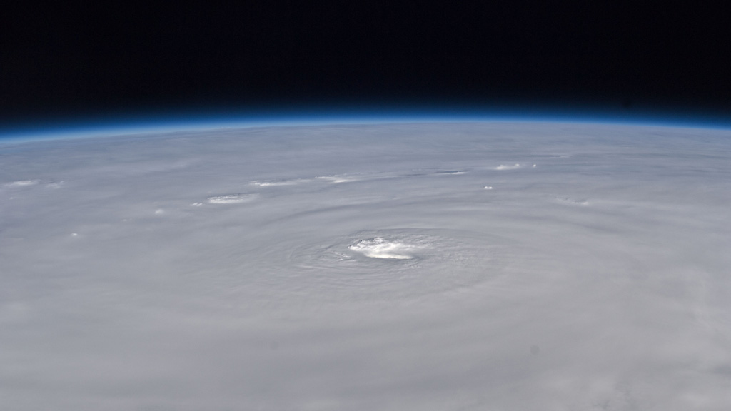
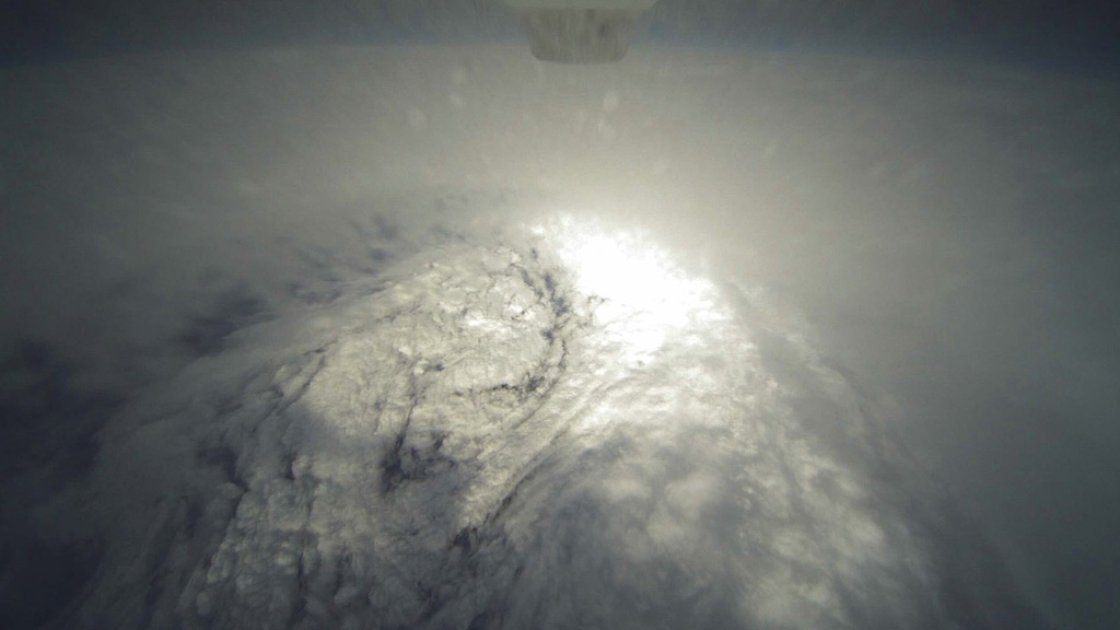
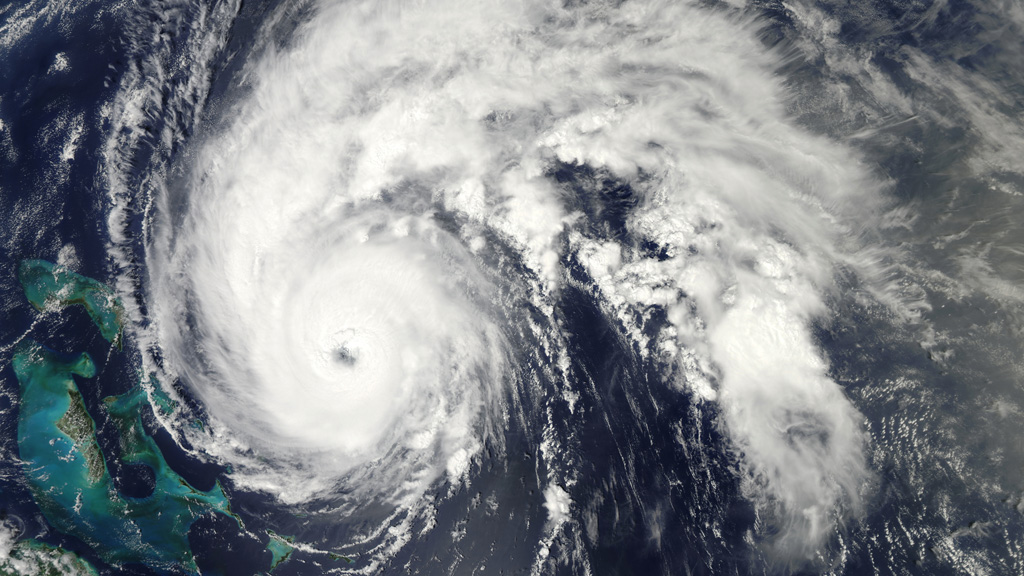
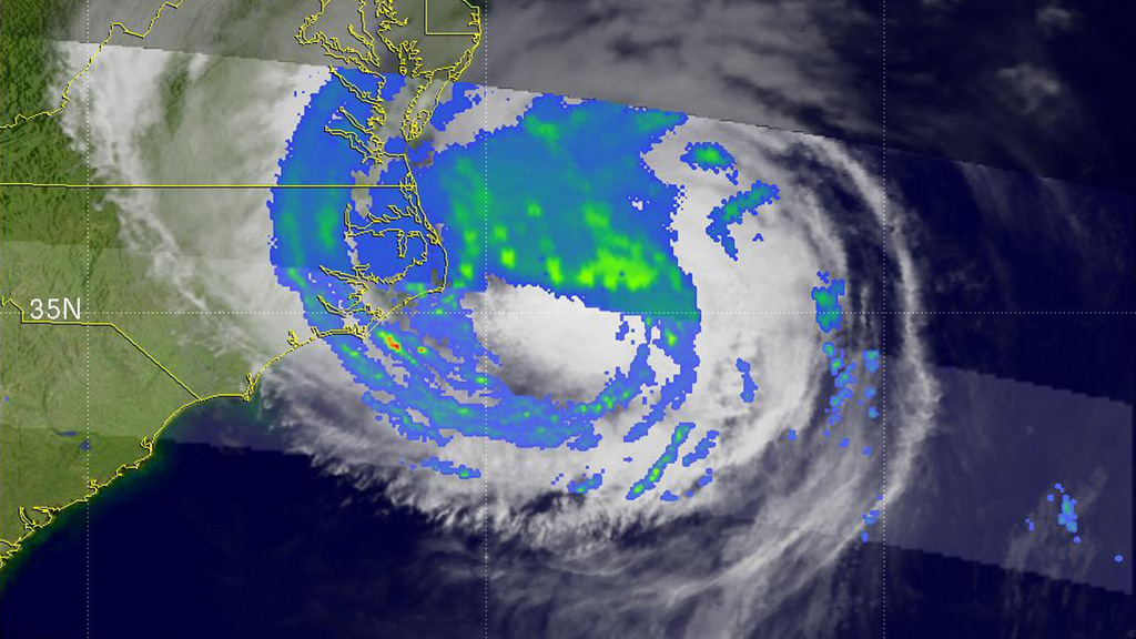
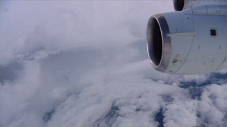
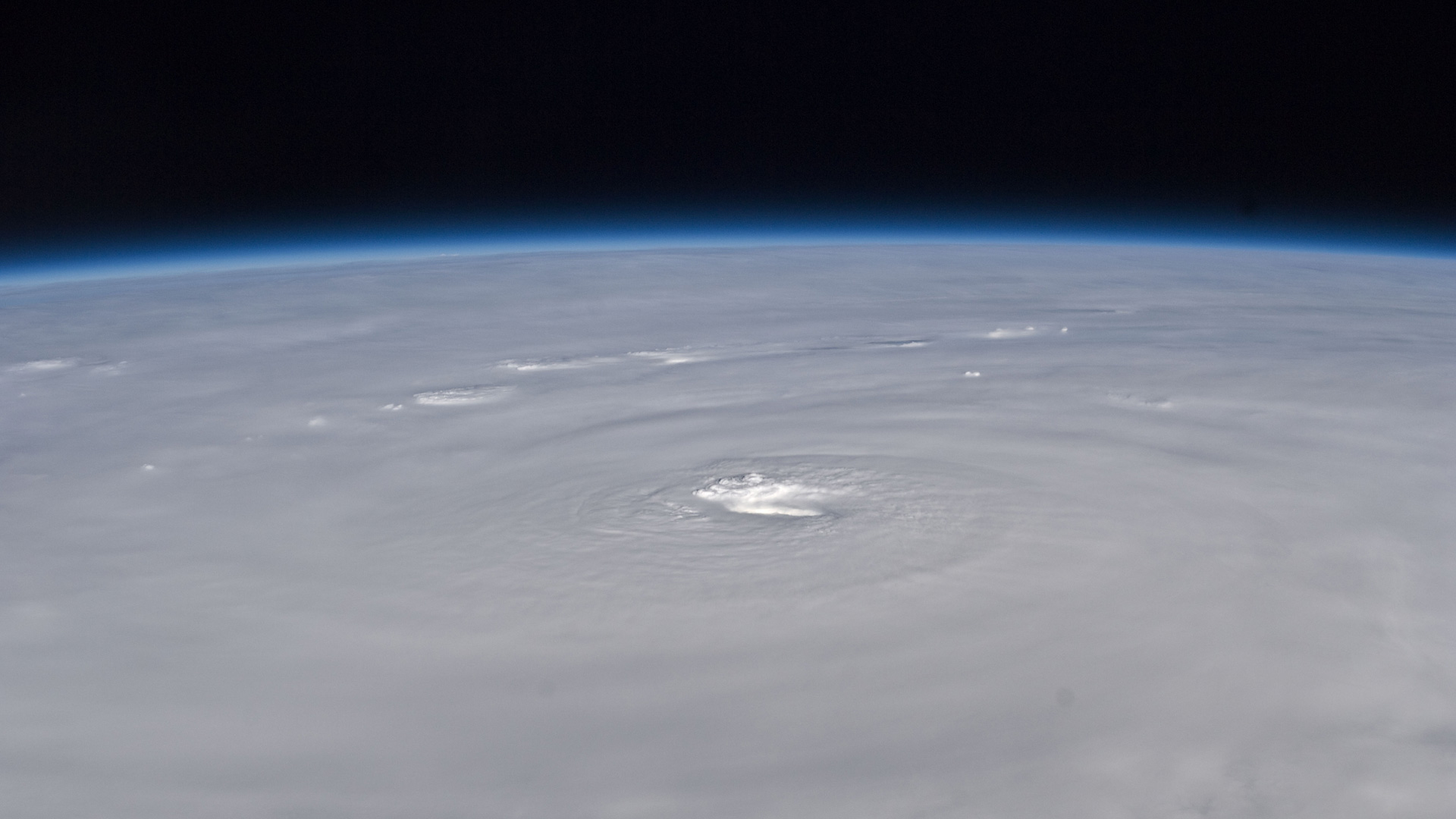
Why do some storms intensify into powerful hurricanes? In search of the answer NASA scientists took to the skies in 2010 aboard a flying laboratory that crisscrossed the path of Hurricane Earl as it approached the East Coast of the United States. By deploying canister-shaped sensors within the storm, researchers collected valuable data that will help them understand how such storms form and develop. But they weren't working alone: Soaring at an altitude of 60,000 feet, NASA's unmanned Global Hawk aircraft cruised over the Category 4 hurricane while astronauts on the International Space Station captured dramatic photos of its massive cloud tops from above. Wonder what it's like to fly through a hurricane? Watch the video to get a window seat view from the scientists' plane as it jetted into the eye of the storm.

Extreme Turbulence
Related Story
For More Information
Story Credits
Producer:
Brooke Harris (USRA)
Videographer:
Jane Peterson (University of North Dakota)
Lead Writer:
Patrick Lynch (Wyle Information Systems)
Brooke Harris (USRA)
Videographer:
Jane Peterson (University of North Dakota)
Lead Writer:
Patrick Lynch (Wyle Information Systems)
Please give credit for this item to:
NASA's Goddard Space Flight Center
Global Hawk photo courtesy of NASA/NOAA
TRMM image courtesy of NASA/SSAI, Hal Pierce
ISS photos courtesy of NASA, Douglas Wheelock
Aqua image courtesy of NASA/MODIS Rapid Response Team
NASA's Goddard Space Flight Center
Global Hawk photo courtesy of NASA/NOAA
TRMM image courtesy of NASA/SSAI, Hal Pierce
ISS photos courtesy of NASA, Douglas Wheelock
Aqua image courtesy of NASA/MODIS Rapid Response Team
Short URL to share this page:
https://svs.gsfc.nasa.gov/11075
Keywords:
NASA Science >> Earth
SVS >> App
https://svs.gsfc.nasa.gov/11075
Keywords:
NASA Science >> Earth
SVS >> App


