Earth
ID: 10830
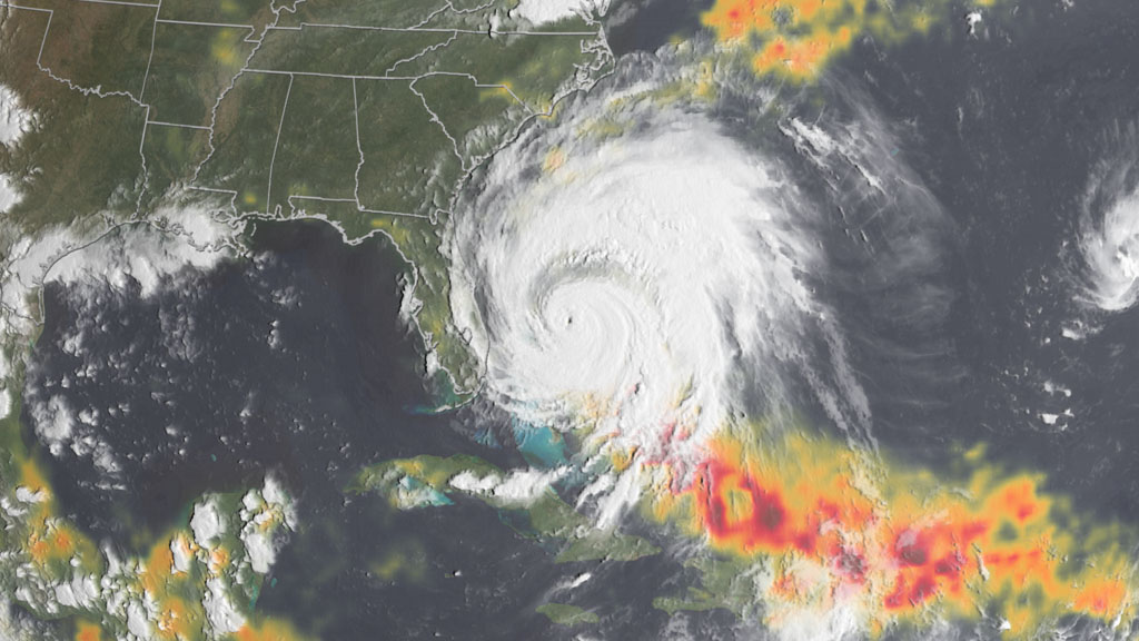
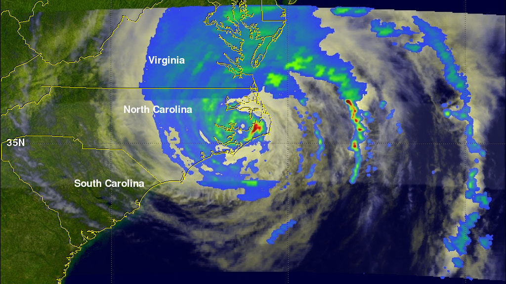
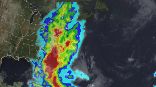
With the peak of the 2011 hurricane season behind us, Irene will likely go down as the biggest rainmaker of the year. The Tropical Rainfall Measuring Mission (TRMM), a joint NASA and JAXA satellite, monitored Irene's rainfall as the storm churned from the Caribbean up the Eastern Seaboard of the United States from August 20 through 29, 2011. Irene's heaviest rainfall totaled over 8.9 inches as its eye reached Cape Lookout, North Carolina. Other rainfall hotspots included New Jersey (upward of 8 inches in some counties), and upstate New York and Vermont, where satellite estimates show rainfall of up to 5.9 inches in some areas. As Irene swept northward, it turned into a depression, dumping heavy, but less damaging rains on parts of Canada before breaking up over the Labrador Sea. In the visualization below, watch Irene whirl its way up the Atlantic coastline.

The Rainmaker
Related Story
Story Credits
Visualizers/Animators:
Greg Shirah (NASA/GSFC)
Lori Perkins (NASA/GSFC)
Trent L. Schindler (USRA)
Producer:
Matthew R. Radcliff (USRA)
Lead Scientists:
Arthur Hou Ph.D. (NASA/GSFC)
Chris Kidd (University of Maryland)
Lead Writer:
Alison Schuyler Ogden (NASA/GSFC)
Greg Shirah (NASA/GSFC)
Lori Perkins (NASA/GSFC)
Trent L. Schindler (USRA)
Producer:
Matthew R. Radcliff (USRA)
Lead Scientists:
Arthur Hou Ph.D. (NASA/GSFC)
Chris Kidd (University of Maryland)
Lead Writer:
Alison Schuyler Ogden (NASA/GSFC)
Please give credit for this item to:
NASA's Goddard Space Flight Center Scientific Visualization Studio
NASA's Goddard Space Flight Center Scientific Visualization Studio
Short URL to share this page:
https://svs.gsfc.nasa.gov/10830
Keywords:
NASA Science >> Earth
SVS >> App
https://svs.gsfc.nasa.gov/10830
Keywords:
NASA Science >> Earth
SVS >> App


