Earth
ID: 10600
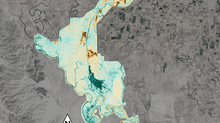
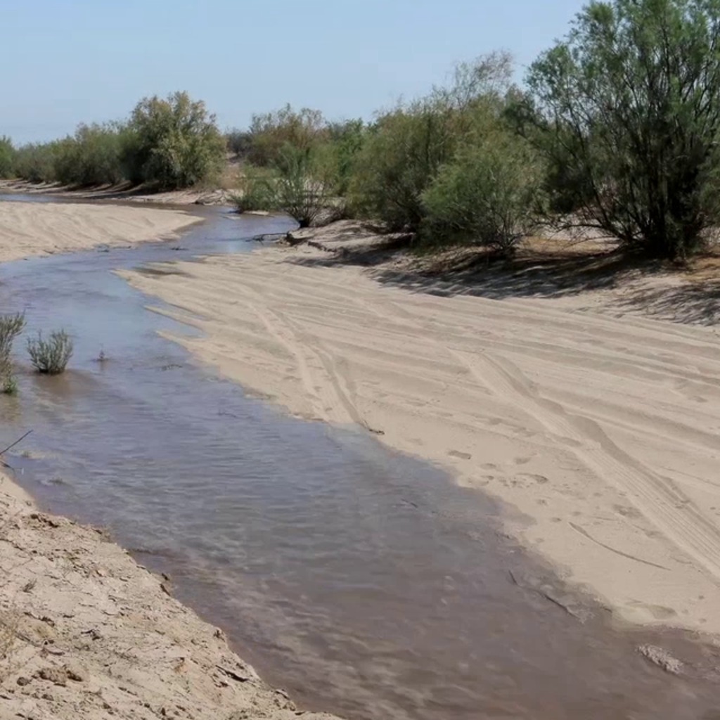
A pulse of water released down the lower reaches of the Colorado River last spring resulted in more than a 40 percent increase in green vegetation where the water flowed, as seen by the Landsat 8 satellite. The March 2014 release of water – an experimental flow implemented under a U.S.-Mexico agreement called "Minute 319" – reversed a 12-year decline in the greenness along the delta.
Instagram: Satellite Sees More Green On Colorado River
Analysis of satellite images of pre-flow August 2013 to post-flow August 2014, scientists with the U.S. Geological Survey (USGS) calculated a 43 percent increase in green vegetation along the route wetted by the flow, called the inundation zone, and a 23 percent increase in greening of the riparian zone, or the river banks.
Scientists presented these and other results this week at the American Geophysical Union's Fall Meeting in San Francisco. Landsat 8 is a joint project of NASA and the USGS.
Related
For More Information
Credits
Please give credit for this item to:
NASA's Goddard Space Flight Center
NASA's Goddard Space Flight Center
Short URL to share this page:
https://svs.gsfc.nasa.gov/10600
This item is part of this series:
Narrated Movies
Keywords:
SVS >> Landsat
DLESE >> Narrated
NASA Science >> Earth
https://svs.gsfc.nasa.gov/10600
This item is part of this series:
Narrated Movies
Keywords:
SVS >> Landsat
DLESE >> Narrated
NASA Science >> Earth


