Ocean Currents in equirectangular projection
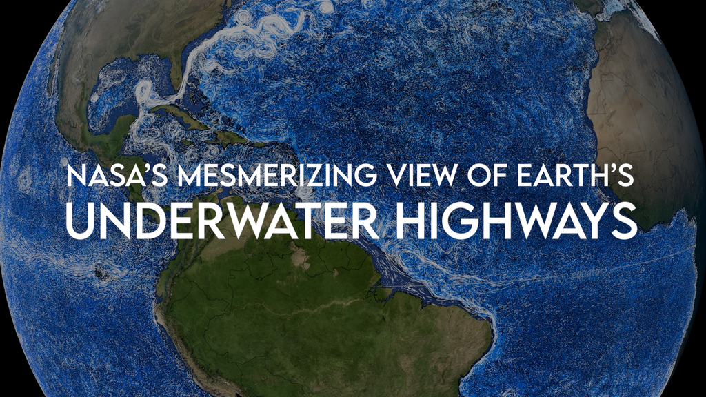
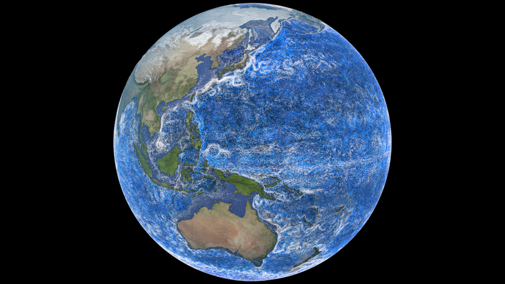
This is a visualization of ocean currents around the world. NASA’s ocean model, Estimating the Circulation and Climate of the Ocean (ECCO)), is used to visualize the currents. The ECCO ocean circulation model incorporates observations from spacecraft, buoys, and other in situ measurements to keep the model accurate. ECCO is a joint project between NASA/JPL and MIT. The model output used here is from ECCO-2 and covers the years 2021-2023.
This page contains equirectangular versions of Perpetual Ocean 2 prepared for Science on a Sphere. There are 3 versions: beauty, temperature, and salinity.
In this visualization ocean currents at all depths are shown. Those closer to the surface (above 600 meters depth) are white while those from 600 meters depth and lower are darker and darker shades of blue).
Science On A Sphere Content (Equirectangular projection)
Driven by global wind patterns and fueled by the Sun, ocean currents play an important role in driving Earth’s climate, weather patterns, and marine life. For instance, the Gulf Stream (shown here in light blue to white) is a powerful current travelling northward from the Caribbean along the United States coast and across to Northwestern Europe. The Gulf Stream carries heat from the tropics toward far northern latitudes, making placeslike the United Kingdon, Ireland, and Scandinavia warmer than they would be otherwise.
Science On A Sphere Content (Equirectangular projection)
In this version, the flows are colored by the temperature.
Science On A Sphere Content (Equirectangular projection)
In this version, the flows are colored by the salinity.
Credits
Please give credit for this item to:
NASA's Scientific Visualization Studio
-
Visualizers
-
Greg Shirah
(NASA/GSFC)

- Horace Mitchell (NASA/GSFC)
-
Greg Shirah
(NASA/GSFC)
-
Technical support
- Laurence Schuler (ADNET Systems, Inc.)
- Ian Jones (ADNET Systems, Inc.)
-
Scientist
-
Atousa Saberi
(NASA/GSFC)
-
Atousa Saberi
(NASA/GSFC)
Series
This page can be found in the following series:Datasets used
-
BMNG (Blue Marble: Next Generation) [Terra and Aqua: MODIS]
ID: 508Credit: The Blue Marble data is courtesy of Reto Stockli (NASA/GSFC).
This dataset can be found at: http://earthobservatory.nasa.gov/Newsroom/BlueMarble/
See all pages that use this dataset -
ECCO2 (ECCO2 High Resolution Ocean and Sea Ice Model)
ID: 707 -
ETOPO-30
ID: 1216NOAA Earth TOPOgraphy global relief model 30 arc-second resolution (ETOPO-30): The ETOPO Global Relief Model integrates topography, bathymetry, and shoreline data from regional and global datasets to enable comprehensive, high resolution renderings of geophysical characteristics of the earth’s surface. The model is designed to support tsunami forecasting, modeling, and warning, as well as ocean circulation modeling and Earth visualization.
This dataset can be found at: https://www.ncei.noaa.gov/products/etopo-global-relief-model
See all pages that use this dataset
Note: While we identify the data sets used on this page, we do not store any further details, nor the data sets themselves on our site.
Related
- ID: 14745
- ID: 5425
 Visualization
Alternate Versions
- ID: 5505
 Visualization
Release date
This page was originally published on Friday, May 30, 2025.
This page was last updated on Tuesday, July 1, 2025 at 4:55 PM EDT.