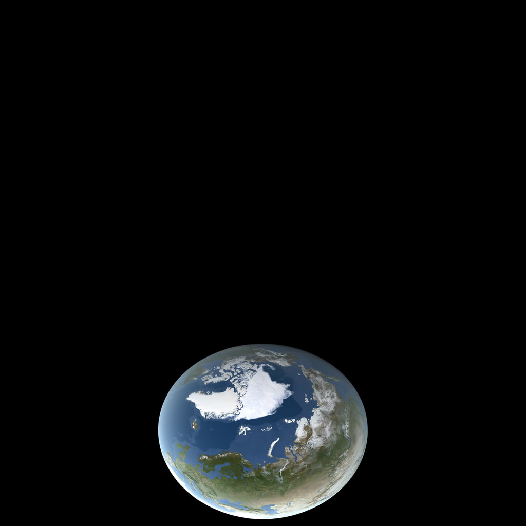
A newer version of this visualization is available.
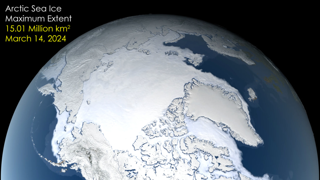
Arctic Sea Ice Maximum 2022

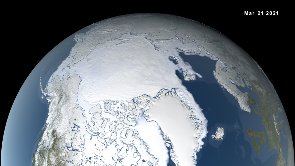
Arctic sea ice maximum, February 25, 2022
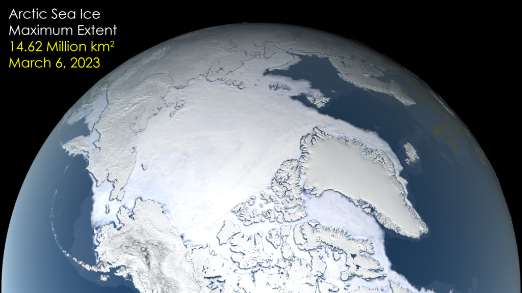
After growing through the fall and winter, sea ice in the Arctic appears to have reached its annual maximum extent. The image above shows the ice extent—defined as the total area in which the ice concentration is at least 15 percent—at its 2022 maximum, which occurred on February 25, tying with 2015 for the third earliest maximum on record. On this day the extent of the Arctic sea ice cover peaked at 14.88 million square kilometers (5.75 million square miles), making it the tenth lowest yearly maximum extent on record.
Animation of arctic sea ice from the September 16, 2021 minimum to the the February 25, 2022 maximum
Credits
Please give credit for this item to:
NASA's Scientific Visualization Studio
-
Visualizer
- Trent L. Schindler (USRA)
-
Writer
- Kathleen Gaeta (GSFC Interns)
-
Producer
- Roberto Molar-Candanosa (KBR Wyle Services, LLC)
Release date
This page was originally published on Tuesday, March 22, 2022.
This page was last updated on Wednesday, May 3, 2023 at 11:44 AM EDT.
Datasets used in this visualization
-
BMNG (Blue Marble: Next Generation) [Terra and Aqua: MODIS]
ID: 508Credit: The Blue Marble data is courtesy of Reto Stockli (NASA/GSFC).
This dataset can be found at: http://earthobservatory.nasa.gov/Newsroom/BlueMarble/
See all pages that use this dataset -
10 km Daily Sea Ice Concentration [SHIZUKU (GCOM-W1): AMSR2]
ID: 795Credit: AMSR2 data courtesy of the Japan Aerospace Exploration Agency (JAXA).
See all pages that use this dataset -
10 km Daily 89 GHz Brightness Temperature [SHIZUKU (GCOM-W1): AMSR2]
ID: 796Credit: AMSR2 data courtesy of the Japan Aerospace Exploration Agency (JAXA).
See all pages that use this dataset
Note: While we identify the data sets used in these visualizations, we do not store any further details, nor the data sets themselves on our site.
Related
- ID: 4927
 Visualization
 - ID: 13300
 Produced Video
 - ID: 13183
 Produced Video
 - ID: 13157
![Music: Ambience by Axel Coon [GEMA], Ralf Goebel [GEMA]](/vis/a010000/a013100/a013157/Max19_Thumb_print.jpg) Produced Video
Produced Video
Newer Versions
- ID: 5242
 Visualization
 - ID: 5091
 Visualization
Older Versions
- ID: 4878
 Visualization