Lee Lincoln Scarp at the Apollo 17 Landing Site
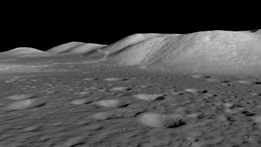
An animated view of Lee Lincoln scarp from above and from near ground level. This visualization is created from Lunar Reconnaissance Orbiter photographs and elevation mapping. The scarp is at the western end of the Taurus-Littrow valley, landing site of Apollo 17, and was explored by the astronauts on their second moonwalk.
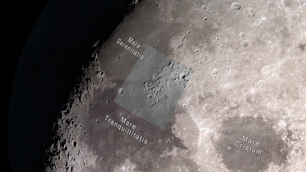
The Lee Lincoln scarp is a low ridge or step about 80 meters high and running north-south through the western end of the Taurus-Littrow valley, site of the Apollo 17 Moon landing. This lobate scarp marks the location of a relatively young, low-angle thrust fault. The land west of the fault was forced up and over the eastern side as the lunar crust contracted.
In a May 2019 paper published in Nature Geoscience, Thomas Watters and his coauthors provide evidence that this fault and others like it are still active and producing moonquakes today. Seismometers left on the Moon by Apollo astronauts recorded hundreds of events between 1969 and 1977, including 28 shallow moonquakes. The study narrowed the locations of these quakes and found that many of them occurred near scarps, implying that the forces creating the scarps also caused the quakes, and they continue to shape the lunar surface. The Lee Lincoln scarp was only about 13 kilometers from one of the epicenters identified by the scientists.
The Apollo 17 astronauts drove their lunar rover onto the scarp during their second day on the lunar surface, and this remains the only extraterrestrial scarp visited by humans.
An animated view of Lee Lincoln scarp from above and from near ground level. This visualization is created from Lunar Reconnaissance Orbiter photographs and elevation mapping. The scarp is at the western end of the Taurus-Littrow valley, landing site of Apollo 17, and was explored by the astronauts on their second moonwalk. Music by Killer Tracks: Smoke and Mirrors
- Gresby Race Nash.
This video is also available on the NASA Goddard YouTube channel.
For More Information
Credits
Please give credit for this item to:
NASA's Scientific Visualization Studio
-
Visualizer
-
Ernie Wright
(USRA)

-
Ernie Wright
(USRA)
-
Producer
- David Ladd (USRA)
-
Scientist
- Tom Watters (Smithsonian/Air and Space)
Missions
This page is related to the following missions:Related papers
Datasets used
-
NAC (Narrow Angle Camera) [LRO: LROC]
ID: 652 -
Stereo DEM [LRO: LROC NAC]
ID: 835 -
LROC WAC [LRO: Wide Angle Camera]
ID: 927 -
SLDEM2015 (DIgital Elevation Model) [LRO/SELENE: LOLA/TC]
ID: 948A digital elevation model of the Moon derived from the Lunar Orbiter Laser Altimeter and the SELENE Terrain Camera. See the description in Icarus. The data is here.
See all pages that use this dataset
Note: While we identify the data sets used on this page, we do not store any further details, nor the data sets themselves on our site.
Related
- ID: 5053
 Visualization
 - ID: 4717
 Visualization
Alternate Versions
- ID: 13275
![Watch this video on the NASA Goddard YouTube channel.Complete transcript available.Music credits: “Boreal Moment” by Benoit Scarwell [SACEM]; “Sensory Questioning”, “Natural Time Cycles”, “Emerging Designer”, and “Experimental Design” by Laurent Dury [SACEM]; “Superluminal” by Lee Groves [PRS], Peter George Marett [PRS] from Killer Tracks](/vis/a010000/a013200/a013275/13275_AstronautRadiation_Twitter.01205_print.jpg) Produced Video
Produced Video
Release date
This page was originally published on Monday, May 13, 2019.
This page was last updated on Wednesday, May 15, 2019 at 10:51 AM EDT.