High Resolution Layers from "Monsoons: Wet, Dry, Repeat..."
Composited layers - all layers on
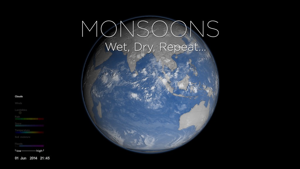
The visualizations here are based on the visualization Monsoons: Wet, Dry, Repeat (#4397). Each data set is presented in three resolutions: 8192x4096, 4096x2048, and 2048x1024. Each the 8192x4096 and 4096x2048 layers have been rendered with alpha transparency channels to allow you to create your own combinations of layered data. NOTE: the preview movies are composited over a black background, but the individual 8192x4096 and 4096x2048 frames have transparency channels. The 2048x1024 frames do not have transparency channels.
The layers have frame numbers from 01000 through 13000. Frame 01000 corresponds to 02 Jun 2014 at 00:00 GMT. Each successive frame is 15 minutes later. Frame 13000 corresponds to 05 Oct 2014 at 00:00 GMT. To determine the time for a specific layer's frame number, you can look at the date sequence's corresponding frame.
Even though all layers are provided at 15 minute intervals, most data sets do not have such a high cadence. In these cases, the frames simply show the same data. See the annotation with each data set for the cadences.
Cloud layer from NOAA Climate Prediction Center (CPC) updated every 4th frame (once per hour)
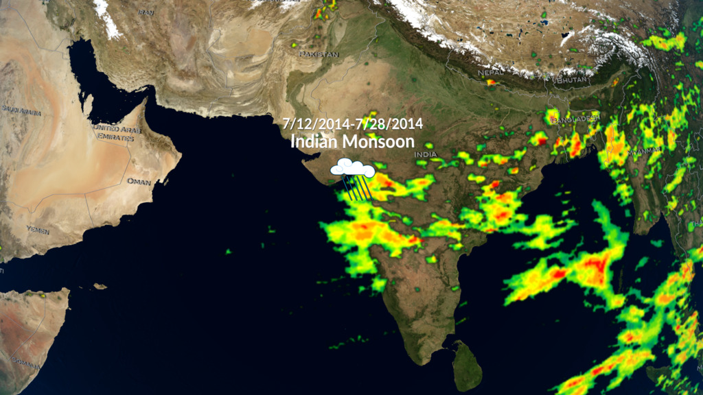
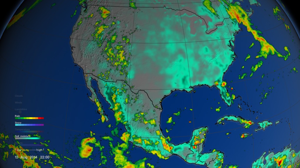
Precipitation from GPM IMERG - updated every other frame (every 30 minutes)
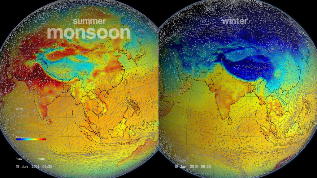
Winds from MERRA - updated every frame via interpolation (every 15 minutes) - distinct data sets are every hour
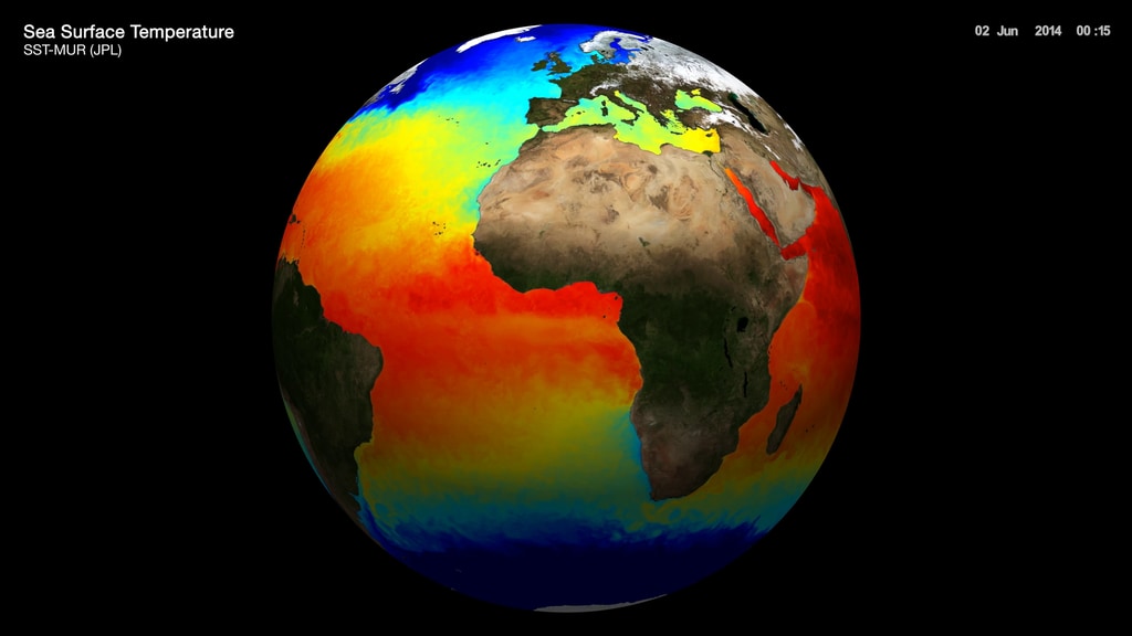
Sea Surface Temperature (SST) layer from SST-MUR (JPL) - updated every frame via interpolation (every 15 minutes) - distinct date sets are once per day
Soil moisture layer from NASA-USDA-FAS - updated every frame via interpolation (every 15 minutes) distinct data sets are every 3 days
Water Vapor from MERRA - updated every 4 frames (every hour)
Date and time layer - updated every frame (every 15 minutes)

Blue marble land layer - this is a static layer
Grid layer - this is a static layer
Political boundary layer - this is a static layer
Blue ocean layer - this is a static layer
Credits
Please give credit for this item to:
NASA's Scientific Visualization Studio
-
Visualizers
-
Greg Shirah
(NASA/GSFC)

-
Alex Kekesi
(Global Science and Technology, Inc.)
- Trent L. Schindler (USRA)
- Lori Perkins (NASA/GSFC)
-
Greg Shirah
(NASA/GSFC)
-
Animator
- Horace Mitchell (NASA/GSFC)
-
Producer
- Ryan Fitzgibbons (USRA)
-
Scientists
- Dalia B Kirschbaum (NASA/GSFC)
-
George Huffman
(NASA/GSFC)
- Gail Skofronick Jackson (NASA/GSFC)
Missions
This page is related to the following missions:Datasets used
-
Soil Moisture [GEMS]
ID: 405GEMS stands for Goddard Earth Modeling System. It is also known as the NSIPP Global Climate Model.
See all pages that use this dataset -
CPC (Climate Prediction Center) Cloud Composite
ID: 600Global cloud cover from multiple satellites
See all pages that use this dataset -
MERRA
ID: 684 -
IMERG
ID: 863This dataset can be found at: http://pmm.nasa.gov/sites/default/files/document_files/IMERG_ATBD_V4.4.pdf
See all pages that use this dataset -
Global Flood Monitoring System (GFMS)
ID: 901
Note: While we identify the data sets used on this page, we do not store any further details, nor the data sets themselves on our site.
Related
- ID: 5361
 Visualization
 - ID: 4474
 Visualization
Used as a Source In
- ID: 31139
 Hyperwall Visual
 - ID: 12254
 Produced Video
 - ID: 4397
 Visualization
 - ID: 12252
 Produced Video
Release date
This page was originally published on Thursday, June 23, 2016.
This page was last updated on Sunday, January 5, 2025 at 11:00 PM EST.