Stratospheric Ozone Intrusion
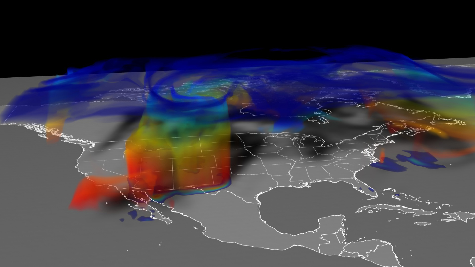
Events called stratospheric ozone intrusions occur most often in spring and early summer, and can raise ground-level ozone concentrations in some areas to potentially unhealthy levels.
This visualization shows one such event that occurred on April 6, 2012. On that day, a fast-moving area of low pressure moved northeast across states in the Western U.S., clipping western and northern Colorado. Ozone-rich stratospheric air descended, folding into tropospheric air near the ground. Winds took hold of the air mass and pushed it in all directions, bringing stratospheric ozone to the ground in Colorado and along the Northern Front Range.
Atmospheric scientists at NASA's Goddard Space Flight Center in Greenbelt, Md., set out to see if the Goddard Earth Observing System Model, Version 5 (GEOS-5) Chemistry-Climate Model could replicate stratospheric ozone intrusions at 25-kilometer (16-mile) resolution. High-resolution models are possible due to computing power now capable of simulating the chemistry and movement of gasses and pollutants around the atmosphere and calculating their interactions.
They show that indeed, the model could replicate small-scale features, including finger-like filaments, within the apron of ozone-rich stratospheric air that descended over Colorado on April 6, 2012.
Stratospheric Ozone Intrusion Short Version
Stratospheric Ozone Intrusion Long Version
This video is also available on our YouTube channel.

Colorbar
Google Version
Coming soon to our YouTube channel.
Credits
Please give credit for this item to:
NASA's Scientific Visualization Studio
-
Animator
- Trent L. Schindler (USRA)
-
Producer
- Alison Schuyler Ogden (NASA/GSFC)
-
Scientists
- Jon Eric Neilson (SSAI)
- Steven Pawson (NASA/GSFC)
-
Project support
- Laurence Schuler (ADNET Systems, Inc.)
- Ian Jones (ADNET Systems, Inc.)
-
Writer
- Kathryn Hansen (Wyle Information Systems)
Series
This page can be found in the following series:Datasets used
-
G5NR-Chem (Chemistry) [GEOS-5: Nature Run]
ID: 946
Note: While we identify the data sets used on this page, we do not store any further details, nor the data sets themselves on our site.
Related
- ID: 11532
 Produced Video
Release date
This page was originally published on Thursday, April 10, 2014.
This page was last updated on Wednesday, May 3, 2023 at 1:51 PM EDT.