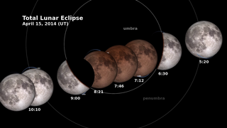
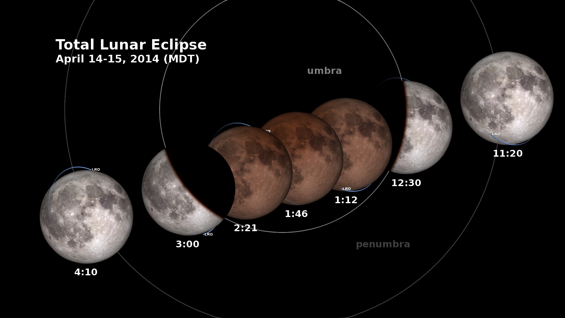
LRO and the Lunar Eclipse of April 15, 2014: Telescopic View
Dial-a-Moon

Enter a time to see what the moon looked like (or will look like) at that time.
| Time (UTC) | 2023-01-01T00:00 |
|---|---|
| Phase | 00.0% (0d 0h 0m) |
| Diameter | 0000.0 arcseconds |
| Distance | 00.0 km (0.00 Earth diameters) |
| J2000 Right Ascension, Declination | 0h 0m 0s, 0° 0' 0" |
| Sub-Solar Longitude, Latitude | 0.000°, 0.000° |
| Sub-Earth Longitude, Latitude | 0.000°, 0.000° |
| Position Angle | 0.000° |
Typically, the Lunar Reconnaissance Orbiter (LRO) spacecraft flies over the night side of the Moon every two hours, spending about 45 minutes in darkness. Because LRO is powered by sunlight, it uses a rechargeable battery to operate while on the night side of the Moon and then charges the battery when it comes back around into daylight.
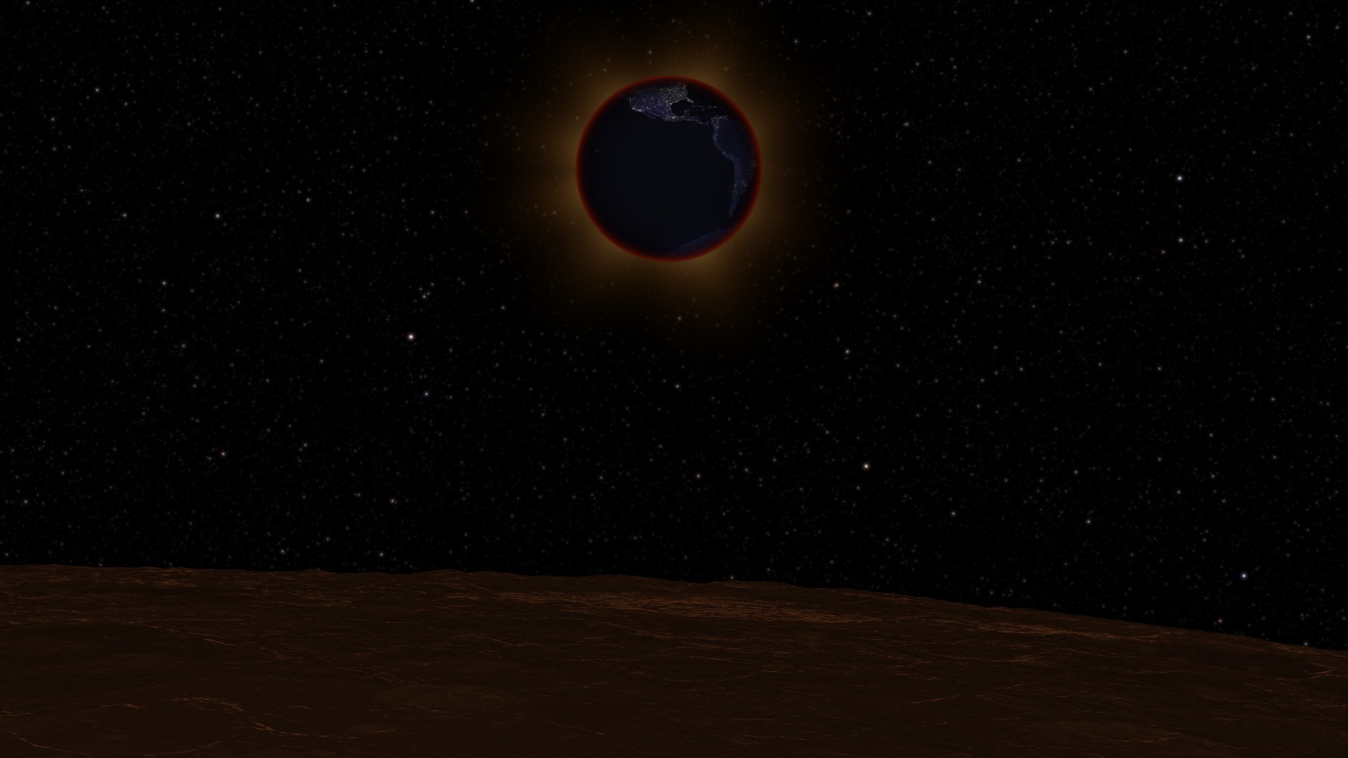
During the total lunar eclipse of April 15, 2014, however, LRO emerges from the night side of the Moon only to find the Sun blocked by the Earth. LRO needs to travel an entire orbit before seeing the Sun again, relying continuously on its battery for almost three hours, longer than it ever has before.
LRO won’t be in any real danger as long as its power consumption is handled carefully. Its scientific instruments will be turned off temporarily, while vital subsystems like the heater will remain on. LRO will be closely monitored throughout the eclipse.
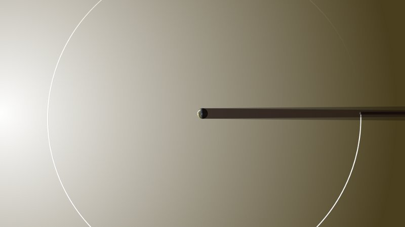
This animation shows the Moon as it might look through a telescope on Earth, with LRO’s orbit, its view of the Sun, and a fuel gauge showing received sunlight and the battery’s charge.
The appearance of the Moon during the lunar eclipse at 10 seconds per frame. Displays LRO's orbit, its view of the Sun, and meters for the amount of sunlight LRO is receiving and the charge of its battery.
The appearance of the Moon during the lunar eclipse at 10 seconds per frame. Displays LRO's orbit. The frames include an alpha channel.
The appearance of the Moon during the lunar eclipse at 10 seconds per frame. Omits LRO's orbit. The frames include an alpha channel.
LRO's view of the Sun during the eclipse. The view is dark when the Moon is in the way. The frames include an alpha channel.
For More Information
Credits
Please give credit for this item to:
NASA's Scientific Visualization Studio
-
Animator
-
Ernie Wright
(USRA)

-
Ernie Wright
(USRA)
-
Producers
- Dan Gallagher (USRA)
- David Ladd (USRA)
- Michelle Handleman (USRA)
-
Scientists
- John Keller (NASA/GSFC)
-
Noah Petro
(NASA/GSFC)
- Michelle Thaller (NASA/GSFC)
-
Project support
- Laurence Schuler (ADNET Systems, Inc.)
- Ian Jones (ADNET Systems, Inc.)
Missions
This page is related to the following missions:Series
This page can be found in the following series:Datasets used
-
DEM (Digital Elevation Map) [LRO: LOLA]
ID: 653 -
DE421 (JPL DE421)
ID: 752Planetary ephemerides
This dataset can be found at: http://ssd.jpl.nasa.gov/?ephemerides#planets
See all pages that use this dataset -
WAC 643nm High Sun Global Mosaic [LRO: LROC]
ID: 803
Note: While we identify the data sets used on this page, we do not store any further details, nor the data sets themselves on our site.
Related
- ID: 4157
 Visualization
 - ID: 4158
 Visualization
 - ID: 11516
 Produced Video
 - ID: 11514
 Produced Video
 - ID: 4155
 Visualization
Release date
This page was originally published on Thursday, April 10, 2014.
This page was last updated on Thursday, January 30, 2025 at 3:17 PM EST.