North America Snow Cover 2009-2012
This entry features visualization material of daily snow cover over North America from July 1, 2009 - March 11, 2012 and still images of snow cover in the Western region of United States.
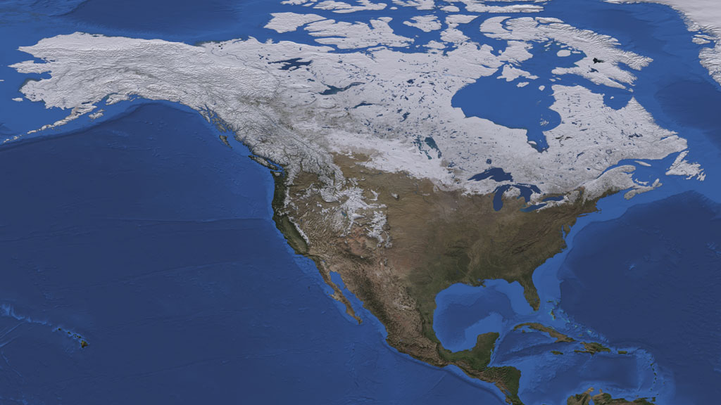
Visualization of North America Snow Cover Map for the period of July 1, 2009 - March 11, 2012.
This set of frames provides the layer of the dates only, with alpha channel.
This set of frames provides the visualization of North America Snow Cover Map without dates.

Close-up view of Snow Cover in US West, on December 20, 2011.
Close-up view of Snow Cover in US West, on January 5, 2012.
Close-up view of Snow Cover in US West, on February 1, 2012.
Close-up view of Snow Cover in US West, on March 1, 2012.
Credits
Please give credit for this item to:
NASA/Goddard Space Flight Center Scientific Visualization Studio
-
Animator
-
Helen-Nicole Kostis
(USRA)

-
Helen-Nicole Kostis
(USRA)
-
Visualizer
-
Cindy Starr
(Global Science and Technology, Inc.)
-
Cindy Starr
(Global Science and Technology, Inc.)
-
Producer
- Rani Gran (NASA/GSFC)
-
Scientists
- Dorothy Hall (NASA/GSFC)
- Jeffrey A. Miller (Wyle Information Systems)
- Thorsten Markus (NASA/GSFC)
Missions
This page is related to the following missions:Datasets used
-
Snow Cover Daily L3 Global 0.05Deg CMG (MOD10C1) [Terra: MODIS]
ID: 504 -
BMNG (Blue Marble: Next Generation) [Terra and Aqua: MODIS]
ID: 508Credit: The Blue Marble data is courtesy of Reto Stockli (NASA/GSFC).
This dataset can be found at: http://earthobservatory.nasa.gov/Newsroom/BlueMarble/
See all pages that use this dataset -
Bathymetry [Terra: MODIS]
ID: 569
Note: While we identify the data sets used on this page, we do not store any further details, nor the data sets themselves on our site.
Related
- ID: 10945
 Produced Video
Release date
This page was originally published on Saturday, April 7, 2012.
This page was last updated on Wednesday, May 3, 2023 at 1:53 PM EDT.