Mars Roll
A redux of entry #2455 using MGS/MOLA data for the Martian topography and MGS/MOC for the Martian surface color. The animation rolls Mars to show major features of the Martian topography. Major features depicted include: Olympus Mons, Valles Marineris, Hellas Basin, and the Martian North and South Poles.
Animation that rolls Mars around to show all the major features of the Martian topography. This animation begins with a hemispherical view of Olympus Mons and Valles Marineris and then rolls around to reveal the Martian South Pole. While traversing Northward, we pass Hellas Basin and end up looking down up the Martian North Pole.
: Ascraeus Mons, Pavonis Mons, and Arsia Mons. Valles Marineris can also be seen. It's the giant valley that slashes equatorially across the Martian landscape to the right of the volcanoes.")
Print resolution image of Mars showing a partly shadowed Olympus Mons toward the upper left of the image. The row of 3 volcanoes that form the base of a triangle in relationship to Olympus Mons are (from top to bottom): Ascraeus Mons, Pavonis Mons, and Arsia Mons. Valles Marineris can also be seen. It's the giant valley that slashes equatorially across the Martian landscape to the right of the volcanoes.
Print resolution nadir view of the Martian South Pole.
Print resolution image of Mars. Hellas Basin can be seen in the lower right portion of the image.
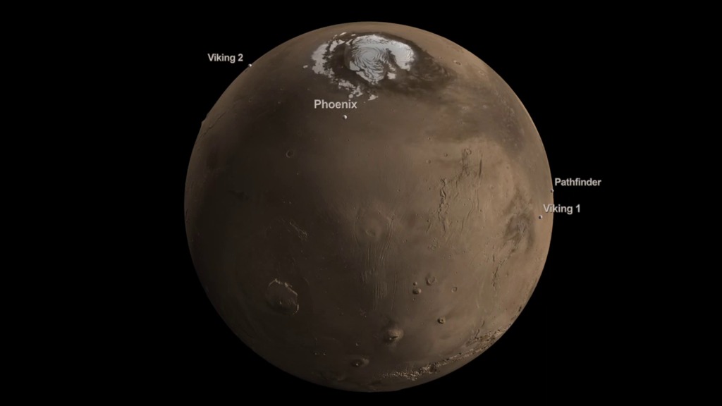
Print resolution image of Mars slightly tilted to show the Martian North Pole.
Print resolution nadir view of the Martian North Pole.
Credits
Please give credit for this item to:
NASA/Goddard Space Flight Center
Scientific Visualization Studio
-
Animator
-
Alex Kekesi
(Global Science and Technology, Inc.)

-
Alex Kekesi
(Global Science and Technology, Inc.)
Missions
This page is related to the following missions:Datasets used
-
[MGS: MOC]
ID: 58 -
[MGS: MOLA]
ID: 59
Note: While we identify the data sets used on this page, we do not store any further details, nor the data sets themselves on our site.
Related
- ID: 11057
 Produced Video
Used as a Source In
- ID: 14261
 Produced Video
Release date
This page was originally published on Wednesday, December 28, 2011.
This page was last updated on Thursday, April 17, 2025 at 10:11 PM EDT.