Antarctic Ice Flow Charted From Space
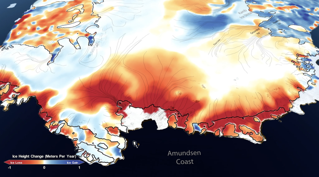
Harsh snows have blanketed Antarctica for so long that the continent has built up an ice sheet a mile thick from bedrock to surface in most places. Despite the ice cap's grip on the rocky landmass below, friction can only hold back the ice so much. A new, first-of-its-kind map from NASA reveals icy Antarctica as a landscape of constant movement. NASA scientists at the Jet Propulsion Laboratory and UC Irvine have charted this movement for the first time, using Canadian, Japanese and European satellite data to create a record of the speed and direction of ice flow across the entire continent. The map reveals glaciers and tributaries in patterned flows stretching hundreds of miles inland, like a system of rivers and creeks. Slow-moving flows found in largely unexplored East Antarctica defied previous understanding of ice migration. And scientists discovered a ridge that splits Antarctica from east to west. Explore the visualizations below to see the new benchmark map scientists can use to study the extent and speed of changes to the largest ice sheet in the world.

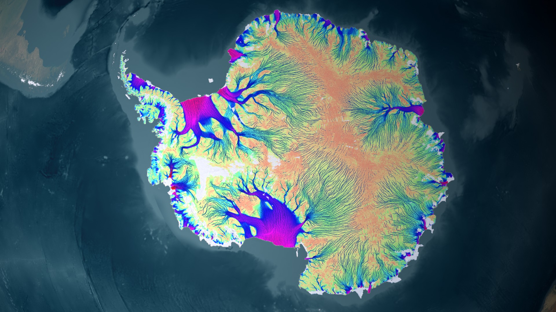
A new map changes our understanding of how ice flows across Antarctica.
Slow, interior flows have been sped up to make them more visible. The colors represent the real flow velocity magnitude.
This video is also available on our YouTube channel.
With all flows shown at the proper scale, only the fastest ice movement is visible.
With colors representing velocity magnitude removed, glacier direction stands out against the icy background.
Black lines mark continental ridges that separate regions of ice moving toward different parts of the coastline.
For More Information
See NASA.gov
Credits
Please give credit for this item to:
NASA's Goddard Space Flight Center Scientific Visualization Studio
-
Animators
- Trent L. Schindler (USRA)
- Horace Mitchell (NASA/GSFC)
-
Greg Shirah
(NASA/GSFC)

- Lori Perkins (NASA/GSFC)
-
Producers
- Whitney B Clavin (NASA/JPL CalTech)
- Alan Buis (NASA/JPL CalTech)
- Janet H. Wilson (University of California, Irvine)
-
Scientists
- Eric J. Rignot (NASA/JPL CalTech)
- Bernd Scheuchl (University of California, Irvine)
-
Project support
- Jeremie Mouginot (University of California, Irvine)
-
Writer
- Patrick Lynch (Wyle Information Systems)
Related
- ID: 11015
 Produced Video
 - ID: 3848
Used as a Source In
- ID: 14116

- ID: 13600
 Produced Video
Release date
This page was originally published on Thursday, August 25, 2011.
This page was last updated on Sunday, October 6, 2024 at 10:02 PM EDT.