Artificial World Captures Reality
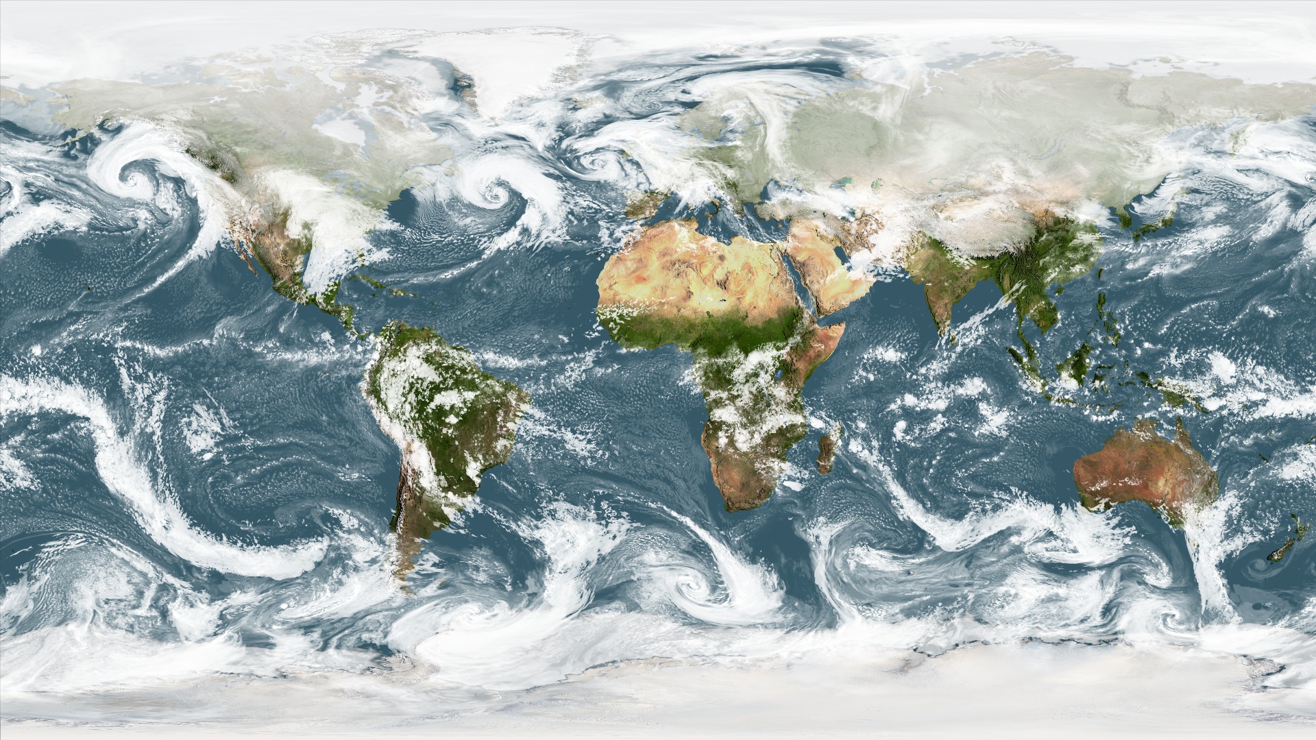
A gold standard for supercomputer models that simulate Earth is the ability to recreate real events—snowstorms, tropical cyclones, long-term climate trends. By that benchmark, this 20-day run of one of the highest-resolution climate models in the world glitters. Called GEOS-5, the model was given data leading up to Feb. 2, 2010 and then predicted the atmosphere's response until Feb. 22, 2010 without any further input. The model simulated real weather events that took place during this period—two major snowstorms that struck the East Coast and a Pacific cyclone that formed out of intense convection in the tropics. A closer look at the simulation below reveals its complexity: 3-D cloud layers, the day-night cycle of humidity appearing and disappearing over the Amazon and streaky "cloud streets" that trail across the Atlantic from the U.S. coastline.

The fine-grained resolution of NASA's most powerful climate model sharpens our understanding of Earth.
This 20-day model run recreated massive 2010 East Coast snows and displays GEOS-5's capacity for complexity.
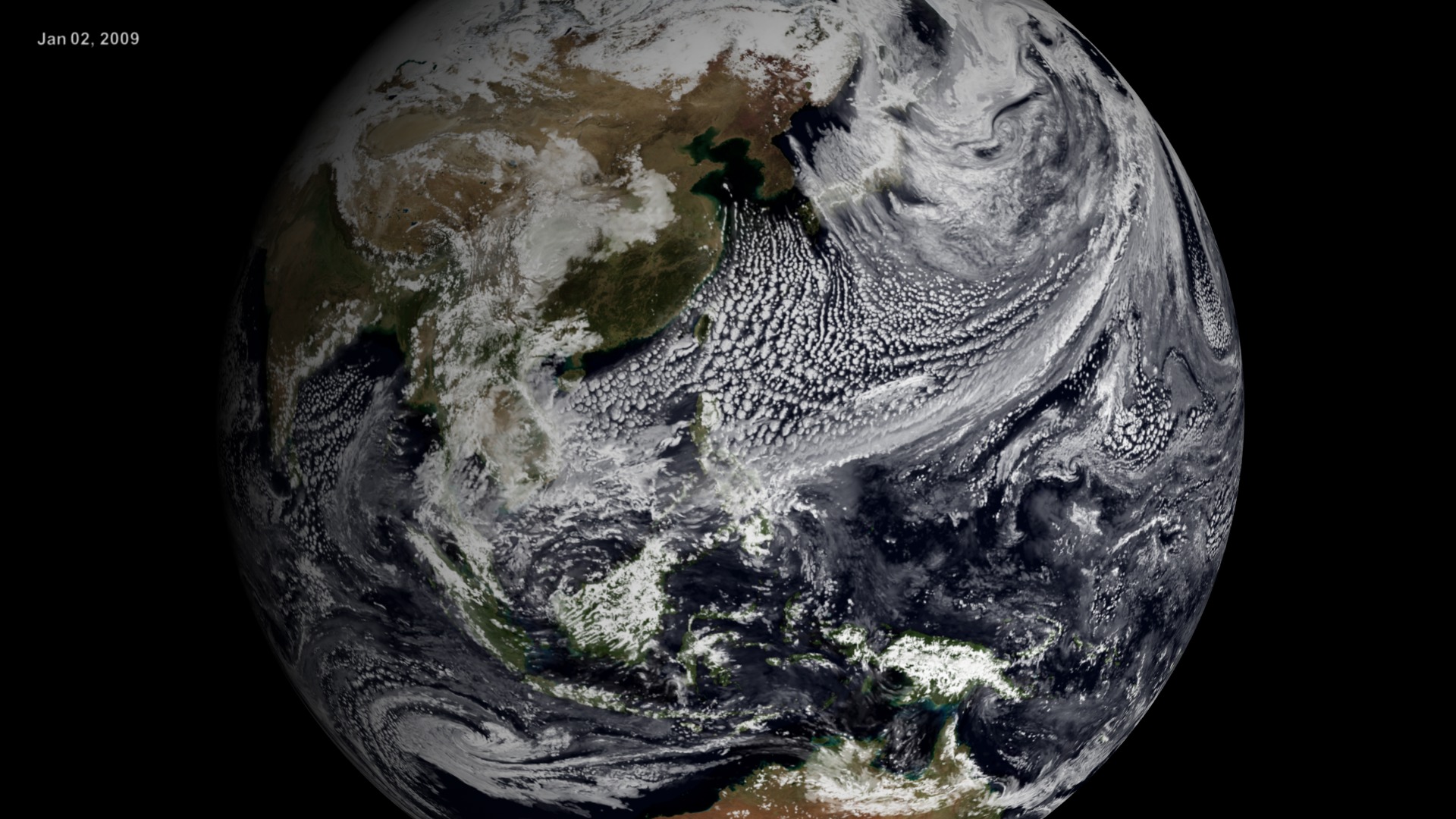
Flashing in the top visual is a symptom of the challenge in collecting infrared cloud data from space.
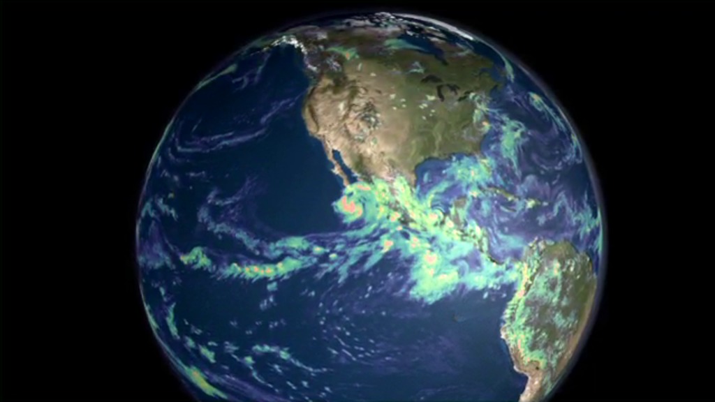
Was this video shot from space? No. Every pixel here was calculated by GEOS-5 in a simulation of the day Jan. 2, 2009.
Like experts in so many fields, NASA climate scientists use numerical models, powered by supercomputers, to gain a better understanding of Earth's behavior.
Even the "hyperwall" at Goddard Space Flight Center does not fully capture the 8000 by 4000 resolution of GEOS-5, although it comes close.
Credits
Please give credit for this item to:
NASA's Goddard Space Flight Center Scientific Visualization Studio
-
Animators
-
Greg Shirah
(NASA/GSFC)

- Trent L. Schindler (USRA)
- Ivy Flores (IRC/UMBC)
- Chris Smith (HTSI)
-
Greg Shirah
(NASA/GSFC)
-
Video editor
- Rich Melnick (HTSI)
-
Interviewees
- Cynthia Rosenzweig (NASA/GSFC GISS)
- Phil Webster (NASA/GSFC)
-
Narrator
- Jarrett Cohen (Global Science and Technology, Inc.)
-
Producers
- Michelle Williams (UMBC)
- Rich Melnick (HTSI)
- Jefferson Beck (USRA)
- Laura Motel (UMBC)
-
Scientists
- William Putman (NASA/GSFC)
- Max J. Suarez (NASA/GSFC)
- Jarrett Cohen (Global Science and Technology, Inc.)
- Phil Webster (NASA/GSFC)
-
Project support
- Eric Sokolowsky (Global Science and Technology, Inc.)
- Andrew Freeberg (NASA/GSFC)
-
Videographers
- Jamal Smith (HTSI)
- Chris Smith (HTSI)
- Michelle Williams (UMBC)
-
Writer
- Patrick Lynch (Wyle Information Systems)
Related
- ID: 3723
- ID: 10563
 Produced Video
 - ID: 3659
 Visualization
Release date
This page was originally published on Thursday, October 28, 2010.
This page was last updated on Wednesday, May 3, 2023 at 1:53 PM EDT.