Megacities Carbon Project - Los Angeles observing network
The Megacities Carbon Project is developing and testing methods for monitoring the greenhouse gas emissions of cities, the largest human contributors to climate change. Pilot activities have begun in the megacities of Los Angeles and Paris that build on existing research infrastructure there and collaboration with efforts in smaller cities.
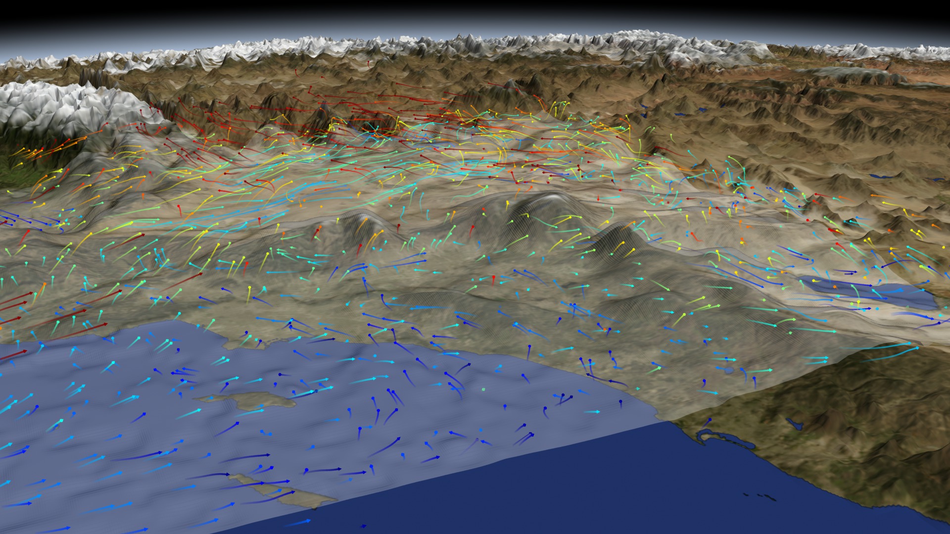
This animation shows a perspective view of the Los Angeles basin looking north. Yellow columns represent continuous measurements of atmospheric carbon from commercial gas analyzers on radio towers and roof-tops. The California Laboratory for Atmospheric Remote Sensing (CLARS) on Mt Wilson uses reflected sunlight to track carbon across the basin.
Aircraft periodically sample the air coming in and out of the megacity domain. Satellites such as NASA's Orbiting Carbon Observatory-2 will sample the "urban domes" of carbon dioxide of Los Angeles and other megacities around the world.
The Los Angeles component of the project is jointly funded by NASA's Jet Propulsion Laboratory, the US National Institute of Standards and Technology (NIST), the Keck Institute for Space Studies (KISS), and the California Air Resources Board (CARB). Implementing project partners for LA include: JPL, California Institute of Technology, Arizona State University, Scripps Institution of Oceanography, Lawrence Berkeley National Lab, CARB, Earth Networks, NASA Ames Research Center, and Sigma Space.
This animation shows the carbon monitoring system for the Los Angeles megacity and the different measurement methods and vantage points.
For More Information
Credits
Please give credit for this item to:
NASA's Goddard Space Flight Center Conceptual Image Lab
-
Animator
- Michael Lentz (USRA)
-
Producer
- Kayvon Sharghi (USRA)
-
Scientist
- Riley Duren (NASA/JPL CalTech)
Related
- ID: 20198

- ID: 20199

- ID: 4077
 Visualization
Release date
This page was originally published on Monday, May 13, 2013.
This page was last updated on Wednesday, May 3, 2023 at 1:52 PM EDT.