GEMx Animations
Conceptual animation illustrating the ER-2 aircraft collecting spectroscopic mineral data over the American West.
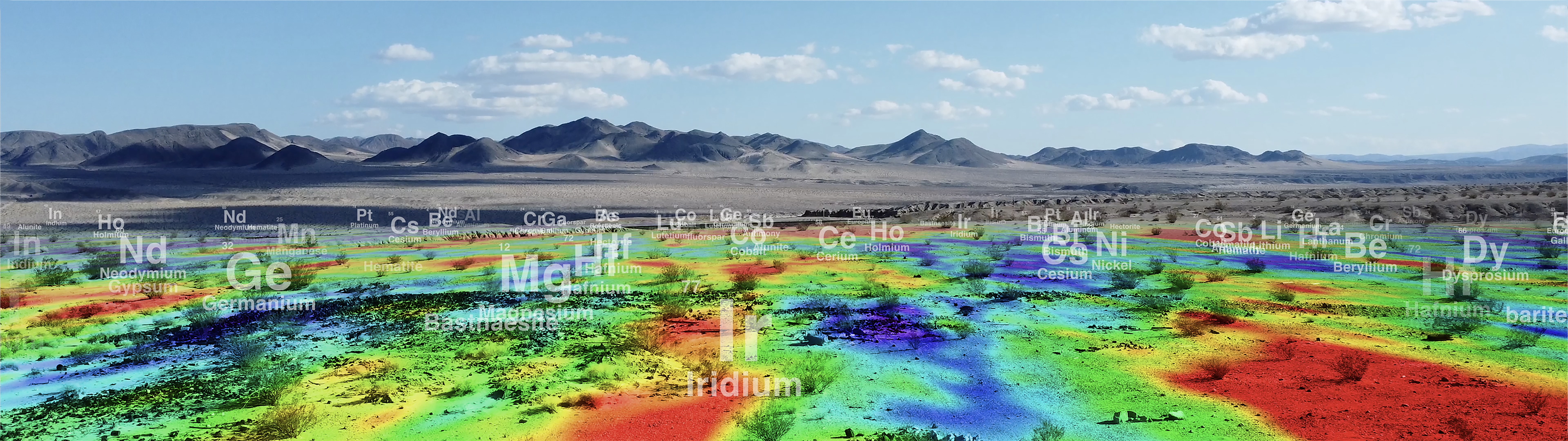
The Geological Earth Mapping Experiment (GEMx) research project uses NASA's Airborne Visible/Infrared Imaging Spectrometer (AVIRIS) instrument flown on NASA's ER-2 to collect the measurements over the country's arid and semi-arid regions, including parts of California, Nevada, Arizona, and New Mexico.
Individual elements of the conceptual animation.
Conceptual animation visualizing the ER-2 aircraft with two of the instruments (AVIRIS Classic/5 & MASTER) used during the GEMx airborne mission.
Credits
Please give credit for this item to:
NASA's Goddard Space Flight Center
-
Producers
- Katie Jepson (eMITS)
- Grace Weikert (eMITS)
- Emme Watkins (eMITS)
-
Animators
- Wes D. Buchanan (eMITS)
- Jenny McElligott (eMITS)
-
Technical support
- Aaron E. Lepsch (ADNET Systems, Inc.)
Related
- ID: 15045
 B-Roll
 - ID: 15042
 Produced Video
 - ID: 14851
 Produced Video
 - ID: 14728

Used as a Source In
- ID: 60001
 Produced Video
Release date
This page was originally published on Tuesday, July 15, 2025.
This page was last updated on Monday, October 6, 2025 at 12:52 PM EDT.