Model Behavior: Visualizing Global CO2
Universal Production Music: Prismatic by David Stephen Goldsmith [ PRS ]
Complete transcript available.
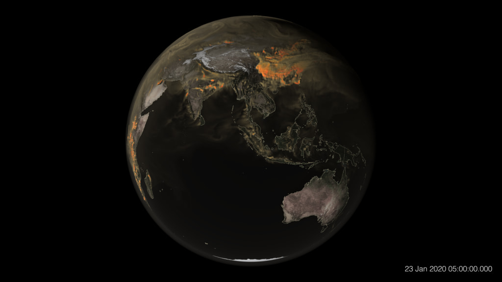
This global map of CO2 was created by NASA’s Scientific Visualization Studio using a model called GEOS, short for the Goddard Earth Observing System. GEOS is a high-resolution weather reanalysis model, powered by supercomputers, that is used to represent what was happening in the atmosphere — including storm systems, cloud formations, and other natural events. GEOS pulls in billions of data points from ground observations and satellite instruments, such as the Terra satellite’s MODIS and the Suomi-NPP satellite’s VIIRS instruments. Its resolution is more than 100 times greater than your typical weather model.
Video formatted for vertical social media platforms.
Universal Production Music: Prismatic by David Stephen Goldsmith [ PRS ]
Complete transcript available.
Credits
Please give credit for this item to:
NASA's Goddard Space Flight Center
-
Producer
- Katie Jepson (KBR Wyle Services, LLC)
-
Scientists
-
Lesley Ott
(NASA/GSFC)

- Brad Weir (Morgan State University)
-
Lesley Ott
(NASA/GSFC)
-
Writer
- Jenny Marder Fadoul (Telophase)
-
Visualizer
- AJ Christensen (AVL NCSA/University of Illinois)
-
Technical support
- Aaron E. Lepsch (ADNET Systems, Inc.)
Sources
- ID: 5333
 Visualization
 - ID: 5330

- ID: 5196
 Visualization
Release date
This page was originally published on Monday, July 22, 2024.
This page was last updated on Monday, July 15, 2024 at 4:33 PM EDT.