Hurricane Harvey

Aug. 24 to 30, Hurricane Harvey dropped a record-shattering 50 inches of rain on east Texas.
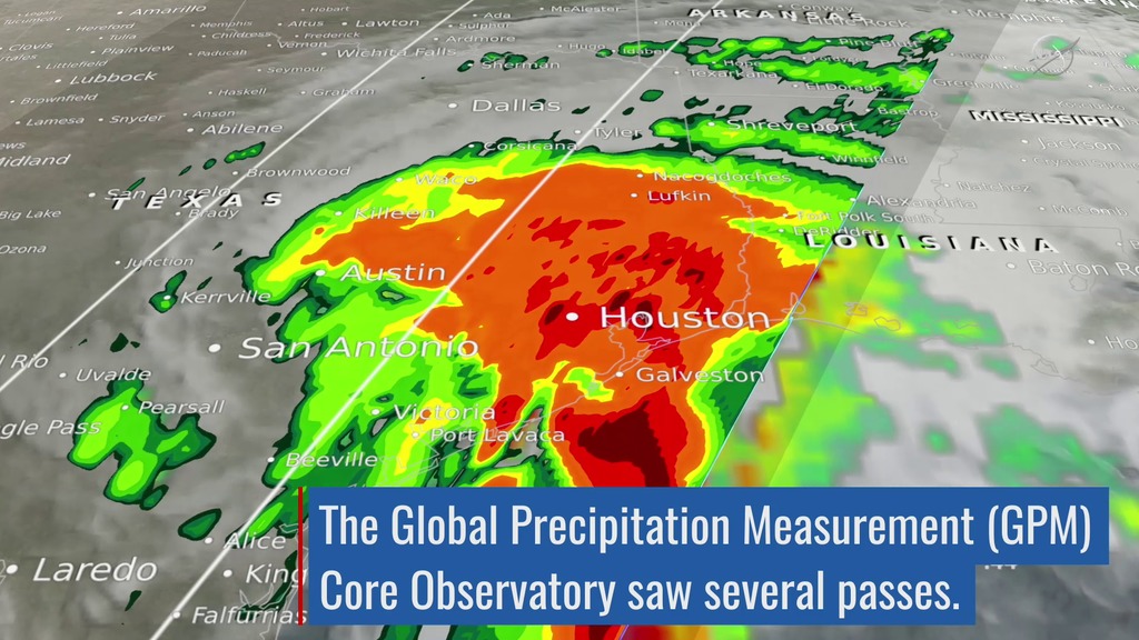
Hurricane Harvey made landfall in southeast Texas at Rockport on Aug. 25 as a Category 4 storm with winds at 130 mph. The hurricane quickly lost its power, downgrading to a tropical storm that lingered as it slowly inched up the coast. The result was a record-shattering amount of rainfall, topping 50 inches – 4 feet – in some areas, that led to catastrophic flooding of Houston and other nearby communities. NASA and the Japan Aerospace Exploration Agency's Global Precipitation Measurement mission's Core satellite passed over the region several times, capturing the scope of the water dropped from the sky. After returning to sea, Harvey made a second landfall in Louisiana, bringing heavy rains. Moving inland, Harvey dissipated as a tropical storm, but its associated clouds moved north and eastward, bringing rain to Arkansas, Tennessee and Kentucky and the East Coast in early September. Watch the videos to learn more.
Watch Harvey as it traverses the Gulf of Mexico and makes landfall in Texas and Louisiana.
The GPM satellite measured rainfall totals for Harvey from Aug. 19-30.
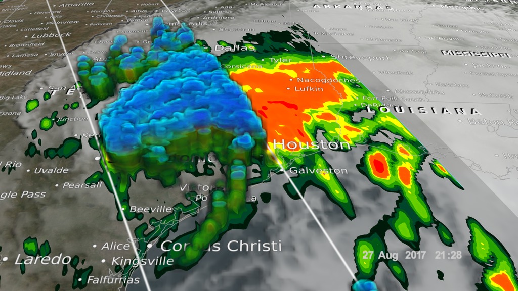
Rainfall drenched Houston and the surrounding areas on Aug. 27 as Harvey lingered.
GPM's Dual-frequency Precipitation Radar shows Harvey in 3-D. Blue is frozen precipitation while green to red is rainfall.
Harvey made its second landfall in Louisiana near the Texas border on Aug. 30, 2017.
Astronaut Randy Bresnik took this photo of Tropical Storm Harvey from the International Space Station on Aug. 28 at 1:27 p.m. CDT.
For More Information
See NASA.gov
Credits
Please give credit for this item to:
NASA's Scientific Visualization Studio.
Astronaut photo courtesy of NASA's Johnson Space Center.
-
Animator
-
Alex Kekesi
(Global Science and Technology, Inc.)

-
Alex Kekesi
(Global Science and Technology, Inc.)
-
Scientists
- Gail Skofronick Jackson (NASA/GSFC)
-
George Huffman
(NASA/GSFC)
-
Producer
- Ryan Fitzgibbons (USRA)
-
Writer
- Ellen T. Gray (ADNET Systems, Inc.)
Related
- ID: 5361
 Visualization
Sources
- ID: 4458
- ID: 12697
 Produced Video
Release date
This page was originally published on Monday, September 18, 2017.
This page was last updated on Wednesday, May 3, 2023 at 1:47 PM EDT.