Crack in Larsen C Ice Shelf

Thermal wavelength image of a large iceberg, which has calved off the Larsen C ice shelf. Darker colors are colder, and brighter colors are warmer, so the rift between the iceberg and the ice shelf appears as a thin line of slightly warmer area. Image from July 12, 2017, from the MODIS instrument on NASA's Aqua satellite.
Credit: NASA Worldview
An iceberg about the size of the state of Delaware split off from Antarctica’s Larsen C ice shelf sometime between July 10 and July 12. The calving of the massive new iceberg was captured by the Moderate Resolution Imaging Spectroradiometer (MODIS) on NASA’s Aqua satellite.
Larsen C, a floating platform of glacial ice on the east side of the Antarctic Peninsula, is the fourth largest ice shelf ringing Earth’s southernmost continent. In 2014, a crack that had been slowly growing into the ice shelf for decades suddenly started to spread northwards, creating the nascent iceberg. The growth of the crack has been tracked by Landsat satellites, which are jointly managed by NASA and the U.S. Geological Survey.
Now that the close to 2240 square-mile (5800 square kilometers) chunk of ice has broken away, the Larsen C shelf area has shrunk by approximately 10 percent.

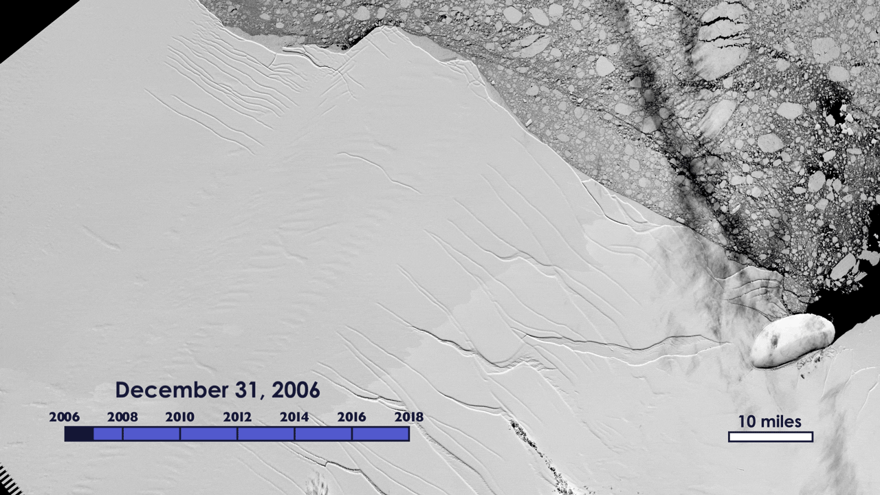
Animated GIF of the growth of the crack in the Larsen C ice shelf, from 2006 to 2017, as recorded by NASA/USGS Landsat satellites.
Version of animation without pink trace
Credit: NASA/USGS Landsat
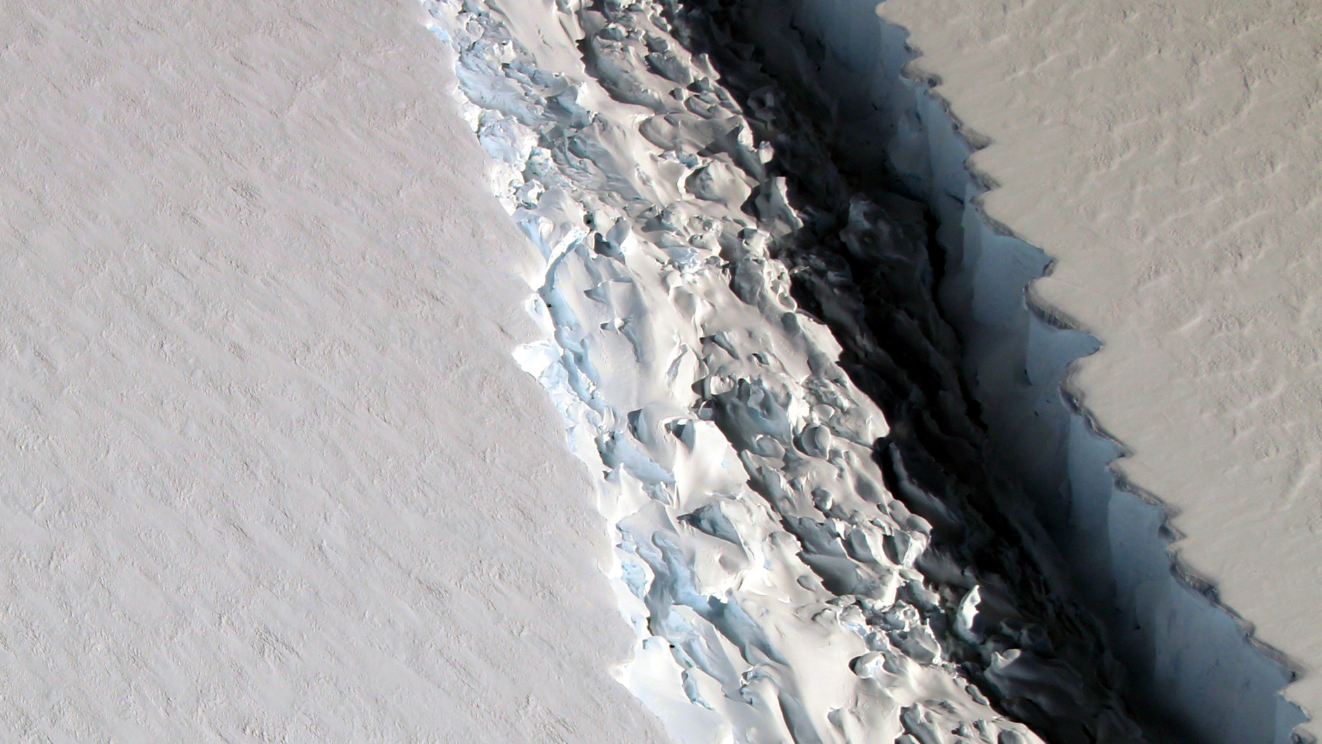
Satellite image of a long crack in the Larsen C ice shelf, taken on March 8, 2017, by the Operational Land Imager on the NASA/USGS Landsat 8 spacecraft.
Credit: NASA/USGS Landsat
NASA/USGS Landsat satellites captured the growth of the crack in the Larsen C ice shelf from 2006 to 2017.
Credit: NASA/USGS Landsat
Wide view of Larsen C ice shelf and its recently calved iceberg. Darker colors are colder, and brighter colors are warmer, so the rift between the iceberg and the ice shelf appears as a thin line of slightly warmer area. Image from July 12, 2017, from the MODIS instrument on NASA's Aqua satellite.
Credit: NASA Worldview
Credits
Please give credit for this item to:
NASA's Goddard Space Flight Center
-
Producer
- Matthew R. Radcliff (USRA)
-
Editor
- Matthew R. Radcliff (USRA)
-
Writer
- Maria-Jose Vinas Garcia (Telophase)
-
Scientists
- Christopher Shuman (UMBC JCET)
- Kelly Brunt (Earth System Science Interdisciplinary Center/University of Maryland)
Series
This page can be found in the following series:Related
- ID: 12449
 Produced Video
Used as a Source In
- ID: 12484
 Produced Video
Release date
This page was originally published on Wednesday, July 12, 2017.
This page was last updated on Wednesday, May 3, 2023 at 1:47 PM EDT.