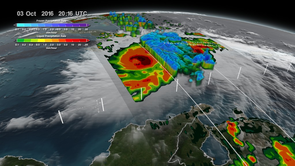
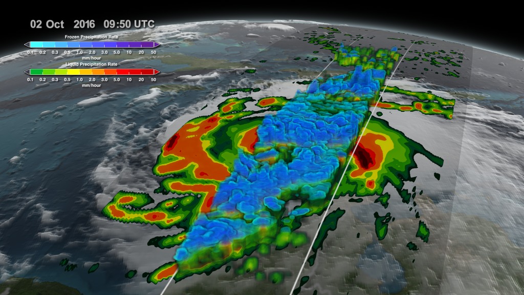
GPM Sees Hurricane Matthew's Life Cycle
Music: "New Lands" by Mark Russell, Atmosphere Music Ltd.
Additional footage: Nelson Aerial Productions
Complete transcript available.
Hurricane Matthew dropped a lot of rain, caused flooding and deaths in the state of North Carolina. Flooding is still widespread in North Carolina. Some rivers in North Carolina such as the Tar and the Neuse Rivers were still rising on Oct. 12.
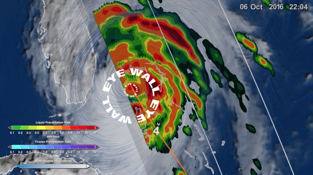
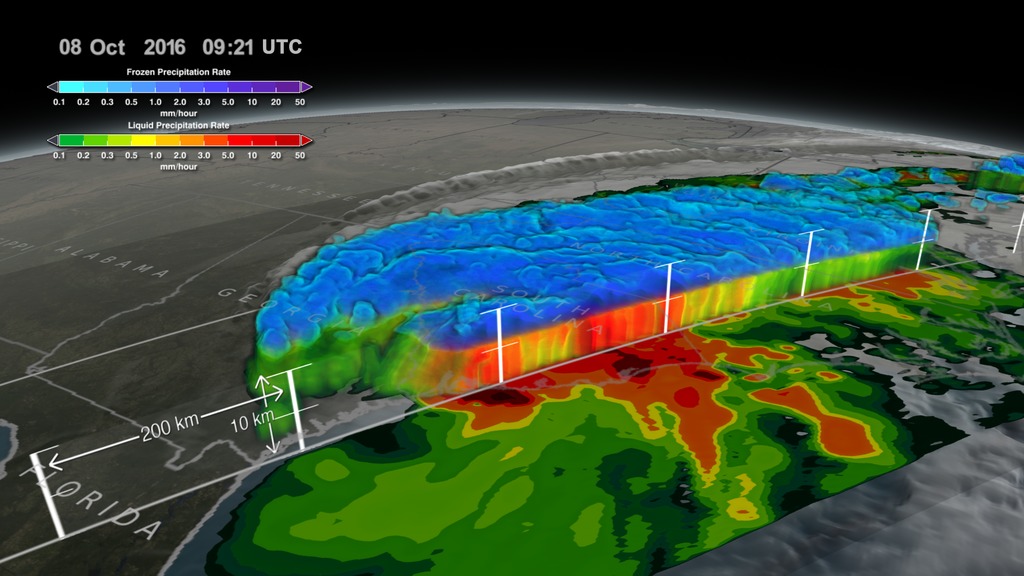
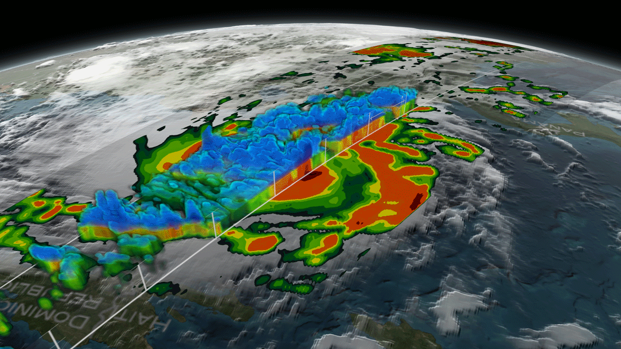
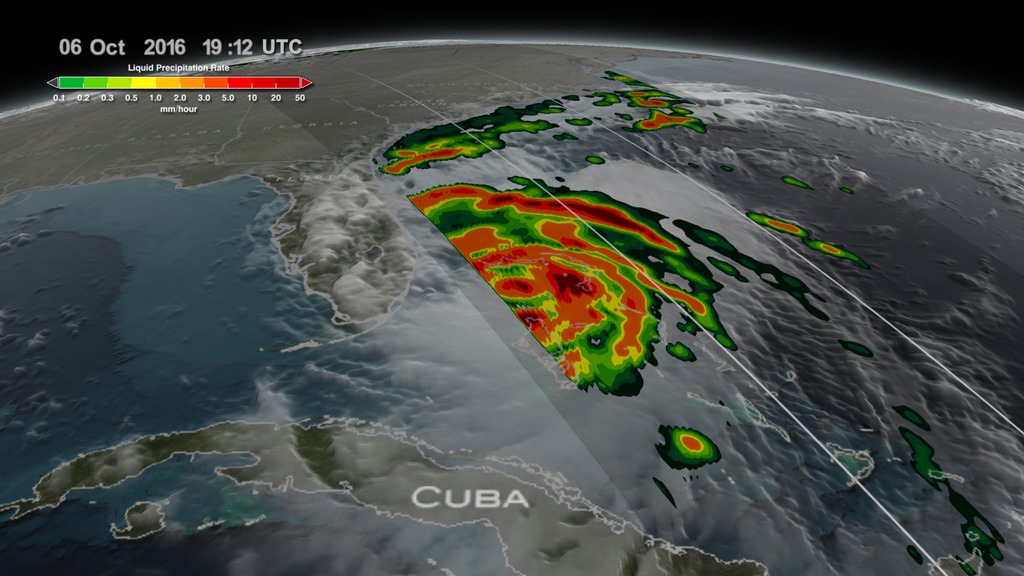
At NASA's Goddard Space Flight Center in Greenbelt, Maryland a rainfall analysis was accomplished using data from NASA's Integrated Multi-satellitE Retrievals for GPM (IMERG). The GPM or Global Precipitation Measurement mission is a joint mission between NASA and the Japanese space agency JAXA.
This rainfall analysis was created using IMERG real time data covering the period from Sept. 28 through Oct. 10, 2016. The totals included some rain from a low pressure area that moved through the area near the end of September.
Hurricane Matthew’s interaction with a frontal boundary caused extreme rainfall in North Carolina resulting in over 20 inches (508 mm) of rain being reported in North Carolina. The area was already saturated before Hurricane Matthew arrived. Heavy rainfall from a slow moving low and frontal system moved through during the last week of September. Maximum rainfall total estimates for the real-time IMERG product have been adjusted to reflect observed values.
Credits
Please give credit for this item to:
NASA's Goddard Space Flight Center
-
Producer
- Ryan Fitzgibbons (USRA)
-
Scientists
- Scott Braun (NASA/GSFC)
- Dalia B Kirschbaum (NASA/GSFC)
- Owen Kelley (George Mason University)
-
Visualizers
-
Alex Kekesi
(Global Science and Technology, Inc.)

- Hal Pierce (SSAI)
-
Alex Kekesi
(Global Science and Technology, Inc.)
Missions
This page is related to the following missions:Series
This page can be found in the following series:Related
- ID: 4575
 Visualization
 - ID: 12635
 Produced Video
Sources
- ID: 4512
 Visualization
 - ID: 12389
 Produced Video
 - ID: 4511
 Visualization
 - ID: 4508
 Visualization
 - ID: 4507
 Visualization
Release date
This page was originally published on Monday, October 17, 2016.
This page was last updated on Wednesday, May 3, 2023 at 1:48 PM EDT.