NASA On Air: NASA's GPM Satellite Tracks Rain For Farmers Around The World (4/28/2016)
LEAD: A network of Earth-observing satellites is helping to track crop growing conditions around the world.
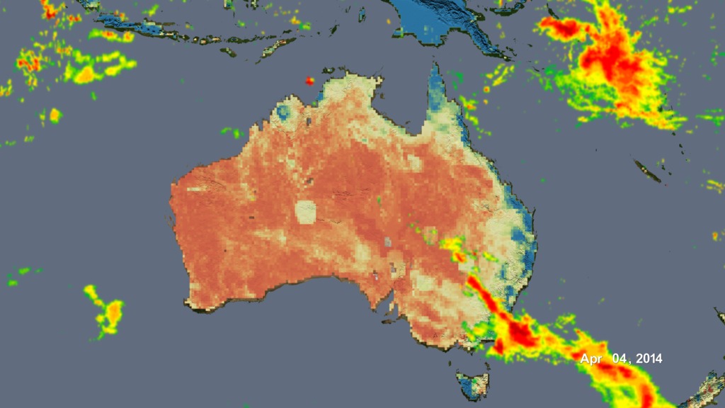
Rainfall, shown here as radar-like moving bands of reds and yellows, can now be tracked every 30 minutes across most of the earth.
The base maps of the continents change color indicating the available moisture (water) in the surface soils for growing crops.
This information is especially helpful to farmers waiting for the summer monsoon rain in countries such as India that only have limited number of weather stations.
TAG: The data is already being used by the USDA Foreign Agricultural Service.
For More Information
See www.nasa.gov/GPM
Credits
Please give credit for this item to:
NASA's Goddard Space Flight Center
-
Producer
- Howard Joe Witte (ADNET Systems, Inc.)
-
Video editor
- Sophia Roberts (USRA)
-
Technical support
- Aaron E. Lepsch (ADNET Systems, Inc.)
Missions
This page is related to the following missions:Related
- ID: 4443
 Visualization
Release date
This page was originally published on Wednesday, April 27, 2016.
This page was last updated on Monday, January 6, 2025 at 1:31 AM EST.